Rest of the week: Heat’s turning back up
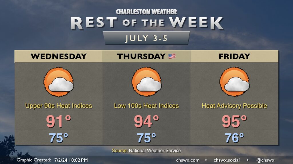
After a brief reprieve Tuesday, the heat is turning back up as we head into the Fourth and beyond. Winds stay onshore for one more day Wednesday, which will keep temperatures “only” in the upper 80s to low 90s. Mid-70s dewpoints, though, will make it feel like the upper 90s during the height of the afternoon. Ridging building in aloft will keep a lid on any shower and thunderstorm development.
Winds begin to go more southerly on the Fourth of July. This, combined with continued high pressure aloft, will send temperatures into the mid-90s in the afternoon. Heat indices will head to the low 100s with dewpoints in the low to mid-70s. Air temperatures will run a few degrees cooler at the beach, but the higher-dewpoint air there will essentially negate that advantage due to higher heat indices, so be sure you’re getting plenty of water if the beach is in your plans for the Fourth. (Might not be a bad idea to have that beach umbrella, either.) Once again, showers and thunderstorms aren’t expected (though you can never totally rule out a popup this time of year).
Advisory-level heat appears possible Friday as air temperatures in the mid-90s combine with dewpoints creeping up a couple more degrees than the previous day to yield heat indices approaching the advisory threshold of 108°. Relief from a shower or thunderstorm doesn’t look terribly likely, so you’ll want to be taking heat precautions once again if you’ll be out during the height of the afternoon.
Hot weather will continue into the weekend as highs in the mid-90s look to continue with dewpoints in the mid-70s the rule. We’ll start to see a weakness develop in the ridge, though, improving the chances for a little shower and thunderstorm relief each afternoon.