The week ahead: Charleston summer in full swing
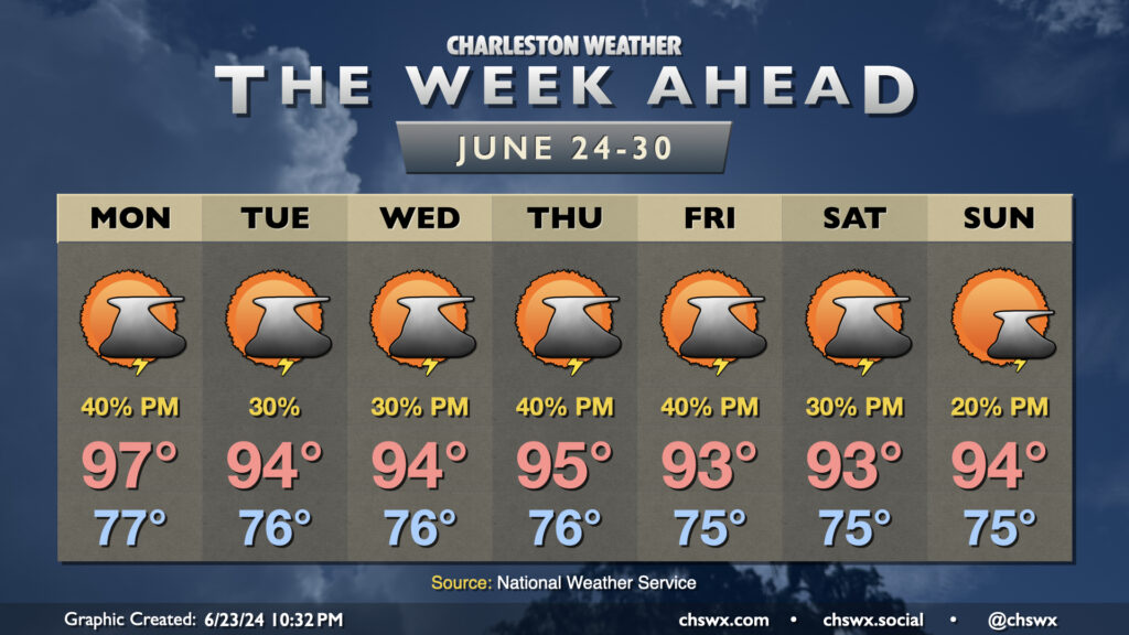
Charleston summer is in full swing as we get into the last week of June as hot and muggy conditions will be prevalent for the foreseeable future.
Monday will be particularly warm with westerly winds ahead of a front that’ll be sagging southward throughout the day. This front along with the pinned seabreeze should help ignite some showers and thunderstorms in the afternoon, but not everyone’s going to get heat relief. We start the day in the mid-to-upper 70s, warming to the upper 90s in the afternoon with heat indices around and even a little above 105° expected. (Note: 105° used to be heat advisory criteria, but that has changed this year — 108° heat index or higher for two hours is the new heat advisory criteria.)
The front hangs around Tuesday before retreating northward Wednesday. This should generally lead to standard afternoon thunderstorms along and ahead of the seabreeze each day. Highs continue in the mid-90s after mid-70s starts both days, with heat indices once again potentially approaching 105°. Rain chances tick up Thursday and Friday as a disturbance moves across the area, while ridging builds aloft for the weekend and starts to reduce afternoon storm chances. Highs continue in the low to mid-90s each afternoon after mid-70s starts, with heat indices flirting with the Heat Advisory criteria especially later in the work week. Be sure you’re taking frequent breaks and hydrating if you’re working outdoors in this swampy weather!