The week ahead: Unsettled, but not quite as hot
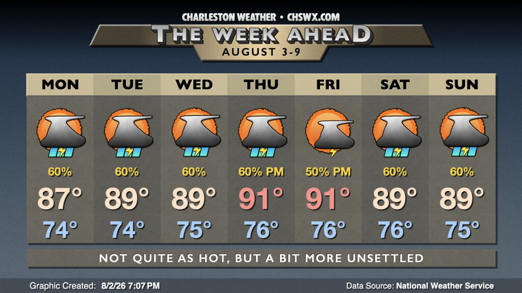
The first week of August looks unsettled with more rain on the way, especially in the first half of the week as low pressure aloft becomes cut off and stalls for a couple days.
Read more »The first week of August looks unsettled with more rain on the way, especially in the first half of the week as low pressure aloft becomes cut off and stalls for a couple days.
Read more »
After a very wet weekend that included flooding rains at Mt. Pleasant and Isle of Palms, we should see a bit of a downtrend in rain chances as some of the deeper moisture that’s been hanging around this weekend moves offshore and further into the Atlantic. The pesky cold front that’s been hanging around will start the day just to our south, lifting north during the afternoon, so between this and the seabreeze, it’s still possible for a few afternoon thunderstorms to fire. Temperatures will run in the mid-70s Monday morning, topping out in the low to mid-90s in the afternoon. Heat indices should run around 102-106°, highest near the coast.
Read more »
The week ahead will continue to feature warm and muggy conditions, with an uptick in rain chances as we get over the hump toward the weekend.
Read more »
After a week of consecutive heat headlines, whether they be Heat Advisories or Extreme Heat Warnings, a front dropping in from the north — and the accompanying unsettled weather — will take the edge off the heat for at least a few days.
Read more »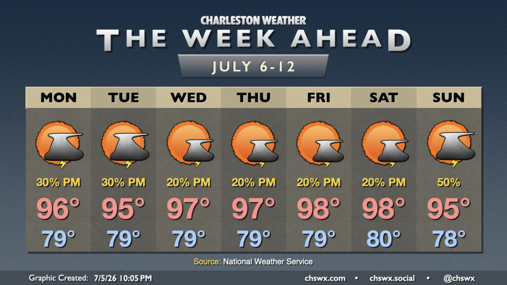
A fairly standard but quite hot summertime pattern takes residence this week, keeping temperatures quite warm — perhaps threatening records at times — with the risk for a few afternoon thunderstorms each day.
Read more »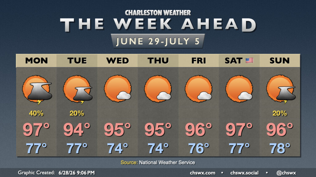
Summer heat and humidity continues as we close June and start July, with sustained heat continuing into the Fourth of July weekend.
Read more »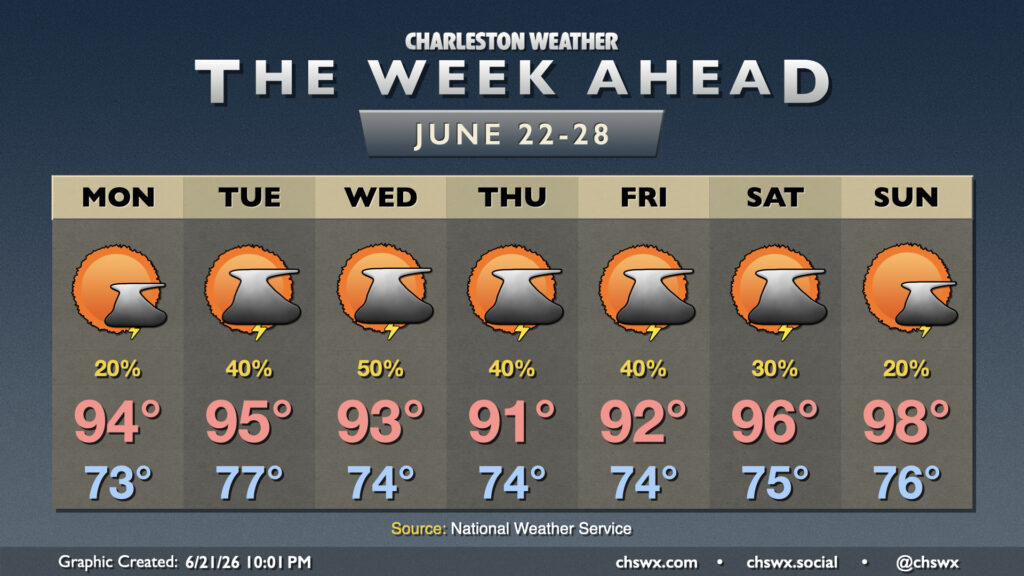
Weather worthy of the summer solstice will continue this week with highs in the 90s and a shot at afternoon thunderstorms each day.
Read more »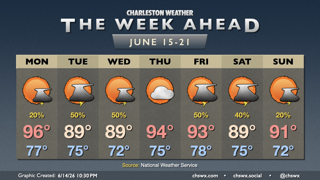
Fairly standard summertime weather continues for the week ahead, though we shouldn’t run quite as hot as we did this past weekend, with no record highs in jeopardy of being toppled this go-around.
Read more »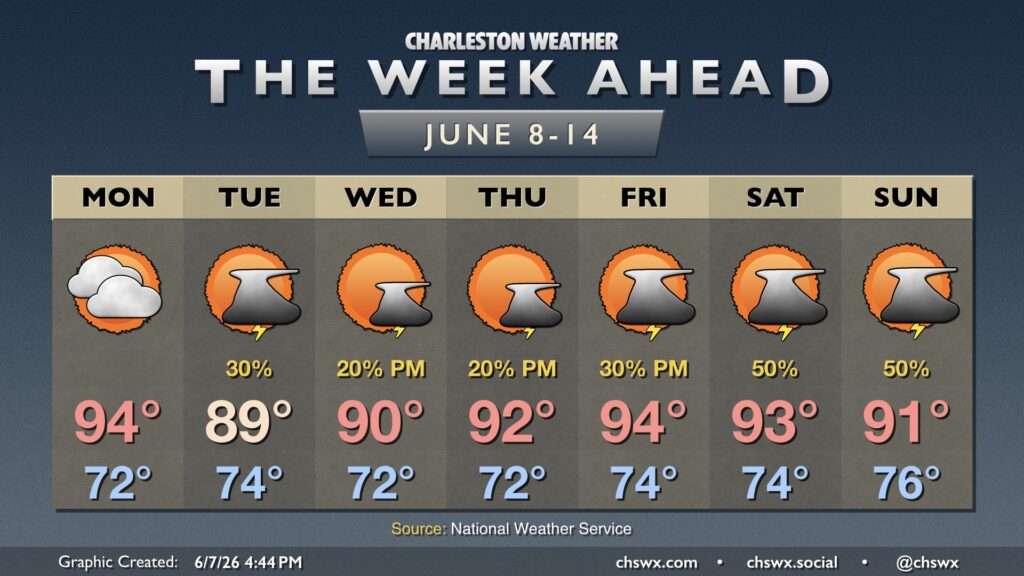
Heat and humidity will feature prominently in the forecast this week as a more summertime pattern takes hold.
Read more »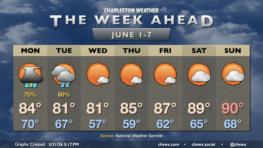
Meteorological summer begins on Monday, but it isn’t going to feel much like it for a few days with unsettled weather to start and cool high pressure for midweek before temperatures rebound toward 90° by the weekend.
Read more »