Friday & the weekend: Warm, muggy, stormy at times
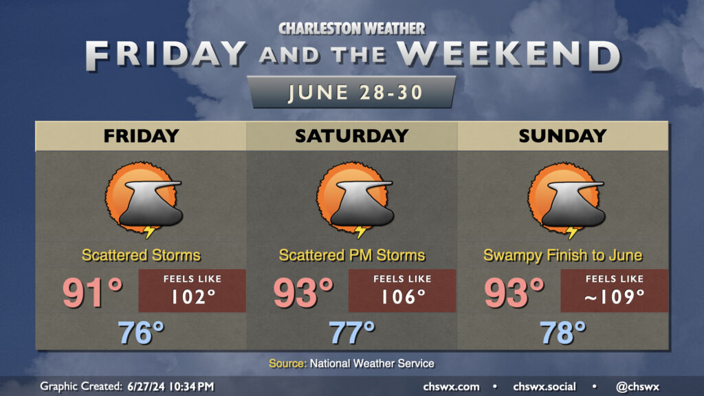
After some much-needed rainfall Thursday, we’ve got a few more shots at additional rain as we close out the month. In fact, the thunderstorm activity Thursday night will likely help keep temperatures and dewpoints down a little heading into Friday, with heat indices “only” in the low-to-mid-100s for many of us before thunderstorms fire in the afternoon. The early return from the late Thursday evening model runs suggests less storm coverage Friday than we saw Thursday, but some of us will still see another round of needed rain.
The active summertime pattern stays in place for Saturday into Sunday as well, with air temperatures in the low 90s combining with increasing dewpoints in the mid-to-upper 70s to prompt Heat Advisory-level conditions once again each afternoon before thunderstorms fire. Scattered coverage continues to be expected, with some of us getting luckier than others as far as rainfall goes. Some of the rain could be quite heavy at times, though, with minor flooding a possibility if it sets up in the more vulnerable locations. And as always, you can’t rule out a stronger or even marginally severe thunderstorm in the summertime; while there isn’t much to hang your hat on as far as organized storms, boundary and cell collisions can help bring down some strong wind gusts.