Thursday: Foggy start to a warm day
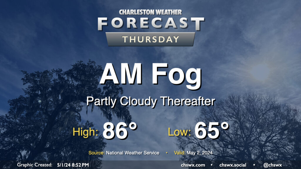
We’ll wake up to some fog in the area on Thursday morning, with some patches of dense fog not out of the question. This might have some commute impacts, to be ready to allow a little extra time to get where you are going tomorrow morning. Be sure to use low beams in fog, even if the sun is out — you want to be seen — but avoid the high beams as they may act to blind you.
Fog looks to scour out around 9-10am or so, and we should be in for a partly cloudy to mostly sunny day across the Lowcountry with temperatures rising to the mid-80s in the afternoon. Aside from the fog, there are no other weather concerns of note.
Friday & the weekend: Seabreeze storms return

Friday & the weekend will remain on the warm side of normal, especially to start the period. High pressure aloft will remain in place one more day Friday, with mostly sunny skies and mid-80s expected. This ridge of high pressure starts to break down Saturday, allowing for a few popup storms on the seabreeze in the afternoon. Temperatures Saturday will run a couple degrees cooler than they did Friday, but still expect them to run generally in the mid-80s. A bit more storm coverage is expected Sunday, but a total washout in any one spot is not expected — just be ready to move outdoor activities inside.
And an early heads up: Temperatures skyrocket well above normal as we head into next week — get ready for a return to 90s by Tuesday as high pressure anchors in the Atlantic, reminiscent of what we typically see a lot of in the summer.
Follow my Charleston Weather updates on Mastodon, Instagram, Facebook, Bluesky, or directly in a feed reader. You can also get daily audio updates via the Charleston Weather Daily companion podcast, available wherever fine podcasts are listed. Do you like what you see here? Please consider supporting my independent, hype-averse weather journalism and become a supporter on Patreon for a broader look at all things #chswx!