Tuesday: One more comfortably warm day before the heat rebuilds
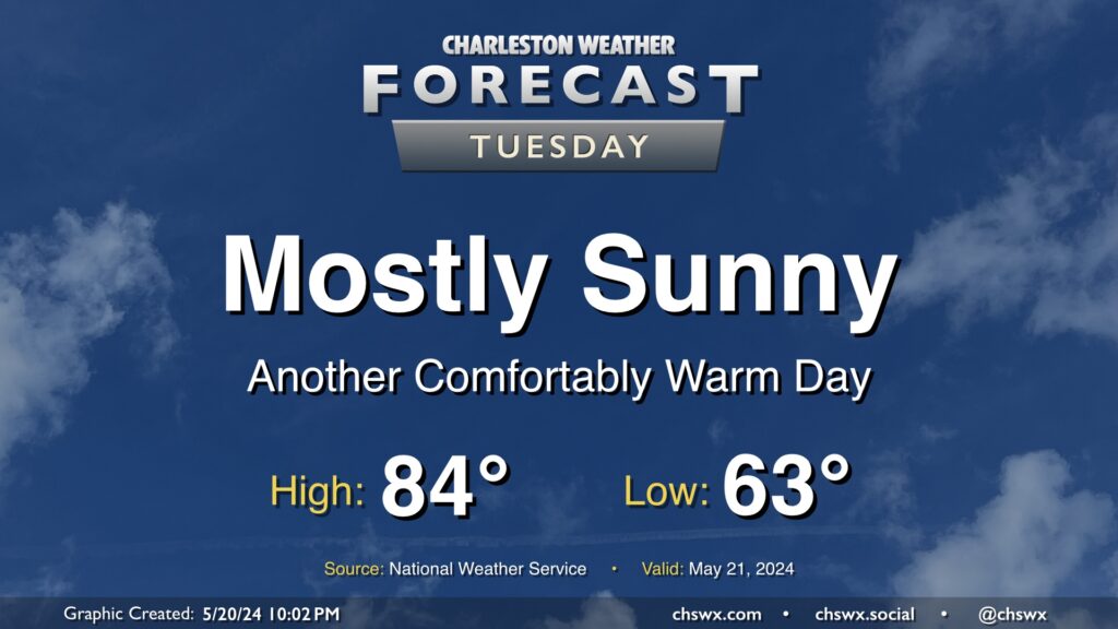
We have another nice day ahead Tuesday. We’ll start the day in the low 60s once again, with highs topping out in the low-to-mid-80s under mostly sunny skies. It’ll be a touch breezy, with winds out of the northeast once again around 10 MPH, but this is what’s keeping us a little on the cooler side, so we’ll take it.
The only weather concern will be the risk for water levels peaking in minor flood stage again with the Tuesday evening high tide. Minor coastal flooding looks probable between 7-9 PM with water levels peaking around 7.1’. It’ll be enough to cover the more vulnerable roads once again with salt water, but it won’t be a widespread issue.
Rest of the work week: Returning to the 90s
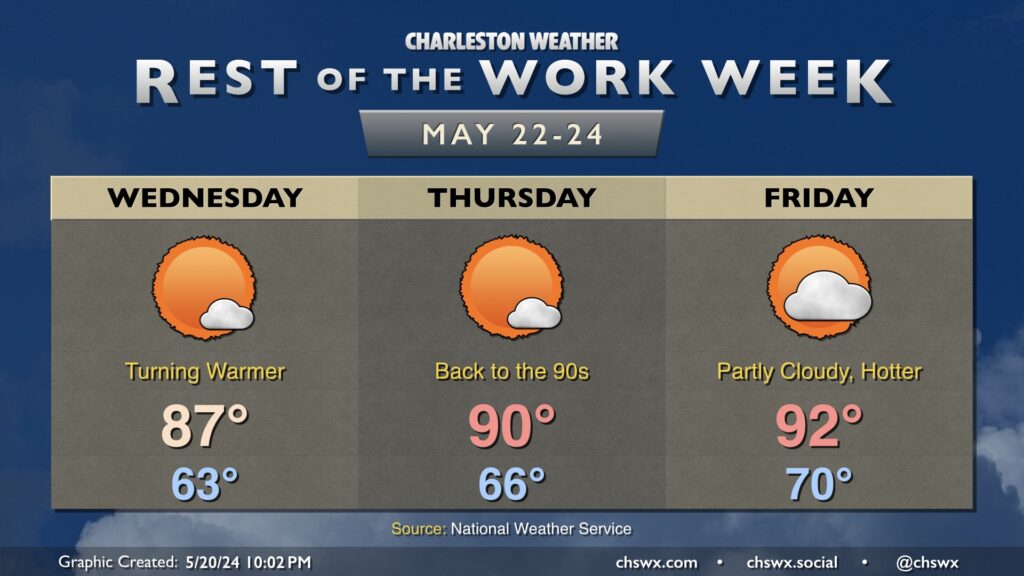
After one more start in the low 60s Wednesday, a warming trend will start to kick in. Expect highs in the upper 80s on Wednesday, followed by a return to highs in the low 90s starting Thursday. Dewpoints will also be on the rise during the latter half of the week, and that’s reflected by the low temperatures being on a warming trend as well. Expect 70s dewpoints to return by Friday, with that trend to continue into the weekend as high pressure shifts offshore.
The weather remains quiet to close out the work week, but as the aforementioned high slips away, upper disturbances will allow for afternoon shower and thunderstorm chances each day beginning Saturday — a seasonally-appropriate way to mark the unofficial start of summer over Memorial Day weekend.