Tuesday: Onshore flow keeps things breezy but seasonable
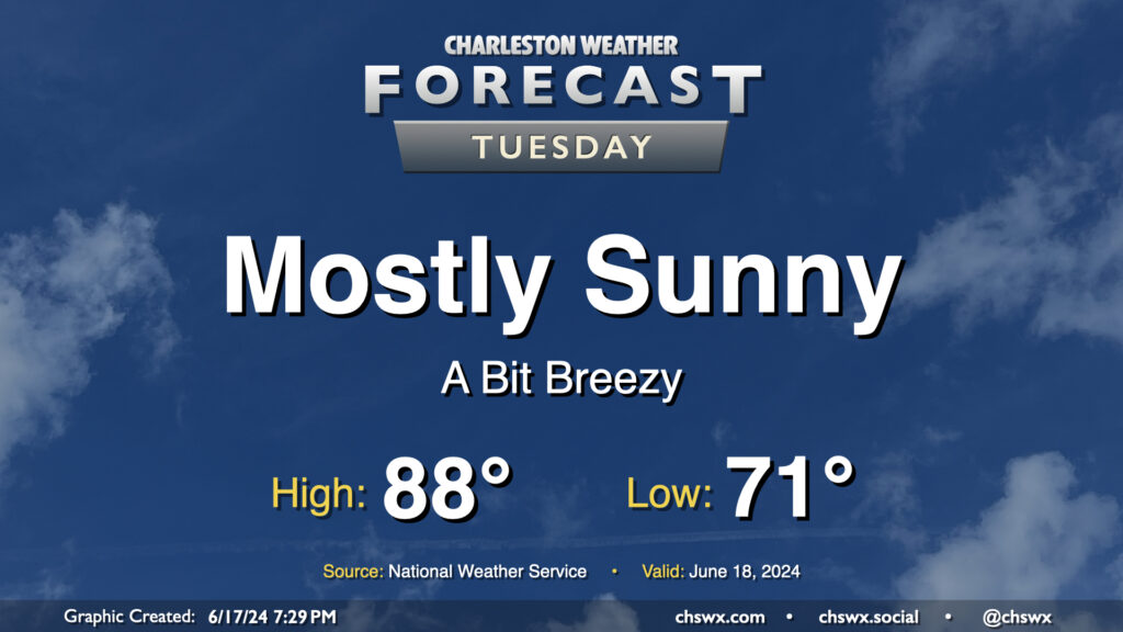
We’ve got one more generally quiet day of weather coming up for Tuesday before turning a little more unsettled heading into the second half of the week. Temperatures will remain around if not a touch below normal as a solid onshore breeze keeps us on the “cool” side. We’ll see a few clouds from time to time, but overall, expect a mostly sunny day. The only downside to the onshore flow will be a moderate risk of rip currents at the beaches, so be alert if you are going to be heading into the surf.
Rest of the work-ish week: Turning warmer and more unsettled
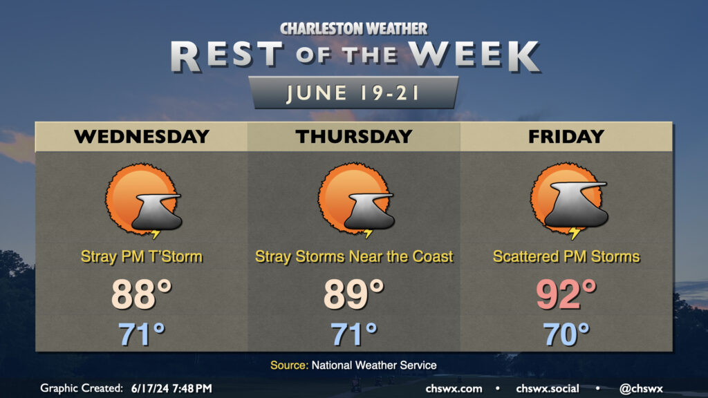
Isolated afternoon thunderstorms return to the forecast as many of us take a pause for Juneteenth. We stay near normal temperature-wise as onshore flow continues, with highs topping out in the upper 80s under otherwise partly cloudy skies. The risk for thunderstorms shifts more toward the coast on Thursday as a disturbance approaches from offshore. (It still looks like this will be an open wave, so the risk for anything tropical remains rather low at this point.) This’ll help surge some more moisture into the area as we head into Friday and the weekend, turning it a bit unsettled at times. We’ll also get some warmer air into the area as well, with highs returning to the 90s by Friday.
We’ll also need to keep an eye out for coastal flooding during the evening high tides as the moon goes full and winds continue onshore. Right now it doesn’t look like tides get too far out of hand, but it’s worth watching regardless.
Follow my Charleston Weather updates on Mastodon, Instagram, Facebook, Bluesky, or directly in a feed reader. You can also get daily audio updates via the Charleston Weather Daily companion podcast, available wherever fine podcasts are listed. Do you like what you see here? Please consider supporting my independent, hype-averse weather journalism and become a supporter on Patreon for a broader look at all things #chswx!