Thursday: One more reasonably quiet and “cool” day
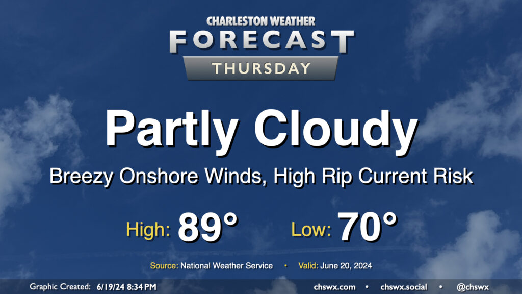
Thursday looks to remain mostly quiet over the area, though a few showers will be possible near the coast once again during the morning as showers within onshore flow reach land and dissipate in drier air. We start the day around 70° and warm to the upper 80s in the afternoon, much like the past few days. If you’ve been enjoying the somewhat lower-humidity mornings that we’ve had lately, enjoy this tomorrow morning because we’re shifting back into more traditional mid-to-late-June dewpoints starting Friday.
Friday & the weekend: A bit more rainy Friday, then turning warmer
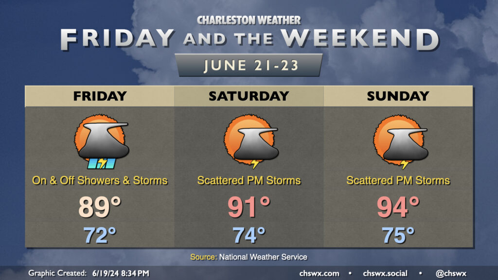
A tropical wave will bring a surge of moisture and lift into the area for Friday, with more widespread showers and thunderstorms possible than in previous days. Rain could be heavy at times, but won’t last all day in any one location as it should be generally on and off in nature.
After one more day topping out in the upper 80s Friday, we return to the 90s on Saturday, with mid-90s possible Sunday as high pressure shifts southward. Scattered showers and thunderstorms will be possible each afternoon this weekend along and ahead of the seabreeze. Some of the guidance points to some fairly robust convection inland on Sunday, which would be helpful for at least some of our lawns.
We keep the warming trend going into next week, which should feature better shower and storm chances each afternoon for some relief.
Follow my Charleston Weather updates on Mastodon, Bluesky, Instagram, Facebook, or directly in a feed reader. Do you like what you see here? Please consider supporting my independent, hype-averse weather journalism and become a supporter on Patreon for a broader look at all things #chswx!