Thursday: Heat and humidity continues
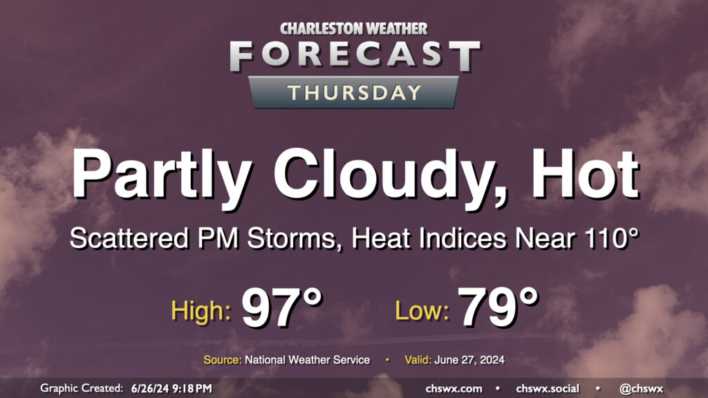
The meteorological status quo continues on Thursday: Heat, humidity, and a few storms in the afternoon. Temperatures will be fairly heinous on Thursday, with lows barely dipping below 80° away from the warmer coastline and highs getting into the mid-to-upper 90s in the afternoon. Mix in dewpoints in the mid-70s, and that’ll yield another day of dangerous heat indices in the 107-110° range. I’d be ready for yet another Heat Advisory to be issued for tomorrow.
A front sinking southward into the area combined with the usual seabreeze influence will help improve shower and thunderstorm chances for more of us tomorrow afternoon and evening. Pockets of heavy rain will be possible, and some gusty winds will be possible in any thunderstorm as well. A stray Severe Thunderstorm Warning certainly is in the cards, but widespread severe weather isn’t expected.
Friday & the weekend: A swampy end to June
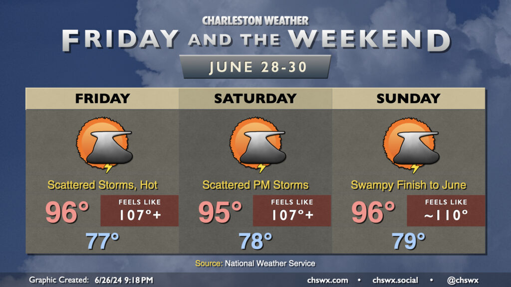
We stay in the sauna heading into the weekend as well, with heat indices regularly breaching 105°+ each afternoon before thunderstorms cool a few of us off. A period of 110° heat indices isn’t out of the question especially on Sunday. If you’ve got outdoor plans during the height of the afternoon, be heat-safe with plenty of water and frequent breaks in the shade. Shower and thunderstorm coverage will generally be scattered in nature and follow the seabreeze inland throughout the day, so while some of us may see some relief, many of the rest of us may not — the standard summertime lament.
Follow my Charleston Weather updates on Mastodon, Instagram, Facebook, Bluesky, or directly in a feed reader. You can also get daily audio updates via the Charleston Weather Daily companion podcast, available wherever fine podcasts are listed. Do you like what you see here? Please consider supporting my independent, hype-averse weather journalism and become a supporter on Patreon for a broader look at all things #chswx!