Friday & the weekend: Quiet and warm
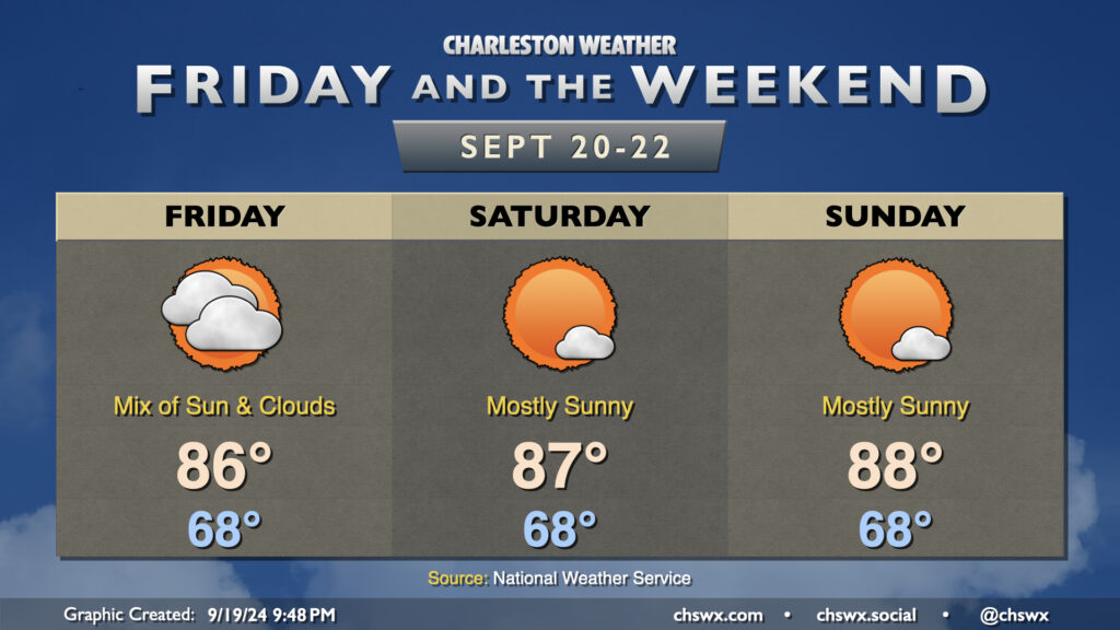
High pressure ridging in at the surface and aloft will make for a quiet and warm weekend of weather across the Lowcountry.
Clouds will still be around Friday as one more piece of energy ripples through before the high pressure ridge takes over. Rain isn’t expected, though a shower can’t be completely discounted. Expect highs in the mid-80s after an upper 60s start.
Despite the autumnal equinox on Sunday, the weekend will feel increasingly more like summer as highs climb into the mid-and-upper 80s each afternoon Saturday and Sunday. The high pressure ridge aloft will also keep a lid on much in the way of showers and thunderstorms (much less cloud cover). Not the worst set of days for an offseason beach visit, IMHO.
Coastal flooding issues continue, with moderate to possibly major flooding in the mornings
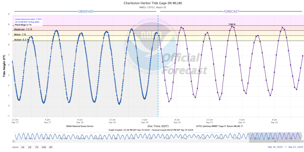
If downtown is in your plans this weekend, keep an eye on the tides. Water levels in Charleston Harbor will be well into moderate flood and approaching major flood stage with the daytime high tides beginning Friday and continuing each day through the weekend. High tide on Friday peaks around 7.8′ at 10:31 AM, while Saturday’s highest tide peaks around 7.9′ around 11:14 AM. Sunday’s daytime high tide just a little after noon should also reach moderate flood stage. When water levels reach moderate to major flood stage, road closures become quite common. The good news is that there won’t be any rain on top!
Nighttime high tides will pose minor flooding concerns as well, particularly on Friday and Saturday. Additional road closures will be possible, but the impacts will be lessened due to the lower water levels and the time of day they’ll be occurring.
Keep an ear out for Coastal Flood Advisories, Watches, and Warnings from the National Weather Service. This will be your signal for when the risk for flooding is highest.
Tropics: A few spots of interest in the Atlantic a reminder we’re still near peak season
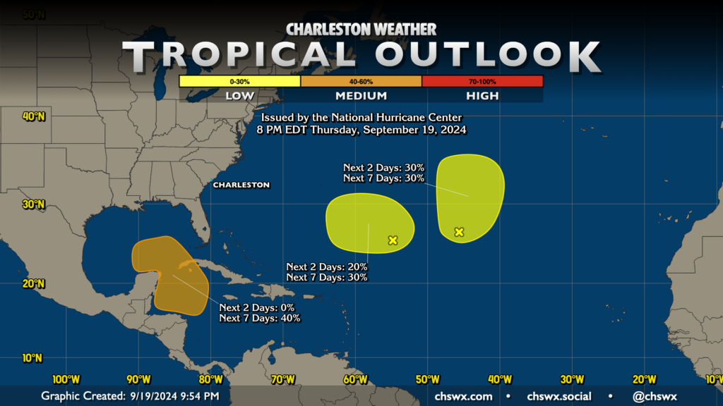
The tropics remain active, with a couple spots of interest in the Atlantic with low probabilities of development that shouldn’t really bother anyone.
The other area of interest in the Caribbean and southern Gulf has a bit more intrigue. Low pressure has not yet formed here, but model guidance has been fairly consistent in developing something here in the next few days, and the National Hurricane Center gives this area a 40% chance of development in the next seven days. From there, it’s anyone’s guess. Operational guidance is going to be pretty useless except for scaring people on Facebook in the near term, while the global model ensembles are very widely spread beyond the general idea that a low pressure system develops. There’s much for the weather nerds to keep an eye on, but as far as the rest of y’all, nothing to worry about at this point.
Follow my Charleston Weather updates on Mastodon, Instagram, Facebook, Bluesky, or directly in a feed reader. Do you like what you see here? Please consider supporting my independent, hype-averse weather journalism and become a supporter on Patreon for a broader look at all things #chswx!