Weekend forecast: Mostly unsettled, especially Saturday
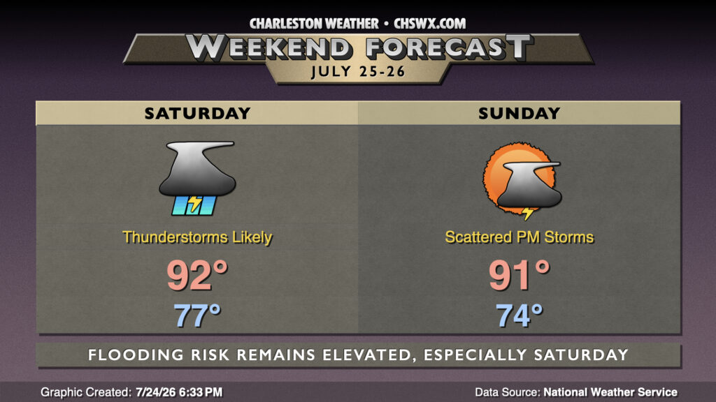
A stalled front will continue to contribute to shower and thunderstorm chances through the weekend, particularly on Saturday as a trough aloft swings through, providing a little extra “oomph” to budding updrafts aspiring to be efficient rain-makers.
Read more »