LIVE BLOG: Tornado Watch cancelled
We in the Charleston weather community are watching the potential for a few damaging wind gusts and possibly tornadoes this afternoon into tonight as a cold front approaches the area.
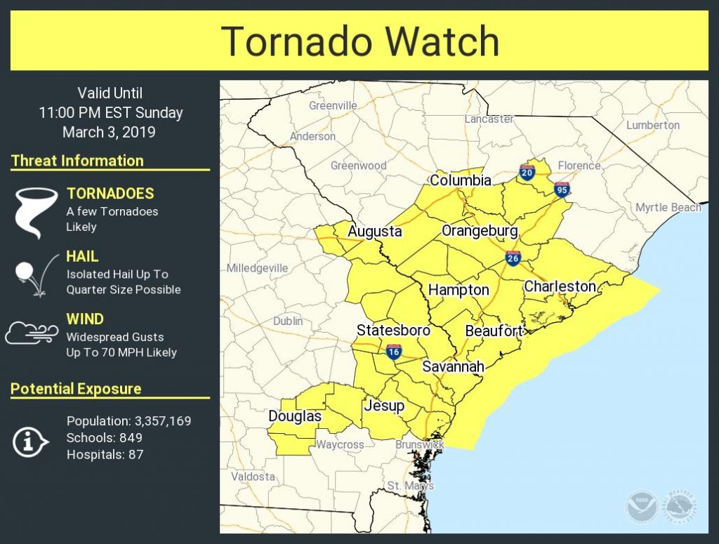
The tornado watch has been cancelled.
What to expect
Overall, here is what to expect throughout the day:
- Mostly cloudy skies will continue. A warm front will lift northward this morning, sending temperatures into the low 70s.
- Isolated showers and thunderstorms may develop ahead of the main line. It does not appear that they will be severe as the best parameters for severe weather remain to the west.
- After 4 PM, we will begin to see the line approach the Lowcountry. From here, the severe weather threat will tick upward. The heaviest weather will arrive in the area roughly around 5-6 PM and last through about midnight.
What to do
There are a few simple things you can do to stay weather-aware today:
- Fire up NOAA Weather Radio or grab an app that can warn you. Any of the local news stations will get the job done.
- Know the difference between a watch and a warning. A watch means conditions are favorable for the development of severe thunderstorms. A warning means severe storms have been observed and that you need to take action to protect yourself.
- Don’t panic. This is Charleston, and strong storms happen from time to time.
Live Blog
Live updates below…