LIVE BLOG: Tornado Watch canceled; severe threat diminishing
UPDATE: The tornado watch has been canceled.
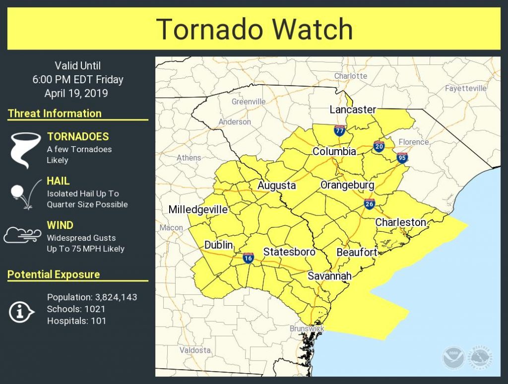
Charleston is under the gun for potentially strong to severe thunderstorms today as a strong cold front, aided by vigorous winds aloft, approaches the area.
Expect a squall line with damaging wind gusts, isolated embedded tornadoes, and hail to come through the area later this afternoon into early evening. Timing for this event will be a little later in the afternoon; suspect anytime after 2PM will be tricky if thunderstorms do not erupt ahead of the line. This will almost certainly have impacts on the evening commute, particularly for those of you trying to get a head start on Easter travel.

The Storm Prediction Center has the area outlined in a Moderate Risk for severe weather — this is the first moderate risk since April 5, 2017 — outlining just how rare and significant this event may be.
I’ll be using this live blog for analysis before, during, and after the storm. Follow along for updates…