Dorian: Impacts becoming better defined, but much uncertainty remains
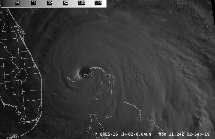
Hurricane Dorian continues to pose a significant threat to the South Carolina coastline this morning. We are awaiting the beginning of a turn to the north or northwest; this should happen at some point today, hopefully freeing the people of Grand Bahama from the eyewall of Dorian sooner rather than later. Where and when this turn happens is key to the forecast evolution down the road, so please keep in mind that there are elements that are still low-confidence.
Timing
Generally speaking, I would have preparations complete by Tuesday night, as weather could start to really deteriorate then. The best chance for impacts right now is Wednesday morning through Thursday evening. Specifics beyond that are unknowable until we can see just how fast Dorian picks up the pace.
Storm surge
Be preparing for the potential of 3-6′ of storm surge. This is going to be highly track-dependent; a wobble to the west with the center still south of us could drive in more surge. Probabilistic guidance suggests tides approaching 9.5′ will be possible in the harbor on Thursday; however, it all depends on when the center makes its closest pass. It is impossible to know exactly when the center will pass by, still, and this brings significant tidal implications.
Here’s hoping that surge peaks during low tide, a la Matthew.
Rainfall forecast

Heavy rainfall will be a major concern for a freshwater flooding threat in the coastal counties, especially right at the coast (including downtown Charleston) where up to 10″ (with even locally higher amounts) is certainly possible. The amount of rain we see is highly track-dependent. Weather Prediction Center guidance depicts a sharp cutoff of total rainfall right at I-95. A jog left or right in the track could be the difference between 1″ of rain and 5″ of rain at a particular location. There is much to watch here, and it is important that people in flood-prone areas — looking at you, Downtown, Shadowmoss, Summerville near the Ashley River — be prepared for significant water rises.
Winds

Sustained tropical storm-force winds (39-73 MPH) are increasingly likely across much of the Tri-County area starting Wednesday morning and abating later Thursday. Once tropical storm force winds kick in, preparations should be complete. The best chance for the strongest winds is going to be at the coast, but rain bands could easily pull down tropical storm-force gusts even well inland. It’s also worth noting that as Dorian moves northward and weakens, its wind field will expand, further expanding the potential for strong winds inland.

Hurricane force winds are a distinct possibility at the coast! Be prepared for the potential for sustained winds over 74 MPH on the barrier islands, beaches, and even downtown Charleston and nearby coastal communities. These winds will down trees and power lines. Again, this is a case where a wobble left or right will make a big difference between how far inland hurricane force winds can spread.
It is worth noting that Dorian is not expected to be a Category 5 storm as it makes its closest approach, but still may be a major hurricane for a time. On the current track, the strongest winds should remain offshore. But, again, we need to watch the jogs.
Bottom line
- Dorian remains notoriously tricky to forecast. Respect the uncertainty! Continue preparations and evacuate if ordered.
- Timing of greatest impacts appears to be Wednesday morning through Thursday evening. Specifics beyond that are unknowable until we get a handle on the storm’s eventual forward speed.
- Heavy rainfall combined with high tides may produce significant flooding in many spots that don’t normally flood during typical tidal flooding events.
- Tropical storm force winds are very likely with hurricane force winds remaining a significant possibility, especially near the coast.
- Track changes will change the magnitude of impacts. Follow updates closely!
Next update
The next update will come a little after 11am, once updated track guidance comes in from the Hurricane Center.
Follow my Charleston Weather updates on Mastodon, Bluesky, Instagram, Facebook, or directly in a feed reader. Do you like what you see here? Please consider supporting my independent, hype-averse weather journalism and become a supporter on Patreon for a broader look at all things #chswx!