[UPDATED] Tonight’s forecast for Dorian
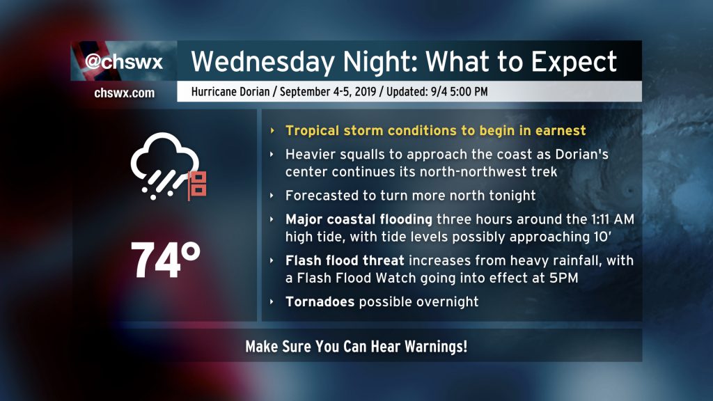
Dorian is about to ramp up across the Charleston metro area as the storm’s more central rainfall begins coming ashore. Tropical storm-force winds are already being felt at Folly Beach, and will spread further inland with time. Your window to safely evacuate has closed. Time to shelter in place and ride this thing out.
Prepare for the potential for flash flooding, power outages, and perhaps a tornado. Make sure you can hear severe weather alerts and that they can wake you!
5PM advisory shows Dorian is a little stronger
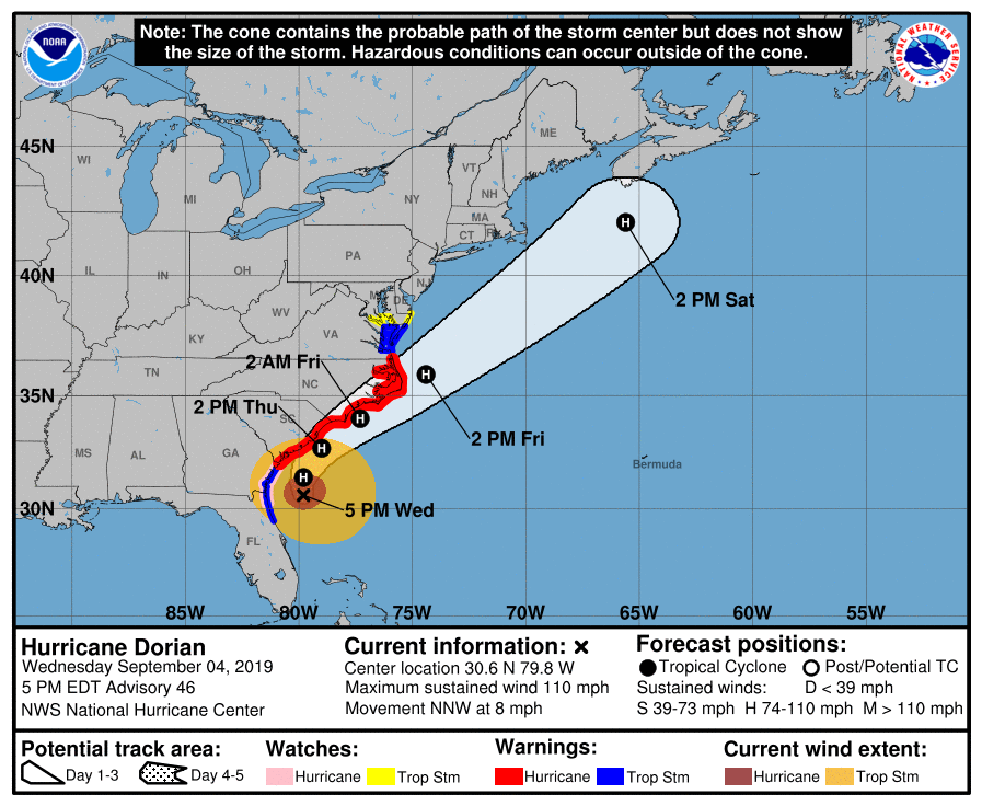
Hurricane Hunters have found that Dorian has gotten a little stronger over the Gulf Stream. This isn’t terribly surprising, but it is certainly cause for concern. There is a decent shot that it could regain Category 3 status for a time. Regardless of this strengthening, the calculus really has not changed as far as impacts on the Charleston area.
Impacts update
Tides
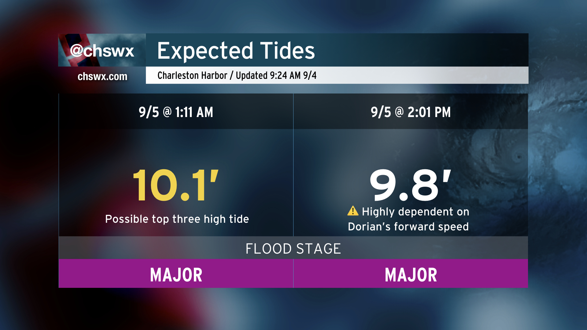
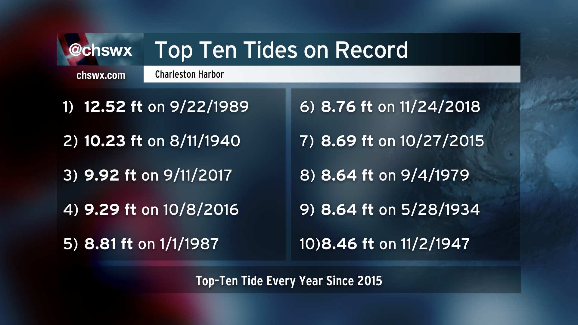
Tides have thus far underperformed, which is a good thing — instead of reaching 8.5′, the high tide only topped out at 7.38′. Surge is definitely becoming more involved, though, and we are seeing steady increases in tidal departures. A 4-7′ surge still appears likely along the South Carolina coast.

There have been a couple changes since this morning’s tide forecast. First, the 1:11am high tide has been revised down slightly to 10.1′. This is a very small adjustment to what is still an extremely high tide and with rainfall on top of it, flash flooding is likely. Second, confidence is growing in another very high tide on Thursday afternoon, when water levels may once again approach 10′. This is highly contingent on where the center of Dorian is near high tide; if it is north of the area, the wrap-around northwest flow will blow the water out.
Rainfall


Very heavy rain is possible starting tonight into Thursday. The heaviest rain looks to fall starting early Thursday morning as convergence on the west side of the center ramps up. Coastal areas look to receive the heaviest rainfall.
The Weather Prediction Center continues to highlight the area in a High Risk for flash flooding, particularly on Thursday.
Winds
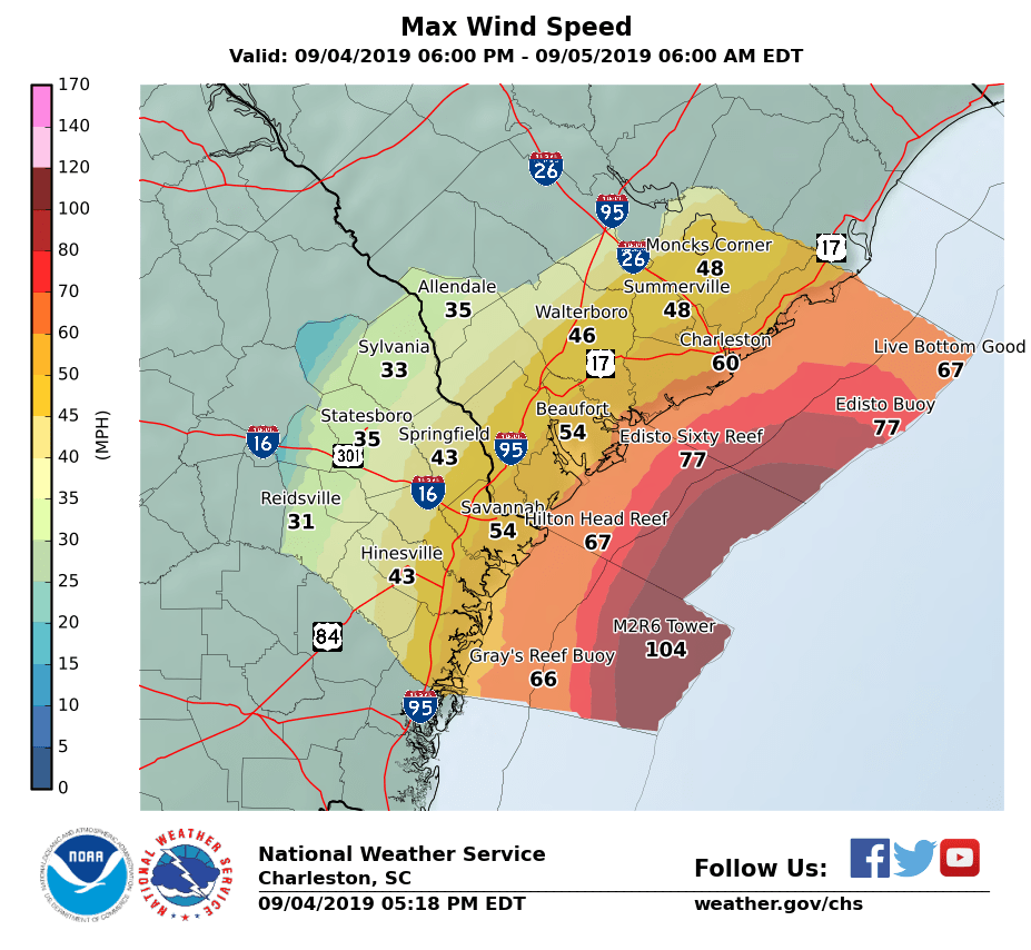
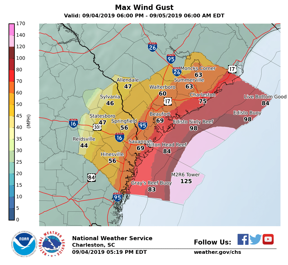
Overnight, winds will head up to tropical storm force, with hurricane force gusts possible near the coast. Power outages will continue to increase overnight. Make sure you have flashlights with fresh batteries handy in case you do lose power.
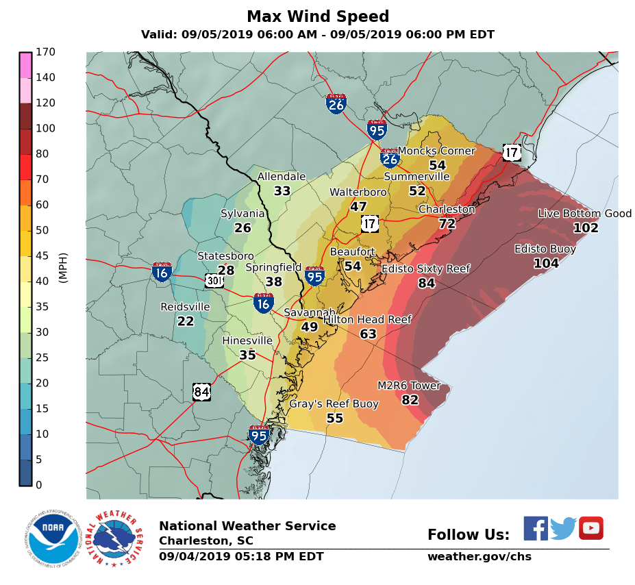
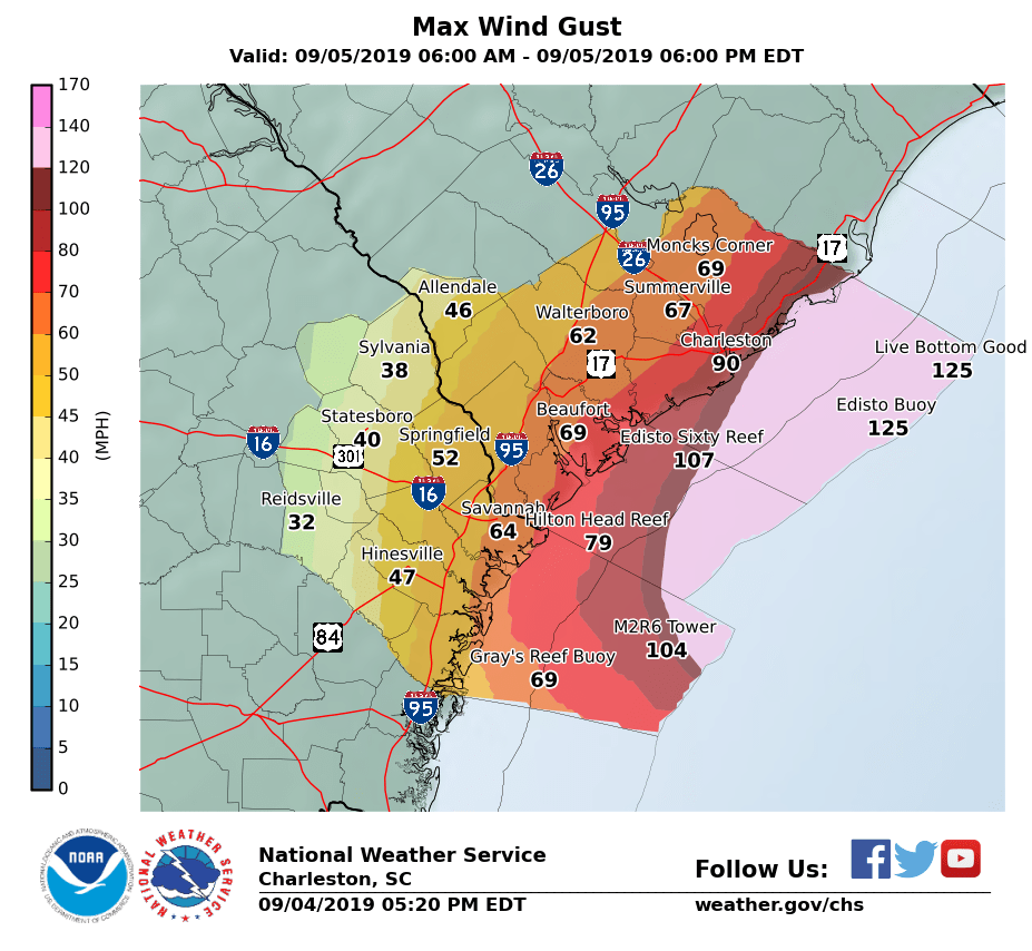
The strongest winds will lay in wait for Thursday, when sustained tropical storm force winds will overspread the entire area and gusts 80-100 MPH will be possible across the coastal areas. Widespread power outages and tree damage is likely, with the potential for some structural damage as well.
Tornadoes

While the risk is relatively low, there is a chance for a couple spin-up tornadoes across the area, particularly in the coastal counties. These tornadoes would be mostly weak and short-lived, but can still do damage and require urgent attention if a warning is issued.
Continue to follow the Live Blog for updates as Dorian’s impacts evolve.
Follow my Charleston Weather updates on Mastodon, Bluesky, Instagram, Facebook, or directly in a feed reader. Do you like what you see here? Please consider supporting my independent, hype-averse weather journalism and become a supporter on Patreon for a broader look at all things #chswx!