[UPDATED] Tornado watch canceled early, threat for severe weather is over
UPDATE: As of 6:44am, the tornado watch for Charleston County has been canceled. The severe weather threat is over. Previous reporting below, for posterity:
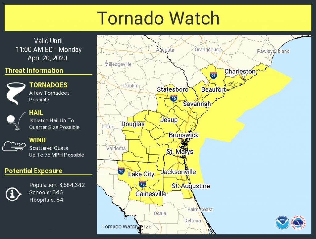
A Tornado Watch has been issued until 11 am for Charleston County and the adjacent coastal waters. We continue to monitor the progression of a warm front that looks to destabilize the atmosphere primarily in the immediate Charleston metro area for now.
Inland counties (looking at you, Berkeley and Dorchester) remain in a very stable airmass. While the warm front could impinge upon these areas and yet destabilize here, it appears that the main threat for severe weather will be along the coast through the morning. With that in mind, though, trends will be watched, and it is possible the Watch may be extended further north.
In addition to tornadoes, gusts to 75 MPH will be possible as a potent low-level jet develops along the coast. Remember, straight-line winds can still cause plenty of problems; they account for a vast majority of the weather-related damage we see here.
This will be the live blog for this morning’s event. (Or, with any luck, non-event.) Follow along with updates below…