Coastal low to bring flooding concerns, possible severe weather threat overnight into Wednesday

We’re getting a rainy start to our Tuesday as showers spread northward ahead of a low pressure system that is hugging the Florida coast. While some of these showers could be heavy at times, flooding is not expected to become an issue during the day on Tuesday. The worst weather is poised to arrive later tonight and into Wednesday as the center of the low makes its closest approach. Let’s get a look at what that means…
Coastal flooding concerns
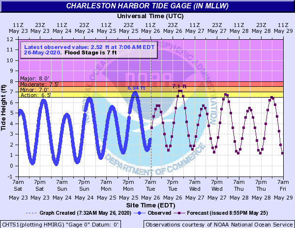
Easterly winds on the north side of the low will be driving tidal departures up today. In fact, departures are already running over a foot, and this is forecast to continue as the day goes on.

The 11:27 high tide, predicted at 5.8′ based on astronomical factors alone, should top out near 7-7.1′ in the harbor, which will be enough to produce some minor coastal flooding, particularly around the hospital district and near the Citadel. If heavy rain coincides, we may see more significant flooding issues develop.
Model data does indicate that the heaviest rain will arrive prior to daybreak Wednesday along with the strongest storms. As we know, it doesn’t have to be high tide for heavy rain to cause problems, either, so be mindful of this if you have travel plans downtown on Wednesday morning.
What to do: Be mindful of where you’re parking downtown this evening. Avoid known low spots if at all possible. Stay attuned to road conditions if you must travel.
Marginal, but non-zero, severe weather risk overnight Tuesday and Wednesday morning
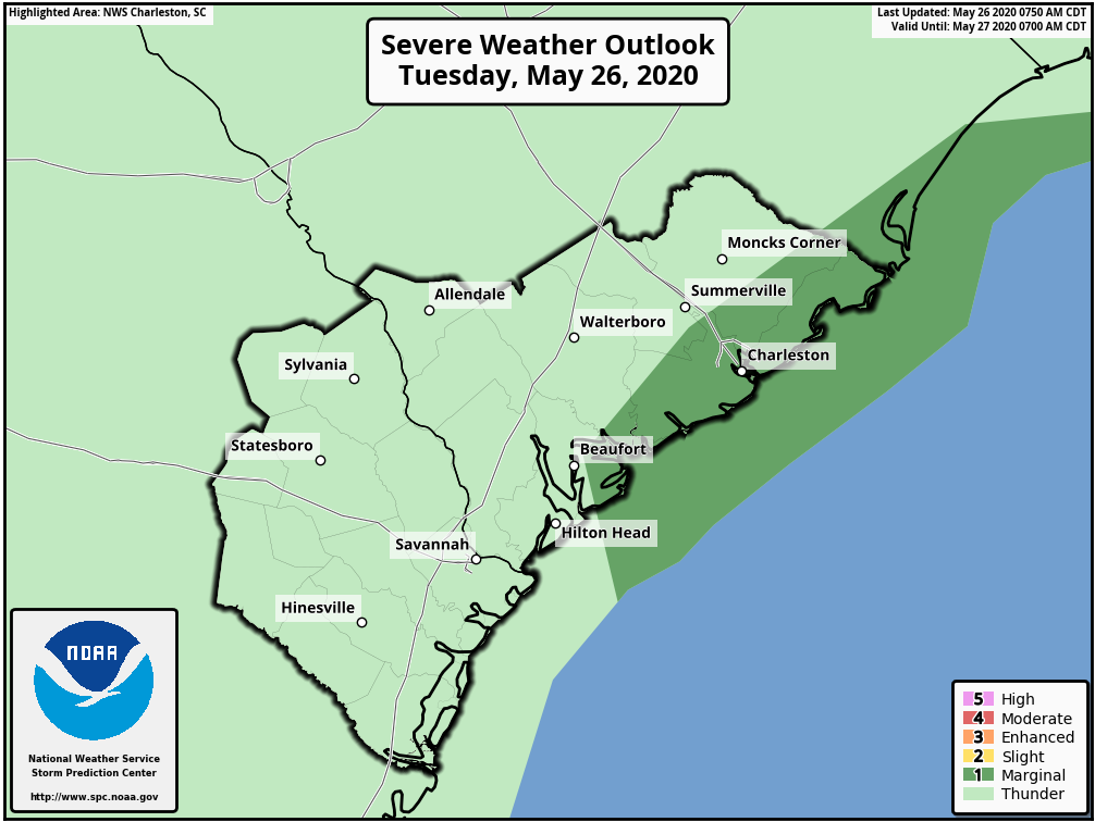
As the low moves northward, there is the potential for well-sheared warm, unstable air to move inland, promoting the risk for some damaging wind gusts and perhaps a tornado or two. The best risk for severe weather will begin very early Wednesday morning, and continue into Wednesday afternoon as the low lifts northward. This severe weather risk is conditional on how far inland the low tracks. If the low stays a bit offshore as depicted by the GFS model, this will keep the best severe ingredients there. However, the NAM and ECMWF both bring the low either onshore over Charleston or keep it just to our west, keeping us in the warm sector.
What to do: Make sure you have redundant ways to receive weather warnings overnight into tomorrow, as there is the potential for severe weather generally along and east of Highway 17-A.
Tropical development is possible, but unlikely
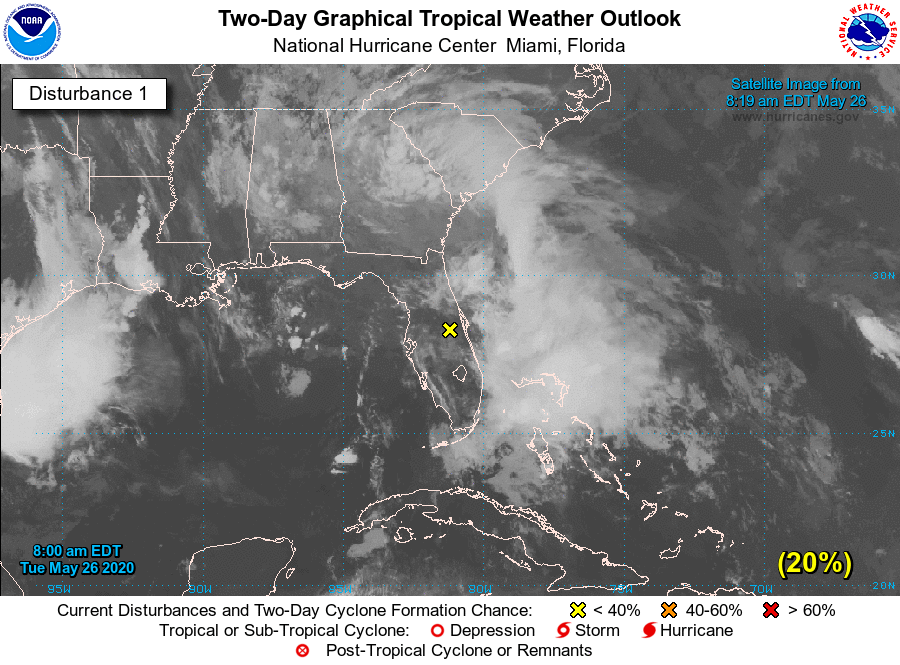
If the storm does end up tracking a little further offshore, there is the possibility that it could acquire tropical or subtropical characteristics. The National Hurricane Center is watching it, but the chances for tropical development are currently pretty low at 20%. Ultimately, I wouldn’t focus on the meteorological structure of the storm too much. Regardless of whether it acquires tropical cyclone characteristics or not, the impacts will remain the same. In the unlikely event it is named, it would be named Bertha.
What to do: Don’t get worked up over the potential for a tropical cyclone to form.