Rest of the work week: Rain-free through Thursday, then turning unsettled
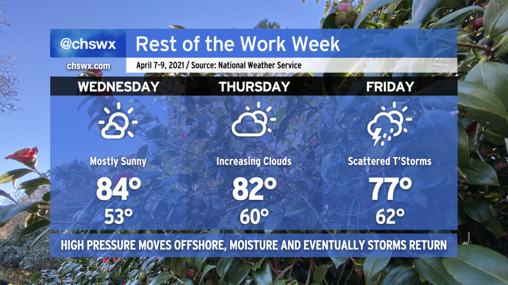
We continue our weather winning streak on Wednesday as temperatures rise into the mid-80s once again under mostly sunny skies. Humidity will remain on the low side as one more day of dry air persists. As we get into Thursday, though, high pressure will be headed offshore, and the resulting moisture return will allow for cloud cover to thicken back up and humidity to increase a little bit more. By Friday, we’ll have enough moisture in place ahead of a stalling cold front to allow for some showers and thunderstorms in the afternoon, with scattered storms remaining in the forecast through the weekend (depending on the progress of the front).
Poor air quality possible tomorrow
If you’re out and about tomorrow and suffer from asthma or other lung conditions, keep an eye on the air quality. Ozone is forecast to get close to levels that may be unhealthy for sensitive groups. While there is no official air quality alert in effect, it can’t hurt to be careful.
#SafePlaceSelfie: April 7 at 11:11am
Tomorrow at 11:11am, Weather-Ready Nation Ambassadors from across the country will be posting their Safe Place Selfie, illustrating where they go when severe weather and tornadoes become an imminent threat. You can and should join in! Tweet your photos from your severe weather safe place with the hashtag #SafePlaceSelfie and you just might get a retweet tomorrow!
Follow my Charleston Weather updates on Mastodon, Bluesky, Instagram, Facebook, or directly in a feed reader. Do you like what you see here? Please consider supporting my independent, hype-averse weather journalism and become a supporter on Patreon for a broader look at all things #chswx!