Tuesday: Chilly, cloudy, rainy
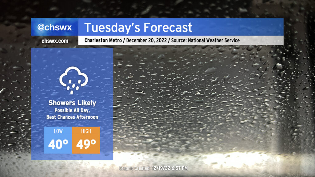
Tomorrow’s forecast, personally speaking, gives me the ick. High pressure wedging southward and moisture running atop of it thanks to low pressure to our south will help generate a chilly, cloudy, and at times rainy day in the Lowcountry tomorrow. We are already starting to see cloud cover thicken tonight primarily in the mid- and upper levels as of this writing with rain encroaching into southeast Georgia. Expect showers to build as the day goes on, with maybe ¾-1″ of rain possible before it’s all said and done.
Rain falling into the wedge will keep temperatures quite chilly tomorrow. Lows in the low 40s will struggle to the upper 40s in the afternoon at best, with the immediate coast maybe touching 50°. The northeasterly breeze will make it feel even cooler at times, with wind chills in the upper 30s falling to the mid-30s by evening. Overall, Tuesday’s a good day for soup, chili, or whatever else comforts you when the weather outside is gray and rainy.
Looking ahead: Arctic blast still on track for Christmas
After a few more unsettled days mid-week, we turn our attention to Friday’s cold front and the accompanying outbreak of Arctic air that’s expected behind it. The forecast remains on track for the weekend: Any lingering rain departs roughly by midday Friday ahead of the front, with the plume of deep moisture associated with the storm system having departed well ahead of the coldest air. (Sorry, snow fans.)
Christmas Eve will be quite a shock to the system with air temperatures bottoming out in the low 20s in much of the metro area. Winds may drive the wind chill down into the single digits, which is well into Wind Chill Advisory criteria for our neck of the woods. Highs will struggle into the upper 30s in the afternoon as winds remain somewhat elevated with cold air continuing to advect in. Christmas Day is not looking much warmer, with pipe-busting lows in the mid-20s once again expected before warming to the low 40s in the afternoon under partly cloudy skies. The cold continues into Monday, with lows in the mid-20s once again anticipated and highs only warming into the mid-40s.
Overall, holiday travel across much of the continental US may be disrupted quite significantly by the storm system that will bring this Arctic blast to much of the eastern ⅔ of the country. Be ready for numerous travel delays and be sure to check ahead with your airlines in case cancellations come about.
Follow my Charleston Weather updates on Mastodon, Bluesky, Instagram, Facebook, or directly in a feed reader. Do you like what you see here? Please consider supporting my independent, hype-averse weather journalism and become a supporter on Patreon for a broader look at all things #chswx!