Rest of the work week: Quieter and cooler
As expected, Monday didn’t last long in the “warmest day of 2023” category. We got to 94° this afternoon, the first 90° reading of the year. We missed the record high by one degree and a late-90s boy band by four. After that, the first really good round of summer thunderstorms rolled through the area, producing some impressive wind gusts particularly around the harbor, including a 75 MPH gust at the tide gauge near Waterfront Park! All in all, it’s been an eventful day of weather. Thankfully, we turn quieter and a little cooler for the second half of the work week as a cold front moves by and high pressure builds in from the north.
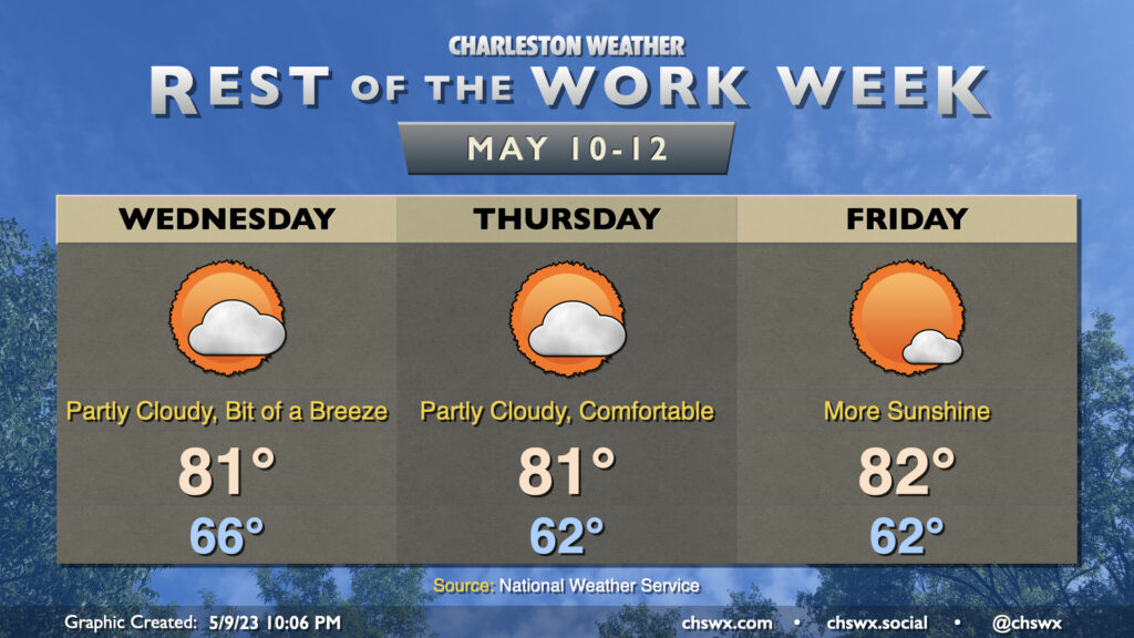
We’ll start a little on the cloudy side Wednesday, but as drier air punches in, cloud cover will thin out and sunshine will increase. Temperatures top out noticeably cooler, but still comfortably warm, in the low 80s. Rinse and repeat for Thursday — partly cloudy skies, lows in the low 60s, highs in the low 80s as high pressure continues its hold on the area with onshore flow keeping us comfortable. Friday should offer even more in the way of sunshine with just a few clouds from time to time. Highs top out in the low 80s once again after starting in the low 60s.
Winds turning a little more southerly on Friday will portend a warming trend for the weekend. We’ll hit the mid-80s on Saturday and the upper 80s to around 90° on Sunday. Rain chances for the weekend continue to be unmentionable and unremarkable — let’s hope this holds!
Follow my Charleston Weather updates on Mastodon, Bluesky, Instagram, Facebook, or directly in a feed reader. Do you like what you see here? Please consider supporting my independent, hype-averse weather journalism and become a supporter on Patreon for a broader look at all things #chswx!