Friday & the weekend: One more active day, then turning quieter
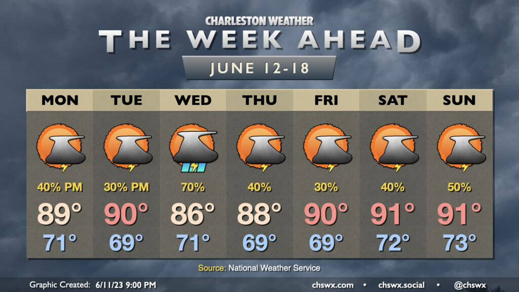
We will have one more day with off and on storms on Friday before improving weather arrives for the weekend. The blocking pattern that’s been plaguing us all week finally starts to dislodge, but a deep trough will remain across the area for Friday. This in conjunction with a front draped across the area will keep shower and thunderstorm chances in the forecast for pretty much any point during the day (though it will not be raining all the time, either). Some guidance this evening has been specifically hitting on some rainfall during the morning commute, so keep that in mind as you head out to work on Friday. Highs top out in the mid-80s with cloud cover and showers expected to be around once more.
The aforementioned upper low finally pulls away for the weekend. This will help move the front offshore and kick a little drier air into place starting Saturday. Highs top out in the upper 80s after we start the day in the low-to-mid-70s under partly cloudy skies, though a few thunderstorms should fire along the seabreeze in the afternoon (as is often the case during summertime). Sunday looks even quieter, with a such a low risk of a random shower or storm as to be unmentionable in the forecast. We should top out around 90° Sunday, and I suspect that’ll help get many folks out to the beaches, so use some patience as you may very well be dealing with traffic.
Tropical update: Cindy forms, Bret moves through the Lesser Antilles
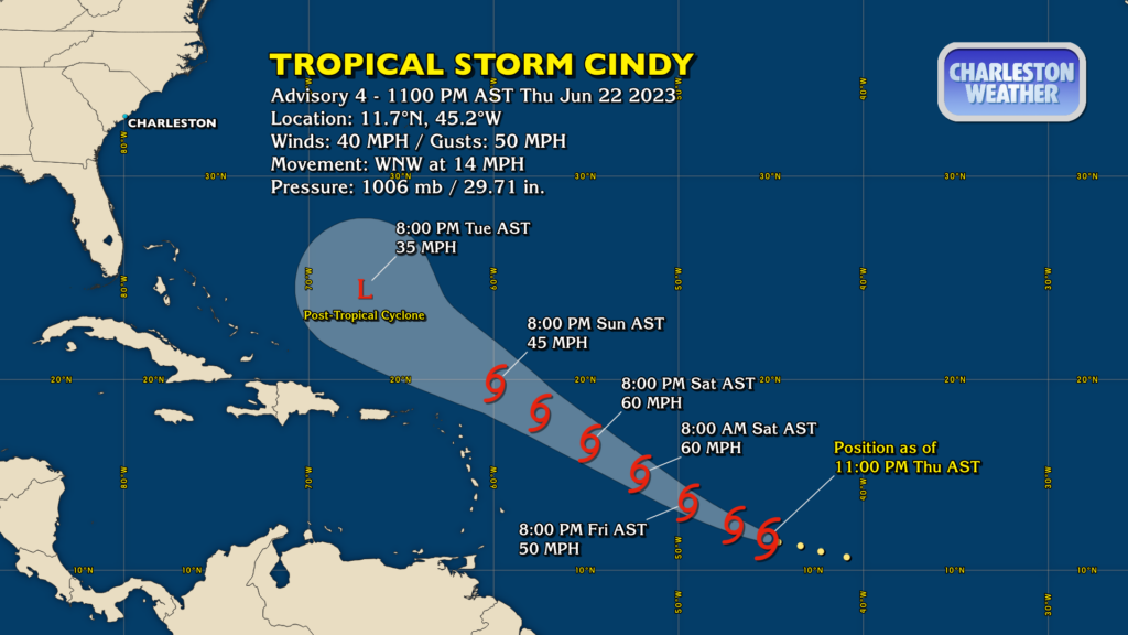
Tropical Storm Cindy has formed in the Atlantic on the heels of Tropical Storm Bret. Cindy was classified as a depression earlier today and as of the 11PM advisory was upgraded to a tropical storm with winds of 40 MPH. It’s moving to the northwest at 14 MPH and doesn’t appear to be a significant threat to land as it should track north of the Lesser Antilles over the weekend before being sheared apart. Despite the ominous look to the track map, rest assured, it does not pose a threat to the Lowcountry.

Bret briefly strengthened to 70 MPH max sustained winds earlier today, but that has since backed off some as the storm has begun moving into a more hostile environment. As of the 11PM advisory, Bret was about over St. Vincent, moving west at 18 MPH. It is forecast to weaken further over the next couple days and should open back up into a wave by Saturday evening. Bret, too, does not pose any risk to the Lowcountry.
Follow my Charleston Weather updates on Mastodon, Bluesky, Instagram, Facebook, or directly in a feed reader. Do you like what you see here? Please consider supporting my independent, hype-averse weather journalism and become a supporter on Patreon for a broader look at all things #chswx!