Blog

/ December 28, 2024 at 1:32 PM

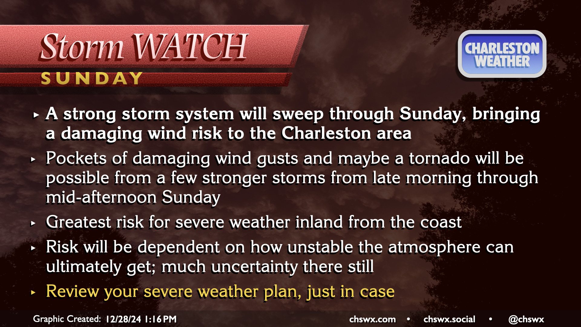
A showery and humid Saturday will give way to a stormier Sunday as a cold front approaches the area. Showers and thunderstorms ahead of the front could produce pockets of damaging wind gusts, with a tornado not out of the question, especially inland. Stay tuned…

A strong storm system will sweep through Sunday, bringing a damaging wind risk to the Charleston area.
Pockets of damaging wind gusts and maybe a tornado will be possible from a few stronger storms from late morning through mid-afternoon Sunday.
The greatest risk for severe weather will be inland from the coast.
The risk will be dependent on how unstable the atmosphere can ultimately get; there is much uncertainty there still.
Review your severe weather plan, just in case.