Tuesday: Another picture-perfect day
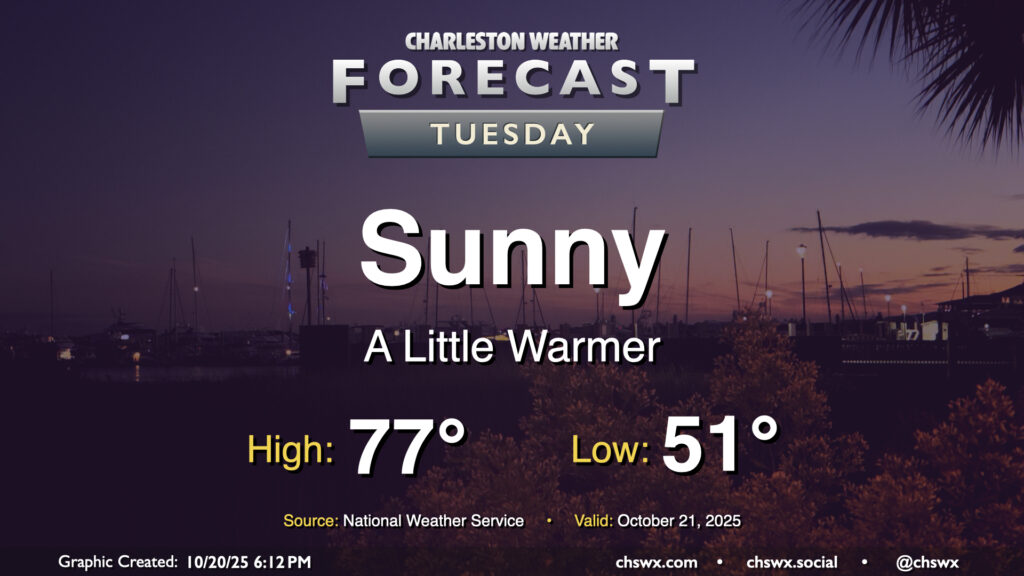
No complaints in the weather department for Tuesday as high pressure remains the main weather driver with deep-layer dry air in place across the region. Temperatures start on the cool side once again, with lows bottoming out in the low 50s (with perhaps a few readings in the upper 40s in more rural and sheltered areas). We’ll warm to the mid-to-upper 70s under predominantly sunny skies in advance of a dry front that comes through early Wednesday morning.
Rest of the work week: Still pleasant with a reinforcing shot of cooler air
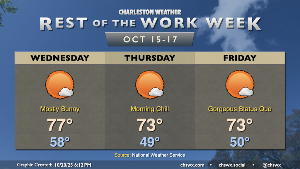
The good times will continue to roll (weather-wise, anyway) over the next few days as a reinforcing shot of cooler and drier high pressure moves into the area. Despite a frontal passage, Wednesday will continue to run on the warmer side, with temperatures topping out in the mid-to-upper 70s thanks to a little bit of downslope flow. High pressure will settle in more overhead on Thursday, and the resulting calming winds and clear skies will allow lows to fall into the upper 40s across the metro Thursday morning. We’ll warm to the low-to-mid-70s in the afternoon with just a stray cloud or two. Similar conditions are expected Friday, with another bit of chill in the air to start followed by a beautiful afternoon. Cloud cover ticks up a bit for the weekend, but otherwise continues to look good, with the next slight shower chance now coming Monday.
Follow my Charleston Weather updates on Mastodon, Bluesky, Instagram, Facebook, or directly in a feed reader. Do you like what you see here? Please consider supporting my independent, hype-averse weather journalism and become a supporter on Patreon for a broader look at all things #chswx!