Thursday: Warming trend begins
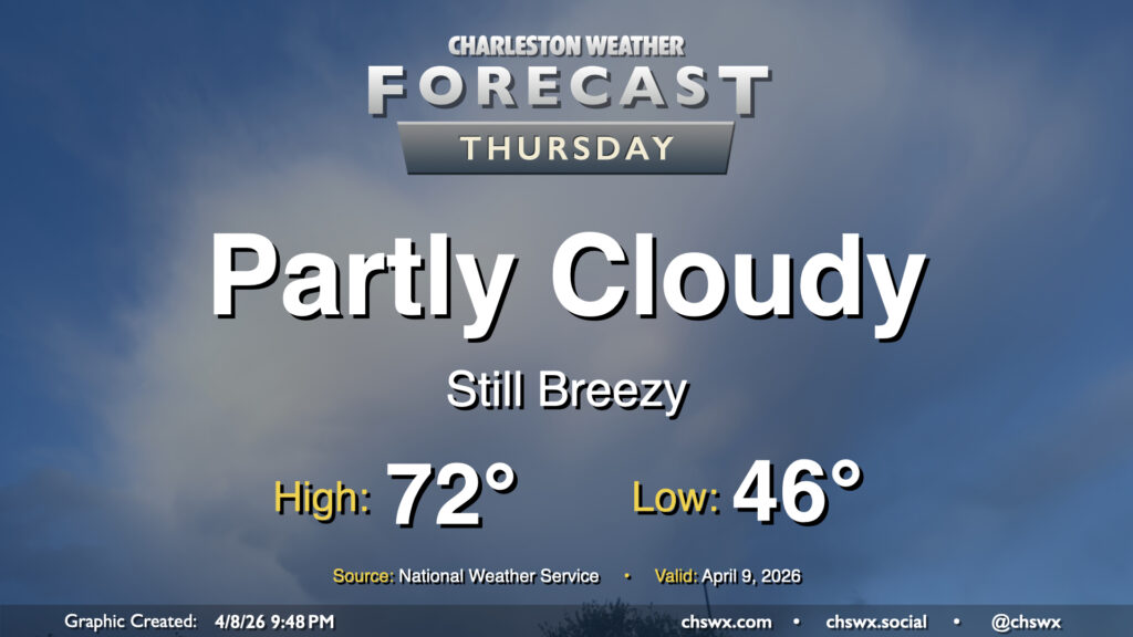
After temperatures topped out just around 70° inland from the coast — which remained in the low 60s, including downtown — we’ll start to warm up a little bit on Thursday, though breezy northeasterly winds will persist and keep the coast pinned to the mid-60s. We’ll see ample sunshine, though, and it’ll be a generally seasonable day for early April.
Friday & the weekend: 80s return
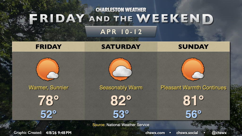
The warming trend gets more pronounced starting Friday as high pressure slips offshore and builds in from the Atlantic, while high pressure aloft nudges in from the west. The stacking high pressure and southerly flow at the surface will bring temperatures into the upper 70s on Friday and the low 80s each day this weekend. These temperatures continue to run above normal for this point in April — we’d normally see temperatures like this toward the end of the month into May. No rain is expected, which isn’t the best news for the ongoing drought, but will be acceptable for getting out and about.
No rain is forecasted well into next week, which will complicate the drought situation further. Fortunately, dewpoints will run in the 50s and 60s, keeping relative humidity values above critical fire thresholds.
Follow my Charleston Weather updates on Mastodon, Bluesky, Instagram, Facebook, or directly in a feed reader. Do you like what you see here? Please consider supporting my independent, hype-averse weather journalism and become a supporter on Patreon for a broader look at all things #chswx!