Jared Smith founded @chswx on Twitter in 2008 as an experiment in disseminating weather data through social media. In the ensuing decade-and-a-half, @chswx has provided live coverage of tropical cyclones, tornadoes, severe weather, and even a couple bouts of winter weather to the good people of Charleston, SC.
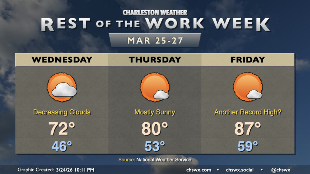
As expected, Tuesday was quite the dreary, cool day. We set the daily highs at both downtown and North Charleston after midnight, with the preliminary daily low of 53° being set in the afternoon as of the 5PM climate report. (This will get cooler — as of this writing, it’s 52° at the airport.) We begin to see signs of recovery on Wednesday, though, as the high pressure wedge weakens and scours out, allowing progressively more sunshine through during the day. Expect lows in the mid-40s to warm to the low 70s in the afternoon — basically right on target for this point in the year.
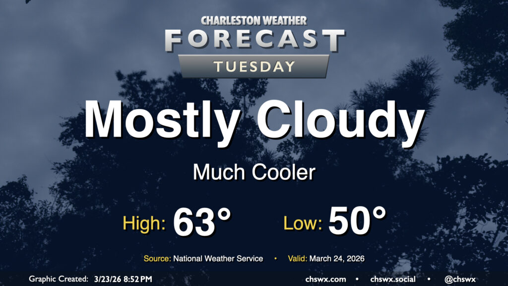
Tuesday could be quite a shock to the system after Monday’s record warmth. We’ll go from a high of 90° on Monday, which was not only a daily record high but the fourth earliest 90° day on record, to a high in the low 60s on Tuesday with mostly cloudy skies in the wake of a cold front that is entering the Tri-County area as of this writing. No rain is expected, but we can expect breezy northeasterly winds as a cold air damming regime takes hold, at least briefly.
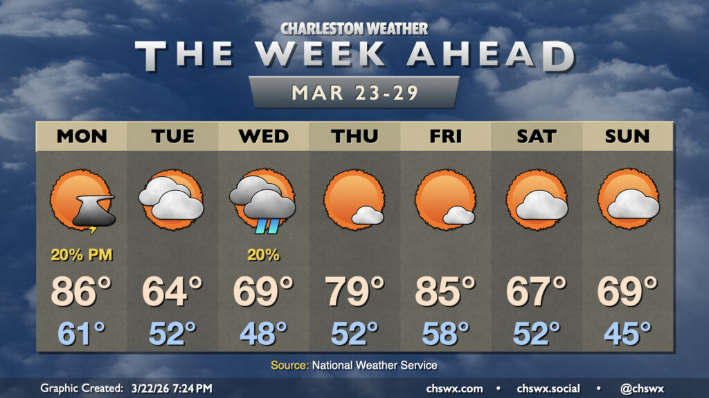
The last full week of March promises quite a big swing in temperatures from seemingly day to day as a series of fronts affect the area. We’ll have a few shots at showers, too, but they don’t look likely to offer much in the way of drought relief.
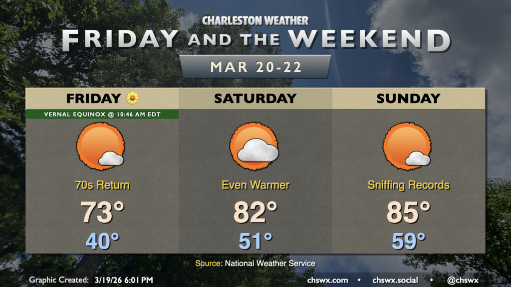
Astronomical spring begins Friday with the vernal equinox at 10:46 AM, and the weather will certainly be appropriate as the warming trend that began Thursday continues into Friday and the rest of the weekend. Friday will be a very pleasant day, even just beyond being Friday; after a low around 40°, temperatures will warm to the low-to-mid-70s in the afternoon with plenty of sunshine to be had.
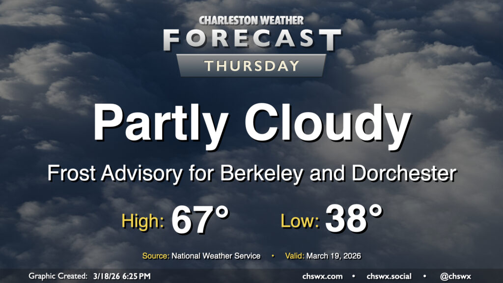
Another frosty start awaits for Thursday as temperatures fall to the upper 30s in the metro and a little lower across inland locations. Calmer winds and higher dewpoints will allow for frost formation overnight, particularly in Berkeley and Dorchester counties where a Frost Advisory is in effect through 9am. From there, it’ll feel much warmer than it did on Wednesday, with highs expected to peak some 10° warmer Thursday afternoon, generally in the mid-to-upper 60s. Cloud cover will be a bit variable, but generally expect a fair bit of sunshine throughout the day with no concerns for precipitation.
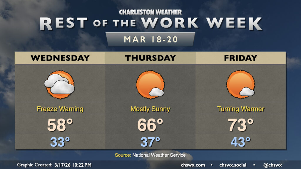
Quiet weather continues for the rest of the work week with high pressure in control. Wednesday gets off to a very chilly start with Freeze Warnings in effect as temperatures fall into the low 30s in the metro with perhaps some upper 20s further inland. Where temperatures don’t fall below freezing, frost will be a concern with mostly clear skies, so everyone should protect plants. Wednesday will remain much cooler than normal for mid-March with highs only peaking in the upper 50s. Clouds will be on the increase throughout the day but there are no concerns for any precipitation.
Thankfully, the atmosphere did not live up to its potential on Monday, leaving us to get some much-needed rain without any of the shenanigans that we thought might come with. The cold front is through now, and temperatures will be falling into the mid-30s overnight in the metro, with subfreezing temperatures expected further inland, perhaps in parts of Berkeley and Dorchester counties. Elsewhere, frost shouldn’t be much of a factor given elevated winds continuing overnight.
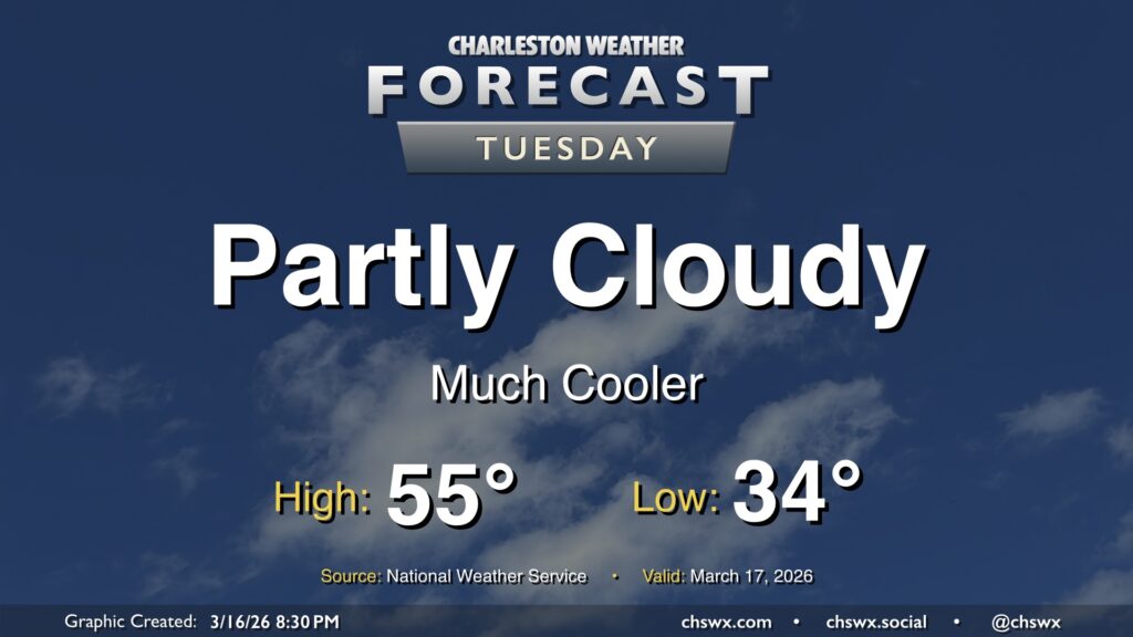
Temperatures will only peak in the mid-50s on Tuesday despite plenty of sunshine, owing to the potency of the cold airmass.
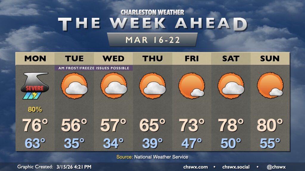
The week ahead gets off to a bit of a rough start as a potent cold front moves through the area Monday, bringing the first significant severe weather threat of 2026 to the Lowcountry. From there, temperatures fall off drastically, with some frost and freeze issues possible especially inland. We’ll warm back up heading into the weekend, though.
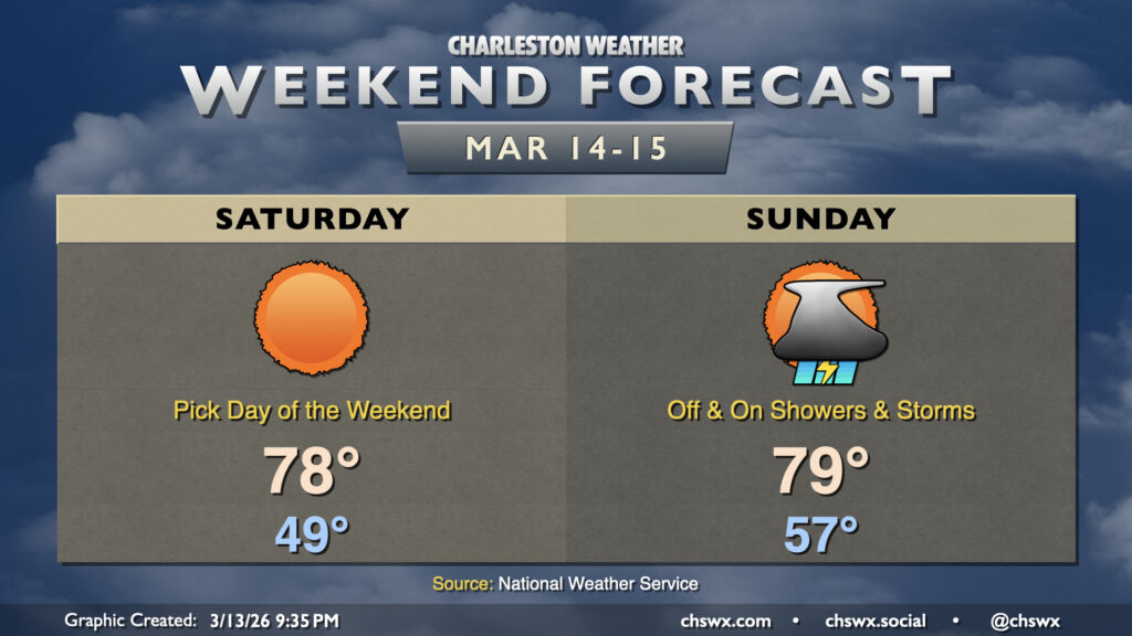
A bifurcated weekend of weather awaits, with a gorgeous day ahead on Saturday followed by a more unsettled day on Sunday ahead of a cold front that could bring about some strong storms Monday.
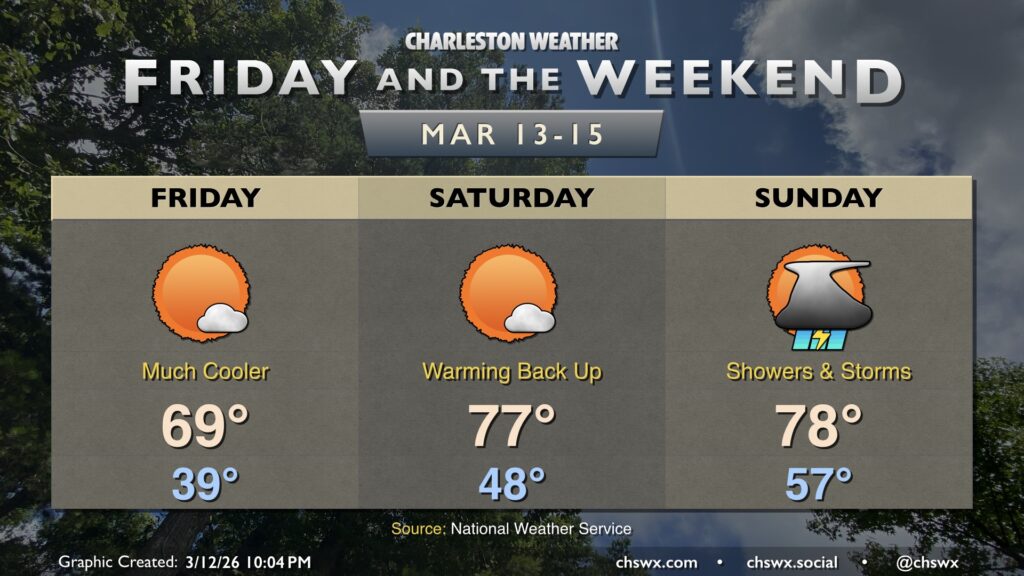
Friday will feel a lot different than much of the past week has, courtesy of a cold front that came through and put a chill back in the air Thursday afternoon and evening. Temperatures Friday start in the 30s across much of the metro away from the immediate coast, warming to the upper 60s to around 70° in the afternoon under mostly sunny skies. These high temperatures are much more in line with what we should normally see in mid-March.