Jared Smith founded @chswx on Twitter in 2008 as an experiment in disseminating weather data through social media. In the ensuing decade-and-a-half, @chswx has provided live coverage of tropical cyclones, tornadoes, severe weather, and even a couple bouts of winter weather to the good people of Charleston, SC.
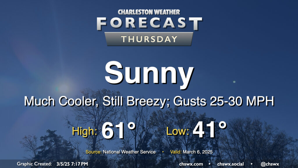
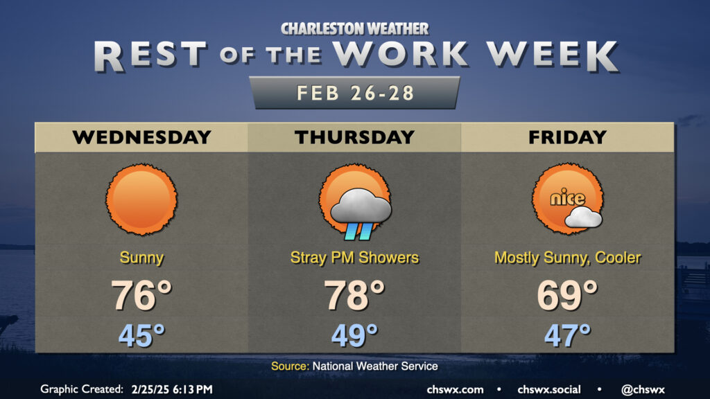
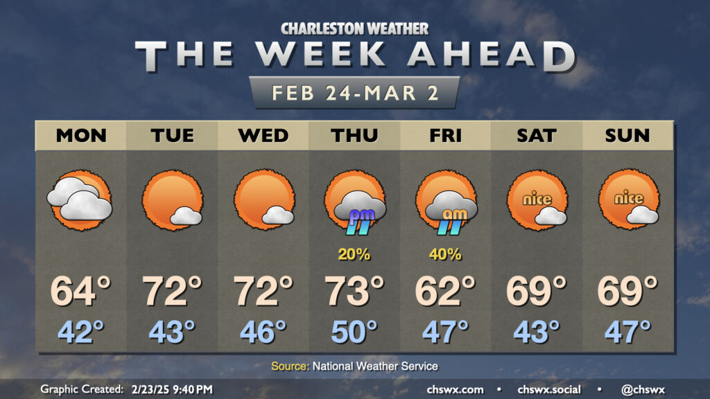
After a windy and occasionally rainy Wednesday that, thankfully, didn’t result in any severe weather, we will turn much cooler and sunnier for Thursday. Temperatures start in the low 40s, warming to just the low 60s in the afternoon with breezy conditions featuring gusts 25-30 MPH at times, particularly in the morning through the early afternoon as high pressure builds in. We’ll see that high pressure settle in a little more later Thursday night, and that will help winds go a little calmer and start to cool us off for potential frost and freeze issues inland for Thursday overnight into Friday morning.
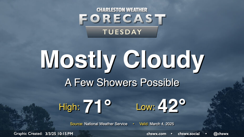
After a sunny but chilly Monday, temperatures begin to warm up ahead of Wednesday’s cold front as we get into Tuesday. We’ll also see cloud cover begin to thicken up as well, and there could even be a few showers at times as Atlantic moisture builds in. We start the day in the low 40s — about 10° warmer than the frosty start we felt on Monday morning — and head back to the low 70s in the afternoon. It’s going to be breezy as well — winds will generally run between 10-15 MPH, but could gust to 20-25 MPH at times.
The first full week of March will have a little of everything, from some frost and freeze to start followed by a round of springtime storms — a few of which could be severe — followed by another dip below normal. Monday starts with a Freeze Warning inland and a Frost Advisory closer to the coast as lows drop to around freezing across much of the area. We’ll warm back into the low 60s in the afternoon under generally partly cloudy to mostly sunny skies; this will still run a few degrees below normal for early March.
Climatological winter has come to an end, and the first day of climatological spring will certainly feel the part. We’ll start the day in the mid-to-upper 40s, warming solidly into the mid-70s in the afternoon with just a few clouds expected.
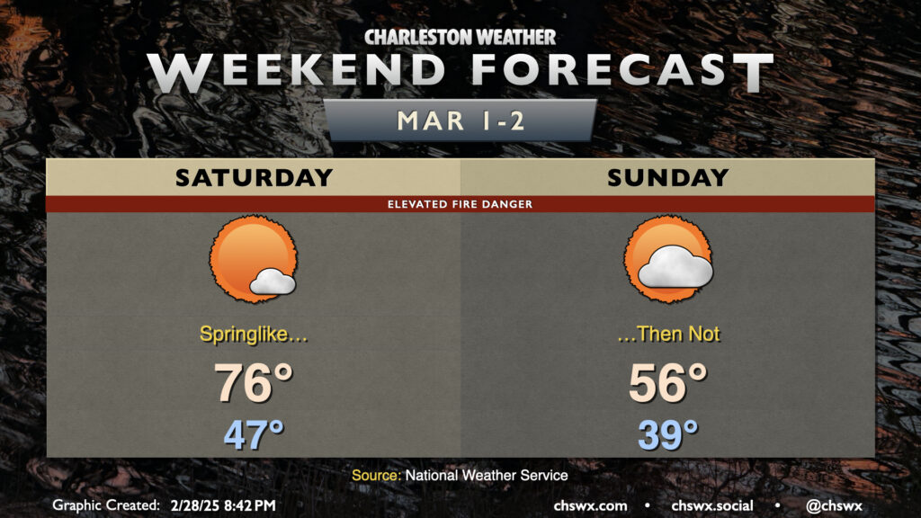
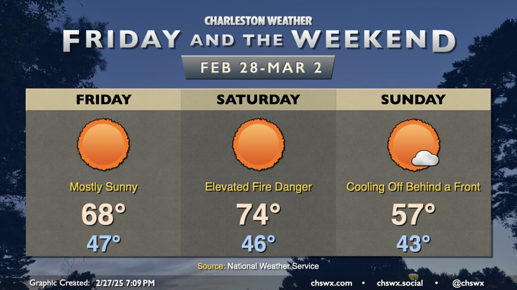
A front swings through overnight Saturday, sending temperatures much cooler for Sunday. We’ll start Sunday a bit more on the cloudy side; expect lows to fall into the upper 30s with cooler air blowing in behind the front. Cold high pressure building in will help clear skies out, but it will also drive highs down some 20° cooler than Saturday — think mid-50s vs. mid-70s. Quite a shock!
The main issue we’ll need to watch for is elevated fire danger due to dry fuels and breezy conditions. Gusts over 20 MPH could help a seemingly benign fire spread more than you might think, so please be careful if you must burn.
Finally, the start of climatological spring also signals the beginning of the 2025 growing season, which means that frost and freeze alerts will once again be issued by the National Weather Service in the event temperatures fall to those levels.
We’ll climb back aboard the temperature rollercoaster this weekend as a series of fronts affect the area. The first one, coming through Thursday night into early Friday, will knock temperatures down about 10° or so with highs in the upper 60s expected Friday afternoon with mostly sunny skies. This is just a click on the warm side of normal for February 28, which marks the end of climatological winter.
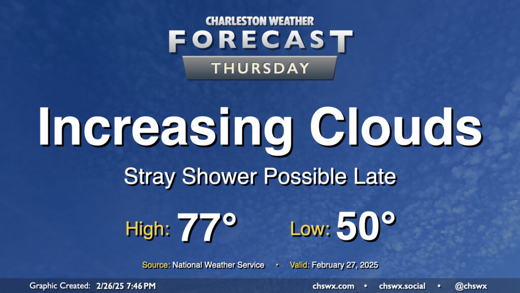
After reaching 79° on Wednesday, some 13° above normal for this point in the year, we’re back in the mid-to-upper 70s on Thursday but with some increasing cloud cover ahead of an approaching cold front. Moisture ahead of the front won’t be the best, but a few showers will be possible later Thursday into the overnight as it gets by, so be aware for the potential for a little rain. It’ll also be a bit of a breezy day, with winds 15-20 MPH possible out of the southwest particularly in the afternoon.
After hitting 76° on Tuesday — 10° above normal, but still 10° below a record — we’re back to the mid-70s on Wednesday with more sunshine expected. Once again, we’ll start the day in the mid-40s, which is close to normal for February 26, but the forecast high of 76° will once again run 10° above normal.
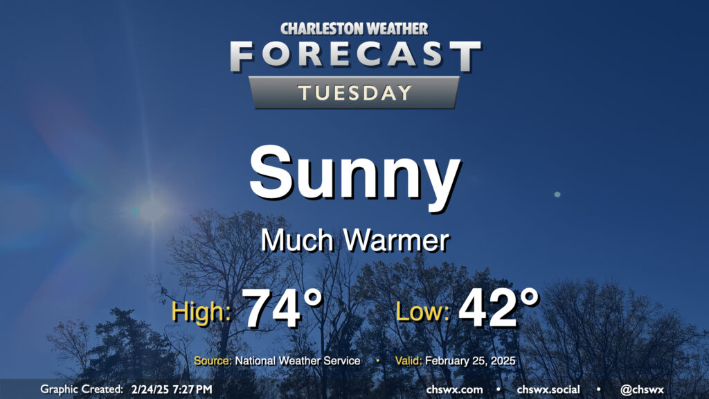
A cloudy and cool Monday will give way to a much sunnier and warmer Tuesday. After starting in the low 40s, expect highs to peak in the mid-70s in the afternoon, several degrees warmer than the 68° we peaked at on Monday. This is well above normal for the end of February; the normal high for February 25 is 66°.
Climatological winter, which runs from December 1 to February 28 (or 29th, depending on the year) will end on a very spring-like note this week as temperatures head back above normal starting mid-week and beyond (with the exception of Friday, when a front comes by with a minor shot of cooler air).