Jared Smith founded @chswx on Twitter in 2008 as an experiment in disseminating weather data through social media. In the ensuing decade-and-a-half, @chswx has provided live coverage of tropical cyclones, tornadoes, severe weather, and even a couple bouts of winter weather to the good people of Charleston, SC.
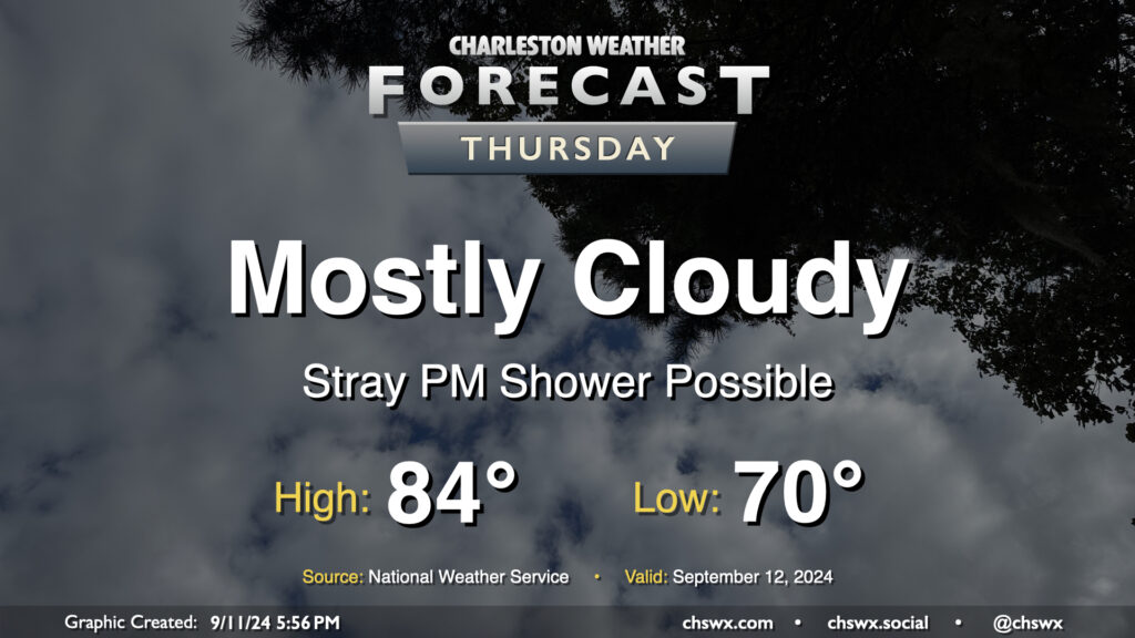
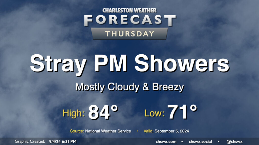
Cloud cover will continue on Thursday as moisture from Hurricane Francine, which has made landfall in Louisiana as a Category 2 storm with maximum winds of 100 MPH, continues to push northward across the Southeast and into the Lowcountry. High pressure will try to hang on across the East Coast, though Francine will continue to dislodge it north and east. Moisture moving atop high pressure will create plenty of clouds and may be enough to get a few showers going in the afternoon as well, though many of us should stay dry for one more day. We start Thursday around 70°, warming to the mid-80s in the afternoon despite the cloud cover.
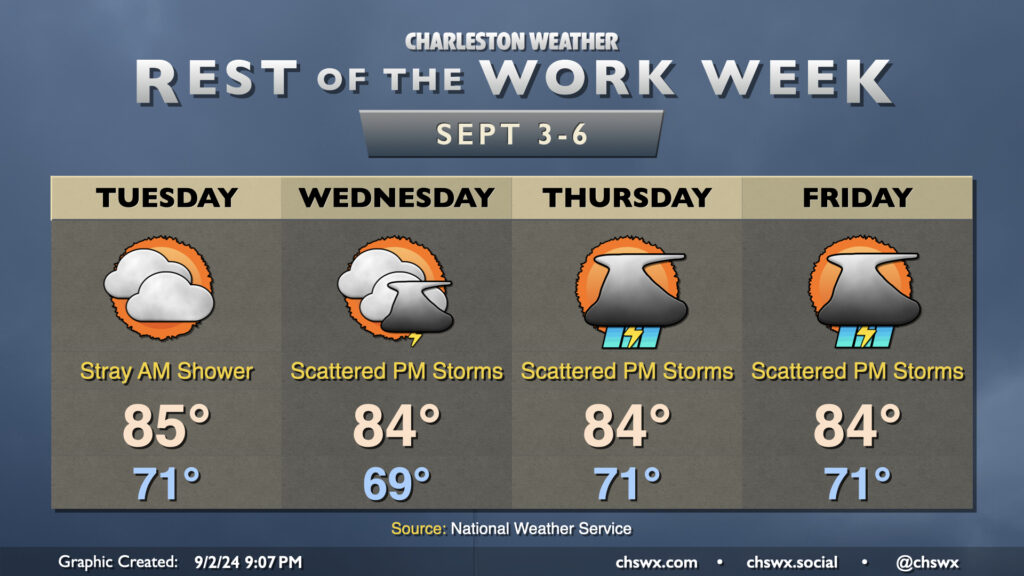
After a beautiful Tuesday featuring plenty of sun and comfortably warm temperatures, cloud cover returns to the area as moisture from Hurricane Francine lifts northward across the area. While Francine won’t have direct impacts in the Lowcountry, its northward advance into the Mississippi River valley will shove high pressure offshore, allowing the stationary front that has been draped to our south to start to retreat northward a bit. Upglide across the frontal surface and high pressure will help produce showers and maybe a few thunderstorms as well.
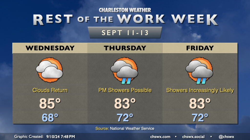
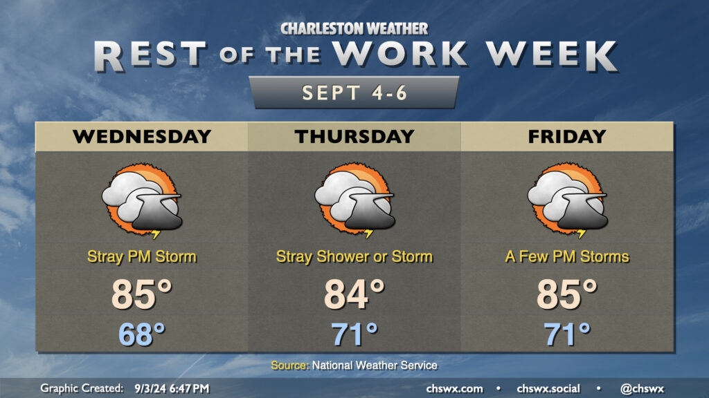
Wednesday looks to be rain-free with merely an uptick in cloud cover and dewpoints. We’ll start the day much warmer than we started Tuesday, with lows generally in the upper 60s to around 70°. Temperatures warm to the mid-80s in the afternoon despite the increasing cloud cover.
Much of the metro should get Thursday in rain-free as dry high pressure continues to hang tough at the surface, but we’ll start to see that erode with time, introducing some shower chances to the forecast starting Thursday afternoon. Cloud cover and persistent northeasterly winds will cap highs to the low to mid-80s after starting in the low 70s. Moisture more fully overtakes the area by Friday, and this leads to increasingly numerous showers and maybe some thunderstorms across the area as we get through the day, with rain chances peaking in the afternoon and evening hours. Once again, highs will be limited to the low to mid-80s with the cloud cover and expected rain.
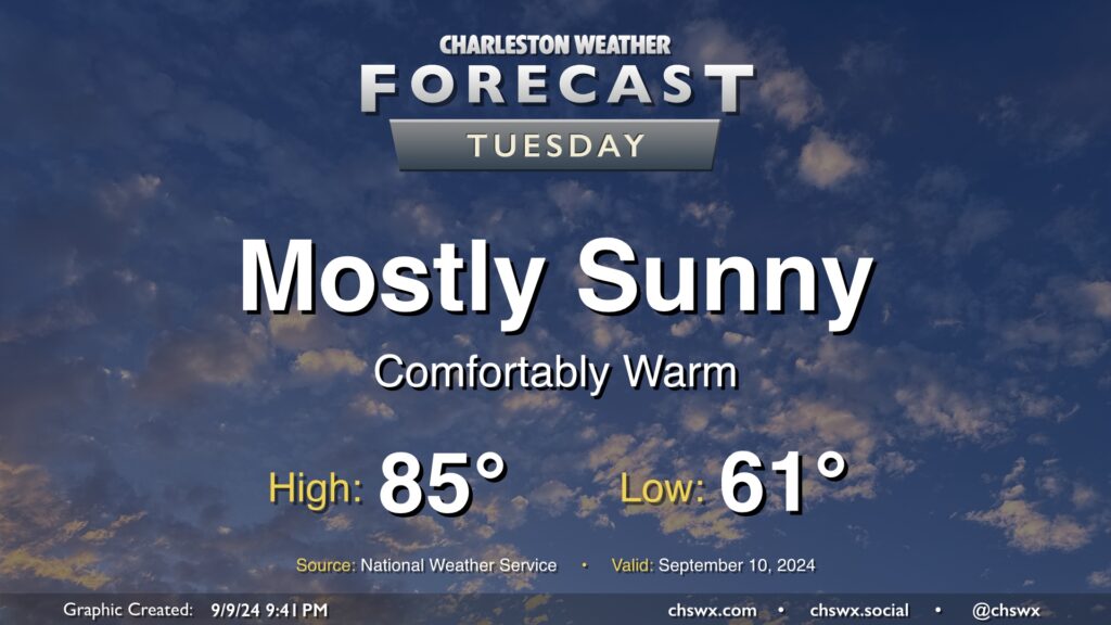
Tuesday looks like a rather nice day in our part of the world with mostly sunny skies, a seasonably cool start in the low 60s, and highs in the mid-80s with relatively low humidity as high pressure’s influence on the area peaks before moisture returns starting Wednesday. I hope you can take advantage! Unsettled weather will return to the area by Thursday.
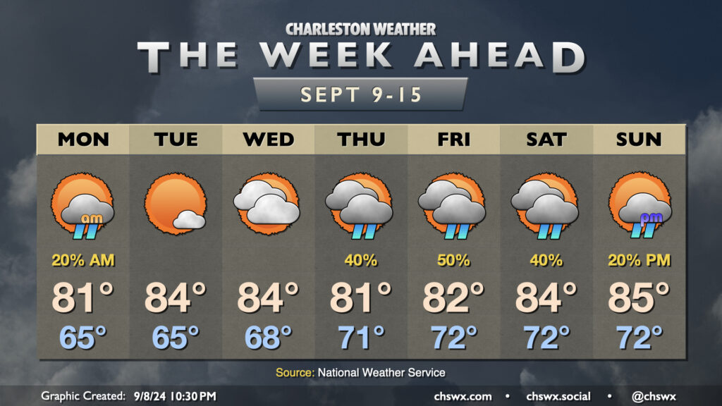
Below-normal temperatures will continue this week as we remain under in the influence of high pressure anchored to the northeast, with showers taking a break for a few days before returning to the forecast for the weekend.
A few lingering showers will be possible Monday morning with a stationary front nearby, though high pressure will continue to nudge that front further and further south, clearing us out for a couple nice days. Mostly cloudy skies keep highs capped to the low 80s on Monday after a mid-60s start, but we should see gradual reduction in cloud cover throughout the day. Tuesday looks to be rather nice, with lows in the mid-60s yielding to highs in the mid-80s under partly cloudy to mostly sunny skies. We’ll start to see the front to our south buckle a little more as low pressure — which is forecast to become Hurricane Francine — moves toward the Louisiana Gulf Coast during the middle of the week. This will net us an uptick in cloud cover and dewpoints for Wednesday, but we’ll get one more rain-free day in.
The high pressure center to our northeast that’ll give us a relatively quiet start to the week will be nudged eastward, which will allow the persistent stationary front to retreat a bit northward. This will bring an uptick in shower chances beginning Thursday and lasting into at least Saturday. It won’t rain all the time, but you’ll want to consider indoor plans as a backup to any outdoor plans. High temperatures will head down a bit with the uptick in cloud cover and showers, with highs in the low 80s expected Thursday and Friday before winds get a little more due-east, bringing some warmer temperatures back to the area for the weekend. Still, though, we stay below mid-September norms, generally running in the mid-80s Saturday and Sunday.
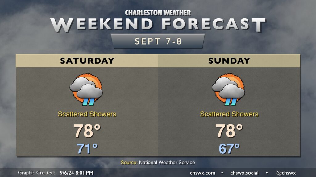
A showery and cool weekend awaits as a trough remains draped over the eastern US, driving disturbances through the area and keeping temperatures well below normal for this point in the year.
Saturday starts in the low 70s, warming only to the upper 70s for the first time since May under mostly cloudy skies. Shower chances will be highest in the morning and will taper, but not completely cease, during the day. Rainfall amounts should be generally light, though you can never totally rule out a pocket of heavier rain or two.
Sunday’s rain chances will tick up some as the day goes on as another disturbance moves through. It’ll be another cooler-than-normal day, with a pretty seasonable start in the mid-to-upper-60s before highs once again top out in the upper 70s in the afternoon. A rumble of thunder isn’t totally out of the question as the stationary front continues to hang out, but otherwise, just be ready for some showers at times.
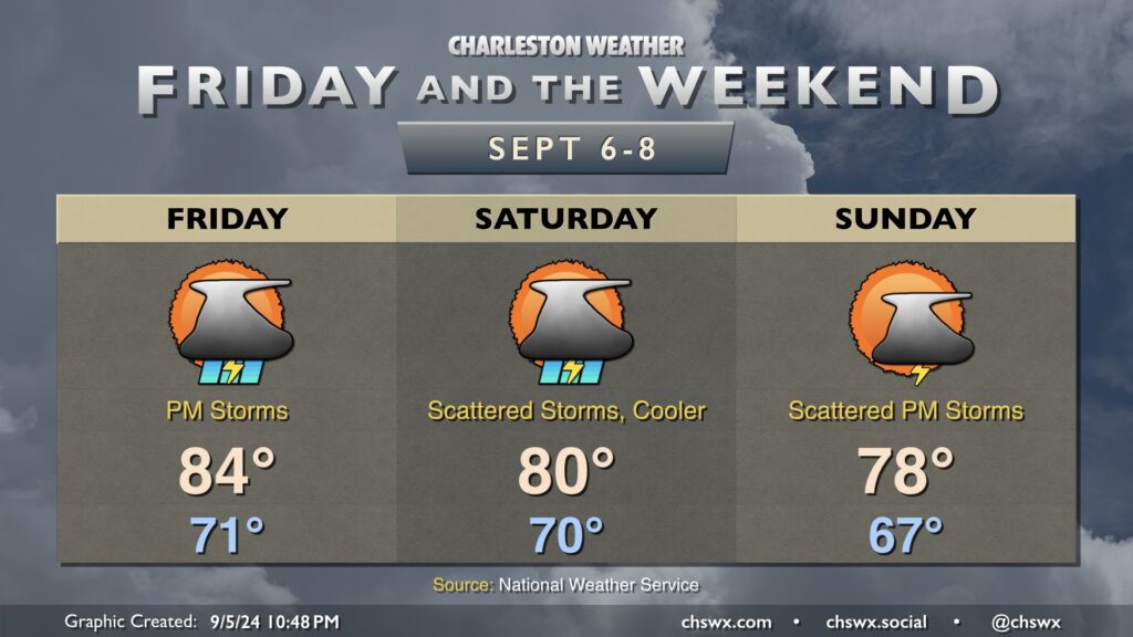
A reinforcing shot of cooler air will send temperatures well below normal this weekend, but first we have to get through some elevated rain chances for Friday that linger into Saturday. Friday starts in the low 70s, warming to the mid-80s in the afternoon. Low pressure developing along the front will strafe the area in the afternoon and evening hours, driving rain chances up across the area as it does so. Rain chances peak Friday evening into Saturday morning, though scattered storms will remain possible much of the day Saturday. A trough of low pressure hangs over the area on Sunday, and this keep the risk for a few showers and storms in the forecast especially in the afternoon.
Temperatures will dive even further below normal Saturday and Sunday. Expect highs to only reach about 80° on Saturday, while we may not even crack 80° on Sunday. If the high of 78° verifies, it’d be the coolest high temperature since May 18, when we also reached 78°! Fall will certainly be a bit more in the air, that’s for sure. Temperatures recover back into the low 80s as we get into next week, but remain well below early September normals.
The wedge of high pressure that’s kept things breezy and cool but largely quiet hangs on for one more day Thursday. We’ll start the day in the low 70s, warming to the mid-80s in the afternoon under a mix of sun and clouds. Breezy conditions with gusts 20-25 MPH will continue to be possible as the pressure gradient stays pinched, and we’ll keep the risk of a shower or two primarily in the afternoon. The best chance for any rain will be closer to the coast, though much of us look to get the day in rain-free.
Tuesday ended up being a rather nice day across the area as the low-level cloud cover that was originally anticipated didn’t quite materialize. Unfortunately, that reprieve may not last as the stationary front offshore buckles back toward the coast a bit more starting Wednesday. This should help spread some cloud cover back into the area, though the best shower and storm chances will reside closer to the coast. Northeasterly flow will keep temperatures well in check, with lows in the upper 60s Wednesday followed by low 70s Thursday into Friday. We’ll see highs continue to peak in the mid-80s, which remains a few degrees below normal for this point in the year.
Rain chances will tick up heading into Friday as a little more moisture works back into the area. We’ll see rain chances peak Saturday into Sunday before another front moves by for Monday, which should bring another round of cooler and drier air into the region for next week.
A front will get through the area overnight into Tuesday morning, bringing with it a cooldown that will last for the rest of the week as high pressure wedges southward into the area. Lingering showers should end Tuesday morning, and we should get much of the rest of the day in without any additional measurable rainfall. Clouds will hang around, though, and this will be commonplace for much of the week with the nearby front and ongoing high pressure wedge.
Tuesday’s temperatures will be fairly representative of what we have in store for the rest of the week. Expect lows around 70°, with perhaps some 60s further inland. We’ll warm to the mid-80s in the afternoon, tempered by the northeasterly winds and cloud cover. Dewpoints on Tuesday will run just in the mid-60s, making it the driest-feeling day of the rest of the week as they’ll trend back up to the upper 60s on Wednesday and back to around 70-71° on Thursday and Friday as the stalled front buckles back northward. Shower chances with some rumbles of thunder head up starting Wednesday afternoon and get a little higher Thursday and Friday thanks to the aforementioned front and the return of more quality surface moisture. We’ll keep this going into the weekend, too, before another front sweeps through the area with a reinforcing shot of cooler and drier air to kick off next week.
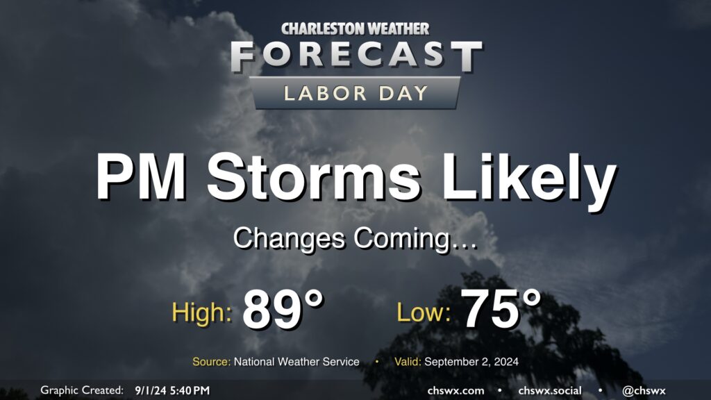
I hope everyone has gotten to enjoy the last few quiet weather days — it’s been warm, but aside from a brief shower in spots, mostly quiet. This begins to change on Labor Day as a cold front moves into the area from the north. We’ll see the risk for showers and thunderstorms increase ahead of the front, with rain chances peaking in the afternoon and evening. Severe storms are not expected, but some brief periods of heavy rain will be possible.
We’ll have one more day of seasonably warm temperatures before high pressure wedging southward drives some cooler air into the area for much of the upcoming week. Expect to start Labor Day in the mid-70s, warming to the upper 80s in the afternoon before showers and thunderstorms fire up. Heat indices should run around 100° given dewpoints in the mid-70s.
The rest of the week will feature below-normal highs in the low to mid-80s each day within a persistent northeast flow. Unsettled weather will continue, though, with the front stalled to our south and a coastal trough hanging around for the foreseeable future. It won’t rain all the time, but the risk will certainly be there. I’ll have more details tomorrow evening.