Jared Smith founded @chswx on Twitter in 2008 as an experiment in disseminating weather data through social media. In the ensuing decade-and-a-half, @chswx has provided live coverage of tropical cyclones, tornadoes, severe weather, and even a couple bouts of winter weather to the good people of Charleston, SC.
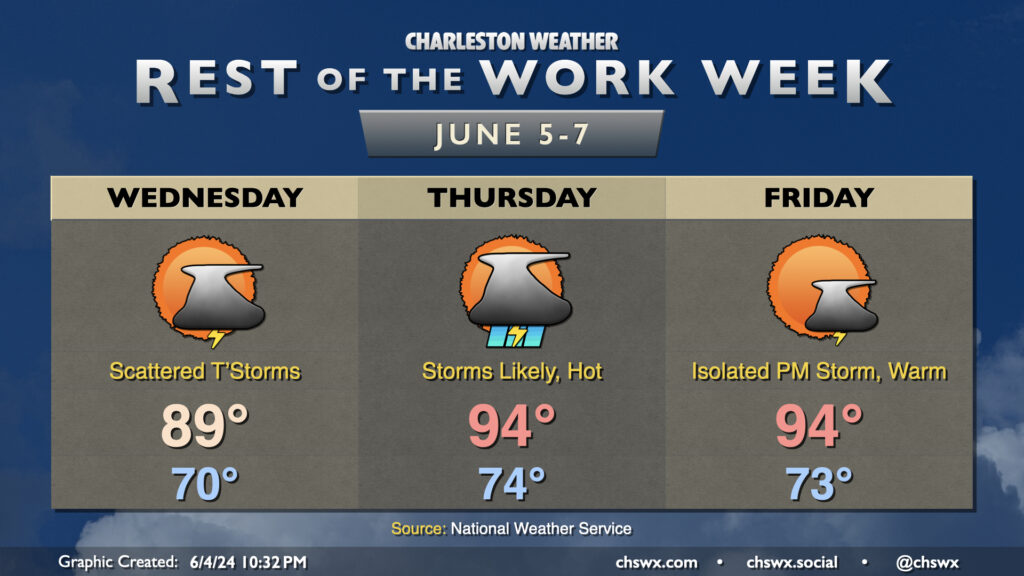
Scattered thunderstorms return to the forecast on Wednesday afternoon, once again focusing inland along and ahead of the seabreeze. It’ll be another mild start around 70°, warming to near 90° in the afternoon. Dewpoints around 70° will help drive heat indices to around the low to mid-90s.
Thunderstorm chances peak Thursday ahead of a cold front. Expect scattered to numerous storms to develop ahead of the seabreeze first as temperatures head to the mid-90s with dewpoints in the low 70s. Heat indices should crack 100° in the afternoon, so if you have outdoor plans, be ready to move those indoors. Thunderstorm chances will approach the coast later Thursday evening into the overnight as the front draws closer, and a stronger storm or two can’t be totally discounted. Be alert to quickly changing conditions if your Thursday night includes some out and about time.
The front clears the area Friday. It won’t get cooler, but the dewpoints will be dropping throughout the day, so while highs top out in the mid-90s once again, we shouldn’t see the heat indices we saw on Thursday. A stray storm might be possible in the afternoon, but all in all we should see plenty of sunshine and a rain-free day for many.
Warm and muggy conditions can be expected for the rest of the work week, with some periods of thunderstorms possible especially Wednesday and Thursday.
Tuesday starts around 70° and warms to near 90° in the afternoon. A few thunderstorms will be possible, particularly further inland near the I-95 corridor. Not everyone will see storms, and the Charleston metro area in particular should be clear of any unsettled weather by evening in the wake of the seabreeze.
Disturbances aloft working with ample instability will maximize shower and thunderstorm chances Wednesday and Thursday. The best risk for storms will be during the afternoon and evening hours. Severe weather isn’t expected, though storms could pack some gusty winds where outflow boundaries collide. Temperatures Wednesday top out once again near 90°, while we turn even warmer on Thursday with highs in the low to mid-90s. Given dewpoints in the low 70s, we could get close to heat indices around 100°.
A front approaches the area on Friday, but drier air will be working its way in, so while temperatures will be similar to Thursday (low to mid-90s), dewpoints will be trending lower. This should also keep the thunderstorm risk a little more at bay, leading into a generally quiet weekend.
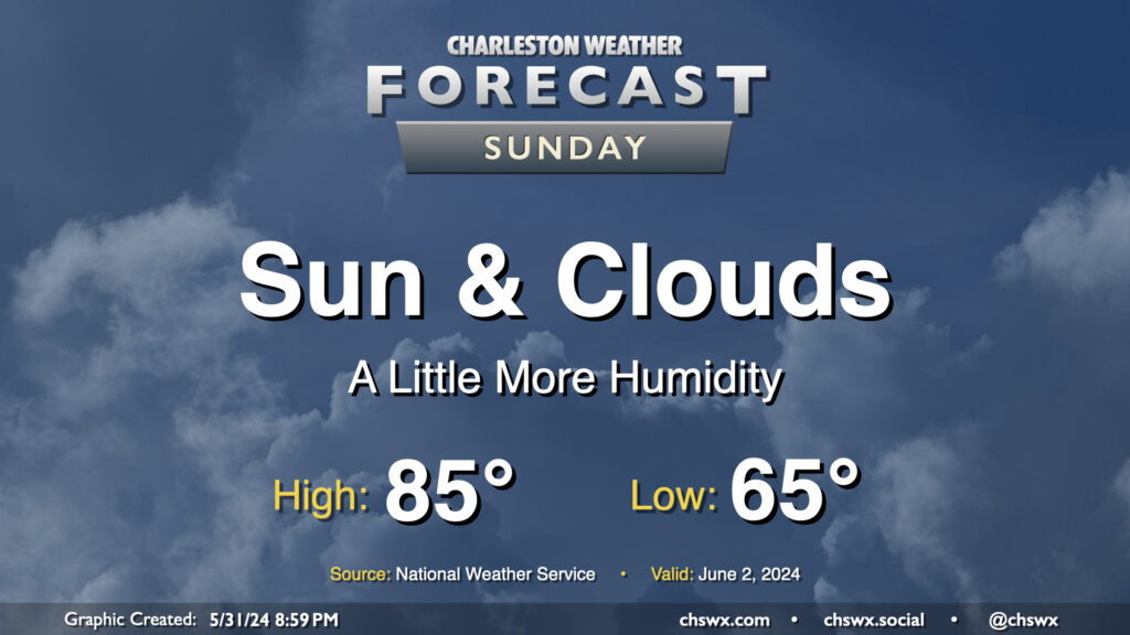
Humidity continues its slow climb on Sunday as onshore flow from the Atlantic gradually sends dewpoints higher. Most of us should stay rain-free, though some guidance does show the potential for a few showers to brush coastal areas in the morning. There’s also the risk for a few popup storms generally near I-95 in the afternoon, but the vast majority of the Charleston metro stays rain-free.
Temperatures head to the mid-80s after a mid-60s start. As alluded to earlier, dewpoints will continue to creep upward, generally remaining in the low 60s. This’ll yield relative humidity values generally in the 45-50% range — still far from horrendous, but you might notice a little more sweat.
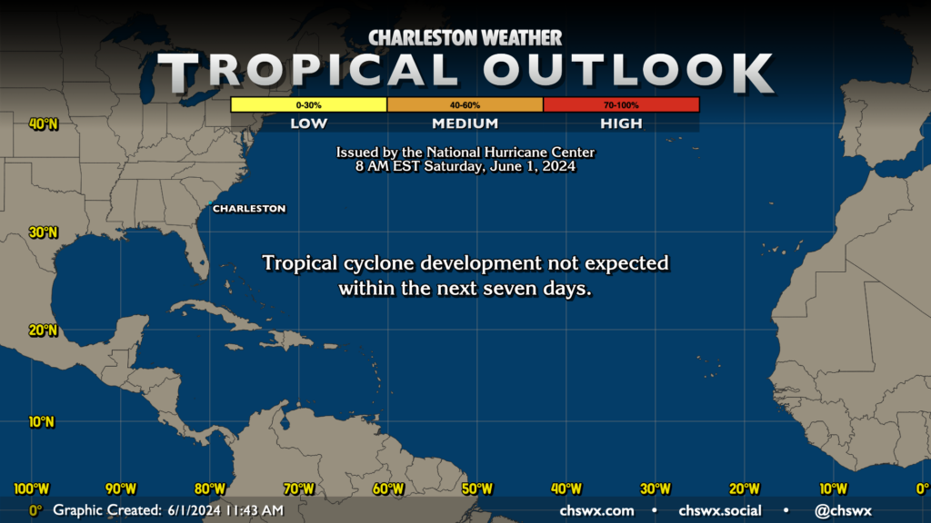
Welcome to the 2024 hurricane season, everybody. From now through November 30, we’ll keep one eye out on the Atlantic basin for whatever spinny mischief may try to get going. The outlook for this year is for an incredibly busy season thanks to flat-out hot water well into the Atlantic and the expectation that we’ll be in La Niña, which tends to relax shear over the Atlantic and turbocharges the environment for tropical cyclone formation as a result. Of course, the outlook only shows how many storms will probably form; it’s not an indicator of how many of those will make landfall, much less where they may do so. It only takes one storm to make a season memorable for all the wrong reasons, too.
The good news to start the season is that tropical cyclone development isn’t expected for the next seven days. We didn’t even have any preseason activity this year for the first time since 2022. However, as we all know, tropical cyclones can spin up on a dime, so it’s important for us all to be prepared. To paraphrase John Philpot Curran, Thomas Jefferson, and others: the price of living in Charleston is six months of tropical vigilance.
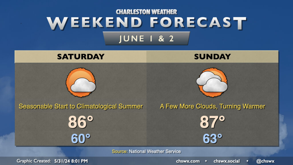
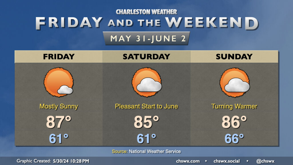
We’ve got no major weather concerns for the start of June and climatological summer. Saturday starts on a cooler-than-normal note once again, with lows bottoming out around 60° away from the beaches. Highs climb to the mid-80s with tolerable humidity, though dewpoints shouldn’t dry out as much as they ended up doing on Friday. We’ll see a little bit more in the way of cloud cover, but there’s going to be plenty of sunshine, too.
High pressure shifts offshore Sunday, kicking off a warming trend that’ll have us back in the 90s by early next week. Dewpoints will continue their gradual climb to more traditional early-June levels, though humidity still should remain generally tolerable. We start Sunday in the low 60s one more time, warming to the mid-to-upper 80s in the afternoon. A stray thunderstorm or two will be possible well inland in the afternoon, generally closer to the I-95 corridor, but the vast majority of us stay rain-free.
We’ll close out May with plenty of sun, temperatures generally near if not slightly below normal (especially in the mornings), and reasonably low humidity. Friday looks to run a little warmer than Thursday did, but the northerly breeze will keep the air on the dry side as dewpoints fall into the low 50s during the height of the afternoon. Expect mostly sunny skies, with just a few passing clouds as moisture remains a little tough to come by.
Saturday will be one more really nice day before a warming trend kicks in beginning Sunday. Temperatures on Saturday will once again bottom out in the low 60s, with highs in the mid-80s in the afternoon. Dewpoints will creep up a couple degrees, but it should still feel plenty comfortable outside as relative humidity values drop below 35% in the afternoon. Dewpoints begin to rebound to more June-like levels on Sunday as high pressure starts to slip offshore. Expect a milder start to Sunday with lows bottoming out in the mid-60s, warming to the mid-80s in the afternoon with a little bit more mugginess in the air as dewpoints return to the 60s. This warming trend continues into next week, with highs returning to the 90s and slight afternoon shower and thunderstorm chances coming along for the ride as well. But first, we have a beautiful weekend to enjoy — so enjoy it!
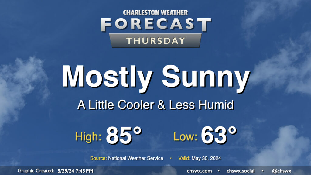
A dry front is getting through tonight, and that will open the door for a really pleasant ending to May. Temperatures start in the low-to-mid-60s, which is a few degrees below normal for May 30. We’ll warm to the mid-80s in the afternoon under mostly sunny skies, right near climatological norms for this point in the year. Dewpoints will mix out to around 50° during the day, which should keep the warmth more on the comfortable side than not.
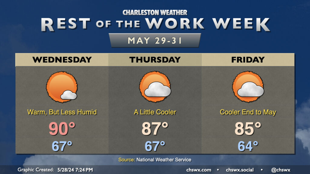
Quieter weather looks to generally be in store for the rest of the abbreviated work week as temperatures run on a cooling trend heading toward the weekend (and the end of May). We start Wednesday in the mid-to-upper 60s, warming to around 90° in the afternoon. Yes, still quite warm, but with some drier air aloft mixing dewpoints down to the mid-50s, relative humidity values will be in the 30-45% range. Expect just a few clouds from time to time with no expectation of any seabreeze showers or thunderstorms.
A bit more in the way of cloud cover arrives Thursday into Friday as a weak front approaches. Thursday’s highs run in the mid-to-upper 80s, while Friday’s highs run solidly in the mid-80s. Showers don’t appear likely, but can’t be totally ruled out with the frontal passage later Thursday into Friday. Dewpoints remain reasonably tame, though slightly cooler temperatures will elevate the relative humidity a little bit. All in all, not a bad end to May (and climatological spring).
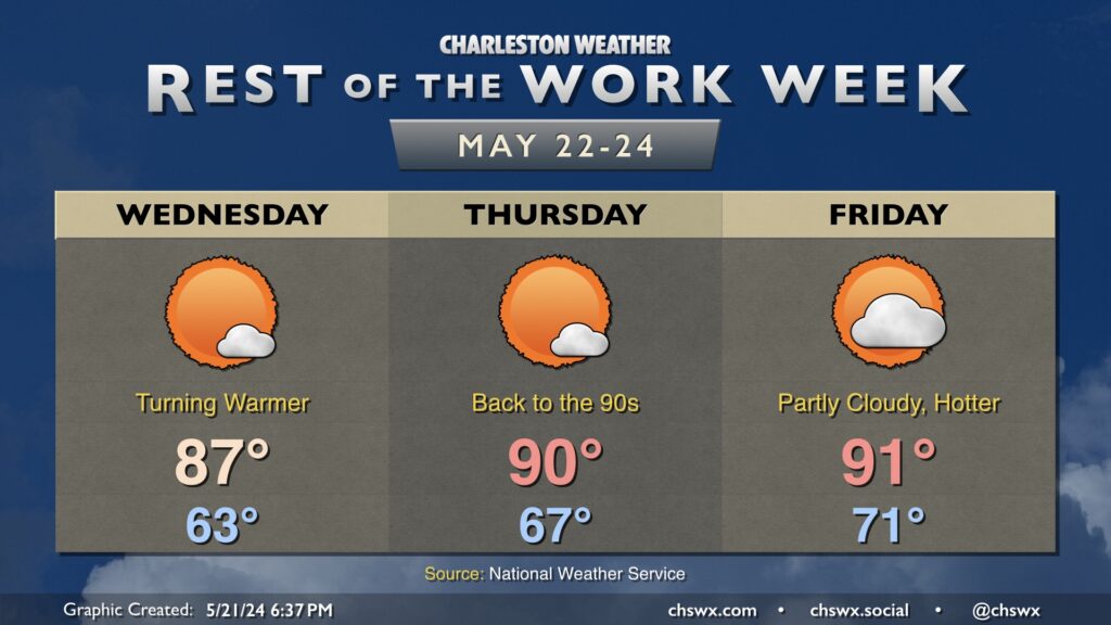
The forecast for the rest of the work week is fairly straightforward: Partly cloudy to mostly sunny skies with temperatures gradually getting warmer (with dewpoints unfortunately following suit) as time goes on. Wednesday will feature one more cool start in the low 60s before warming to the mid-to-upper 80s in the afternoon. Dewpoints will mix out to the low 60s, so it won’t feel too bad. They’ll start to climb into the upper 60s on Thursday, though, as highs reach 90° in the afternoon. With the additional humidity, expect heat indices to run a few degrees warmer. Friday continues the warming trend, with highs once again in the low 90s and dewpoints creeping up even further to the 70° mark making for another warm and muggy day.
While the rest of the work week looks to remain rain-free, slight shower and thunderstorm chances will figure into the forecast as we head into the Memorial Day weekend. It doesn’t look like a rainout, but you’ll want to have indoor backup plans in case thunderstorms threaten.
Finally, a programming note: I’m taking the next few days off for some much-needed downtime. Posts will be scattershot at best. As always, the latest NWS forecast is on the chswx.com homepage. See y’all next week!
We have another nice day ahead Tuesday. We’ll start the day in the low 60s once again, with highs topping out in the low-to-mid-80s under mostly sunny skies. It’ll be a touch breezy, with winds out of the northeast once again around 10 MPH, but this is what’s keeping us a little on the cooler side, so we’ll take it.
The only weather concern will be the risk for water levels peaking in minor flood stage again with the Tuesday evening high tide. Minor coastal flooding looks probable between 7-9 PM with water levels peaking around 7.1’. It’ll be enough to cover the more vulnerable roads once again with salt water, but it won’t be a widespread issue.