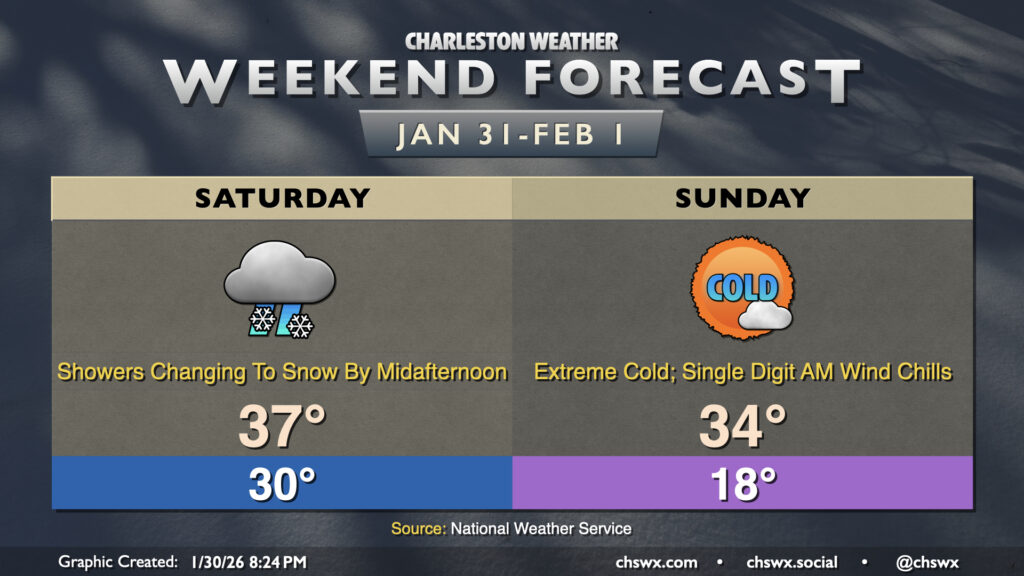
Well, it certainly appears as if the third time will be the charm for snow-lovers in the Lowcountry as a long-anticipated winter storm system impacts the area this weekend. A Winter Storm Warning goes into effect Saturday at 7AM and will run until Sunday at 1PM. Meanwhile, an Extreme Cold Warning will also go into effect Saturday at 7PM until noon Sunday for air temperatures in the mid-to-upper teens and wind chills dropping perhaps as low as 3° above zero in the morning — extraordinarily rare cold air for this part of the world.
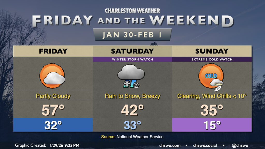
A cold and snowy weekend lies ahead as the storm we in the weather enterprise have been watching closely for the last several days in guidance looks to become a reality for a pretty solid winter weather event for this neck of the woods on Saturday followed by bitterly cold temperatures on Sunday. A Winter Storm Watch and Extreme Cold Watch have been issued by the National Weather Service for much of the weekend, so that’s how you know it’s getting real.
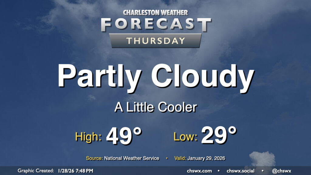
Another chilly day lies ahead for Thursday as a dry cold front slides southward across the area, reinforcing the cooler airmass that’s been in place for much of this past week so far. Temperatures will start in the upper 20s to around 30° for yet another subfreezing start this week. We’ll see some clouds at times, with greater cloud cover expected as we get into the evening, but otherwise there should be plenty of sunshine. Despite the sun, though, the reinforcing shot of cooler air keeps highs pinned to the upper 40s to around 50°.