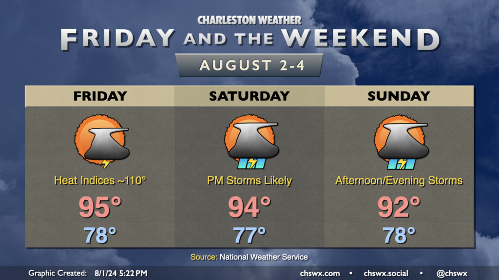
The weather stays hot and turns increasingly unsettled as we get into Friday and the weekend. Warmth peaks Friday; expect highs in the mid-90s to combine with dewpoints in the mid-to-upper 70s to yield heat indices approaching 110°. Another Heat Advisory, while having not yet been issued at publish time, certainly seems like a decent possibility for Friday, so keep that in mind if you have outdoor activities planned. Scattered showers and thunderstorms should provide some relief to a few of us, though slow-moving storms are certainly a possibility and could lead to some localized flooding. Strong wind gusts remain a concern as well.
Shower and storm chances increase heading into Saturday and especially on Sunday as a weakening front approaches the area and stalls out. Temperatures will start to trend downward a bit thanks to the increase in storm coverage and cloud cover, though Saturday continues to look quite toasty with peak heat indices around 105°. Storms should fire by mid-afternoon and could be somewhat numerous Saturday. Greater coverage is expected on Sunday as the front stalls nearby and moisture continues to increase. That’ll keep highs in the low 90s at most in the afternoon. While it won’t rain all day at any one location, slow-moving storms could produce localized flooding. Be ready to halt outdoor activities if a storm approaches.
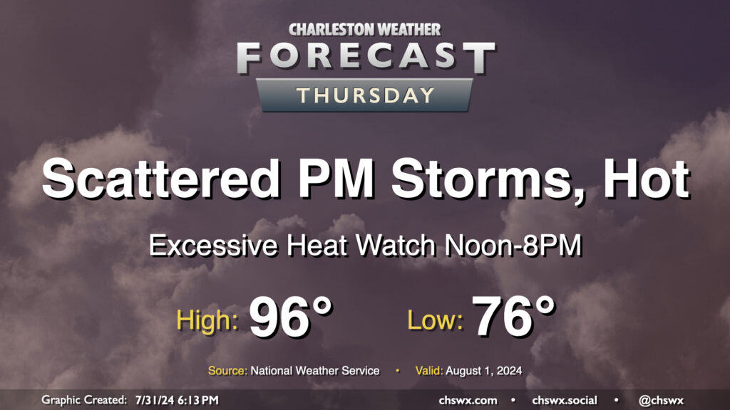
Heat will be the main weather story on Thursday as air temperatures reach into the mid-90s and dewpoints peak in the mid-70s, combining for heat indices that could approach 110-115° in the afternoon. This has prompted an Excessive Heat Watch from noon-8PM, when heat indices could be highest. If the forecast indicates heat indices approaching or exceeding 113°, this could be upgraded to an Excessive Heat Warning; otherwise, a Heat Advisory would likely be the move barring an unexpected cooler start (like we saw today, in fact!)
Showers and thunderstorms will be possible in the afternoon and evening hours as the seabreeze pushes inland. We could also see storms coming our way from the Midlands once again as well. Widespread severe weather is not expected, but you can never rule out a damaging wind gust or two this time of year.
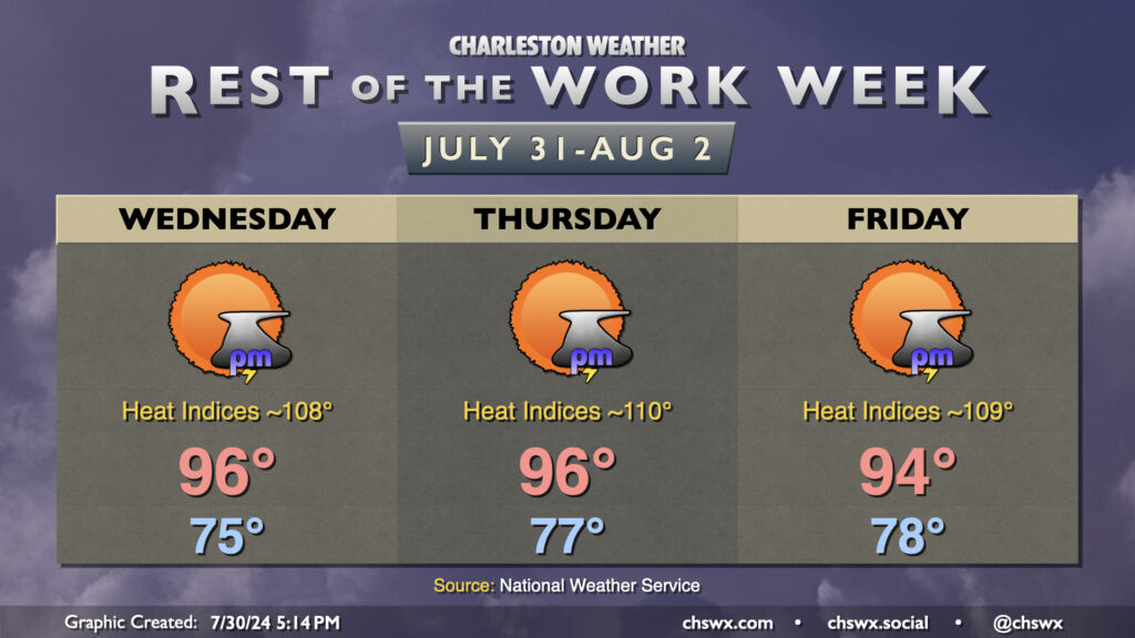
High pressure building in aloft will turn on the heat and keep storms at bay for the rest of the work week. After reaching 93° on Tuesday, we should reach well into the mid-90s for the next few days. Dewpoints surging back into the mid-to-upper 70s will drive heat indices back into Advisory territory possibly as early as Wednesday and more likely on Thursday and Friday. Be ready to take heat precautions once again as you head outside at the height of the afternoons.
Looking for relief from storms? Don’t count on it — the high pressure aloft will generally put a lid on much in the way of thunderstorm activity. If one can get going, then you might get some heavy rain and gusty winds, but otherwise, widespread storm activity doesn’t appear likely until next week.