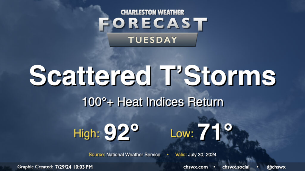
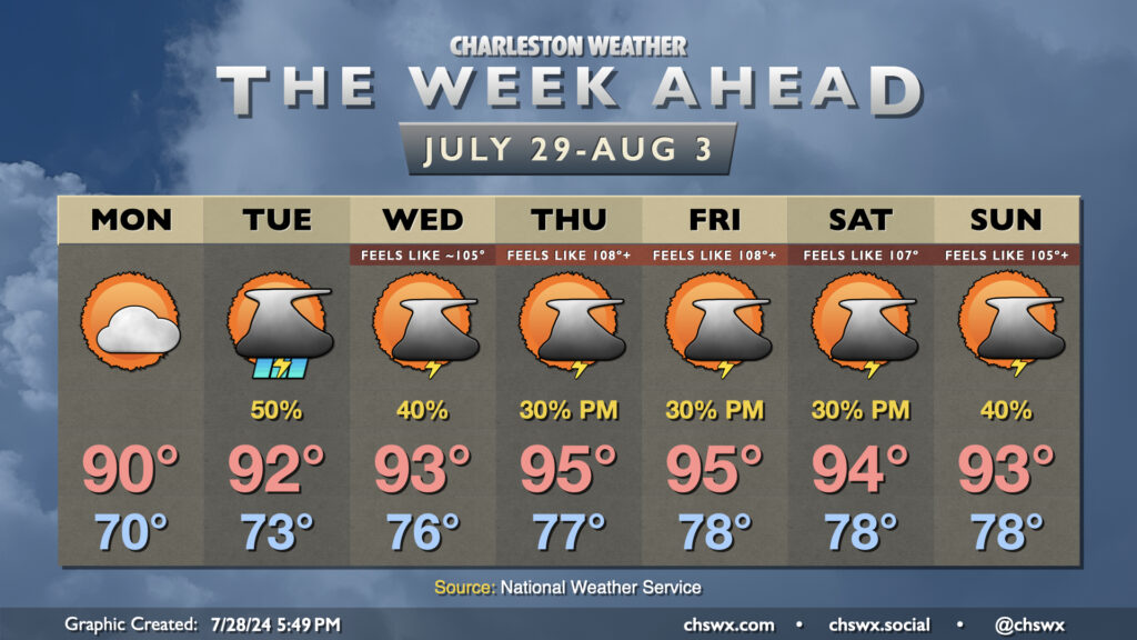
Well, the respite is decidedly over: we’re back to 100°+ heat indices on Tuesday as surface high pressure shifts offshore and higher-dewpoint air returns to the area. We start the day in the low 70s one more time, but will warm quickly into the 80s by mid-morning and should be back in the 90s by early afternoon. Dewpoints look to climb into the mid-70s throughout the day, and this will yield heat indices around 103° — hot to be sure, but shy of advisory criteria. Scattered showers and thunderstorms are primarily expected in the afternoon and evening hours, though a few showers can’t be ruled out in the morning. A few showers may try to get going on the seabreeze, but high-resolution guidance suggests that the bulk of any activity will get going perhaps in the Midlands and Upstate before dropping southeasterly into the metro. Some heavy rain is possible, and a damaging wind gust or two is not out of the question, either. Keep an ear out for possible warnings Tuesday evening, just in case.
After a really nice Sunday that featured dewpoints dropping into the low 60s and no rain to speak of, we get one more day of lower humidity before we return to the swamp for the rest of the upcoming week. For Monday, though, enjoy lows around 70° yielding to highs around 90° in the afternoon with dewpoints generally in the mid-60s. We’ll see a mix of sun and clouds throughout the day, but rain should just hold off to our west for one more day. (Can’t rule out some showers near I-95, though.)
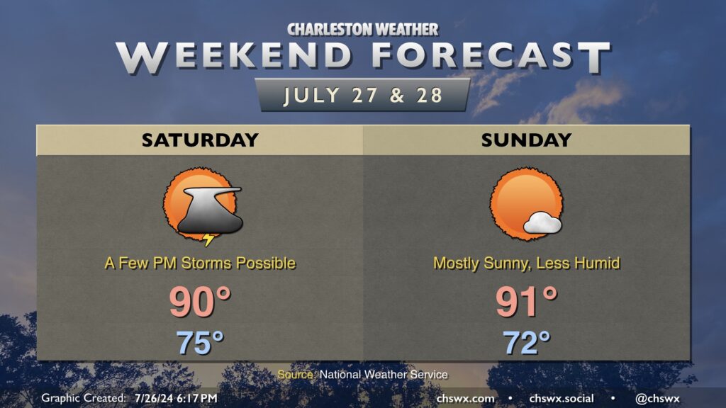
After several days of periodic, road-flooding deluges, a break is in store for the weekend as a front pushes south of the area. While we could see a few lingering storms on Saturday, we should see a little more in the way of sunshine through broken cloud cover as well. After a mid-70s start, temperatures will head to about 90° in the afternoon. Heat indices will not be quite the factor that they have been thus far in July, either: it’ll feel around 95° or so. Certainly not cool by any objective measure, but it’s not 105°, either.
Drier air pushes into the area on Sunday, and despite highs in the low 90s once again, it’s just going to feel a lot better as dewpoints mix out to the mid-60s in the afternoon. (We’ve been dealing with mid-to-upper 70s dewpoints for the better part of several weeks now, so this will be nice!) The drier air will help promote generally sunny skies with little to no chance of any rain in the afternoon. It’ll be one of the better outdoors days in recent memory, and dewpoints in the mid-60s essentially remove the heat index from the equation.
Enjoy this, because as we depart July and head into August next week, we’re back into a pretty standard summertime pattern with warm temperatures, mid-70s dewpoints, and afternoon storms.