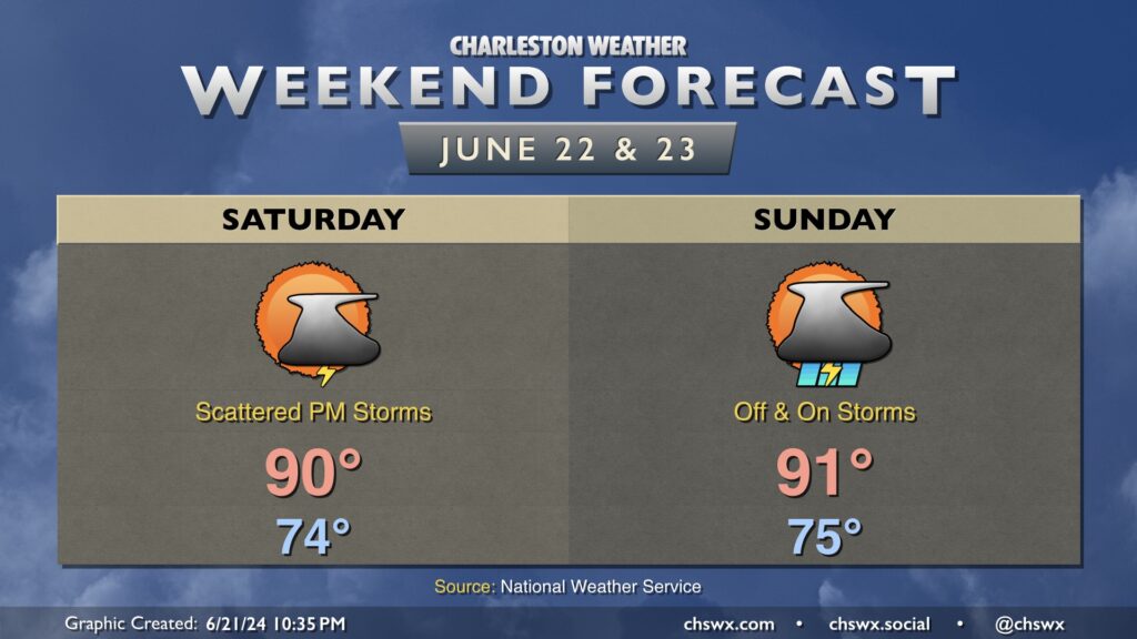
The tropical low — but not depression — that’s been driving Friday’s periods of rain will be ashore in far southern Georgia by Saturday morning. It’ll start to turn more northward throughout the day, and that’ll help instigate showers and thunderstorms Saturday afternoon. Outside of storms, expect a warm and muggy day with highs topping out around 90°.
We’ll keep the risk for showers and a few thunderstorms in the forecast for Sunday as well, with the best chances once again in the afternoon (though a few showers or storms could be around all day). We stay muggy, with lows in the mid-70s yielding to low 90s in the afternoon that’ll feel more like the upper 90s.
Humid days are here again: tropical moisture associated with a disturbance (which might become a tropical depression before coming ashore in Georgia tomorrow) will overspread the area, with showers and a few thunderstorms expected for a fair bit of the day as a result. It won’t rain all day at any one location — the rain will generally be off and on and be moving fairly quickly — so generally expect a half-inch of rain in most spots. A few locations could see locally heavier rainfall in the wetter storms. Thankfully, severe weather and flooding don’t appear to be major issues this go-around. Temperatures start in the low 70s, warming to the upper 80s between storms. It’ll be a muggy day as dewpoints surge into the low 70s by morning, with heat indices in the mid-90s expected.
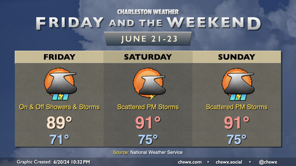
High pressure gets into a typical summertime configuration starting Saturday, and we’ll definitely be feeling it as lows bottom out only in the mid-70s. The 90s return Saturday afternoon and will have some staying power through the weekend and well into next week, too. Showers and thunderstorms will be possible each afternoon along and ahead of the seabreeze, with locally heavy rain possible but severe weather generally not expected. Just be ready to bring outdoor activities inside if a thunderstorm approaches your location.
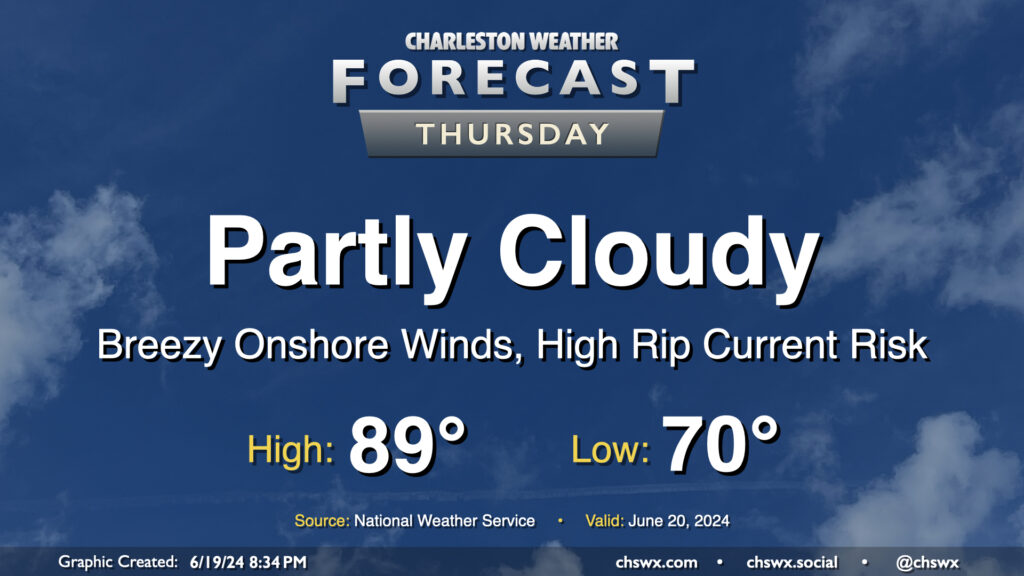
Thursday looks to remain mostly quiet over the area, though a few showers will be possible near the coast once again during the morning as showers within onshore flow reach land and dissipate in drier air. We start the day around 70° and warm to the upper 80s in the afternoon, much like the past few days. If you’ve been enjoying the somewhat lower-humidity mornings that we’ve had lately, enjoy this tomorrow morning because we’re shifting back into more traditional mid-to-late-June dewpoints starting Friday.
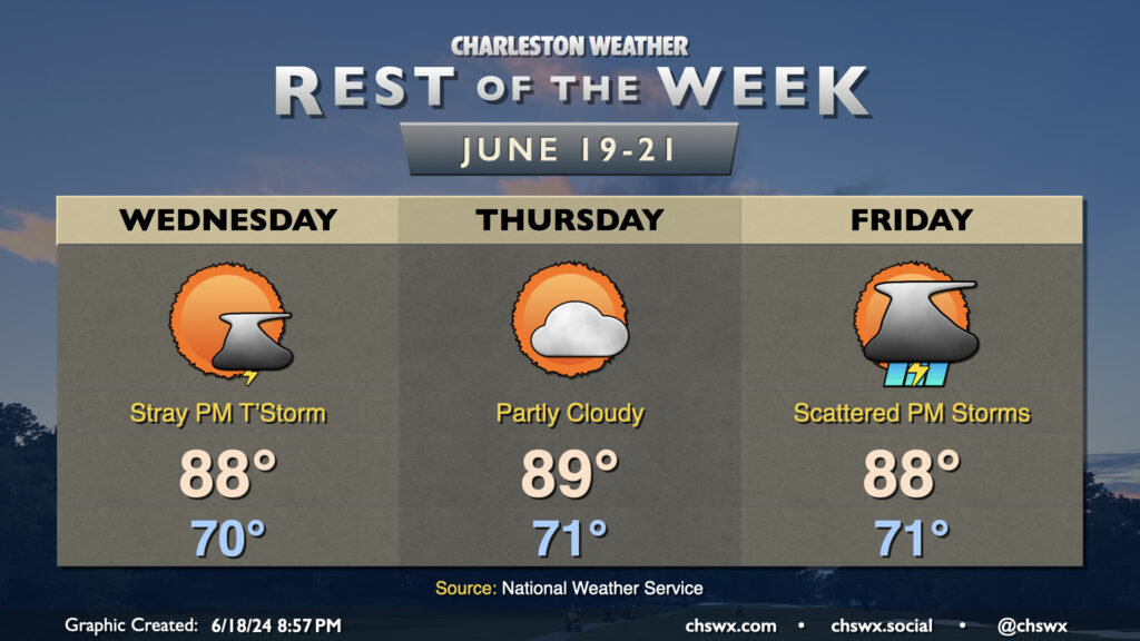
Near-normal temperatures and a few stray storms will mark Juneteenth across the Lowcountry. We start the day around 70°, warming to the upper 80s in the afternoon as onshore flow continues to keep temperatures a little lower. A few showers and maybe a thunderstorm will be possible, particularly in the afternoon, but many of us stay dry once again.
An approaching tropical wave — thankfully, of the open wave variety and nothing more organized — will be the weather feature of interest later Thursday into Friday. Ahead of the wave, we should see a mostly quiet day of weather with temperatures near normal and partly cloudy skies. Rain chances tick up Friday as the wave comes ashore, with scattered showers and thunderstorms a decent bet. It won’t rain all day at any one location, though. Temperatures Friday will be limited to the upper 80s with the shower and thunderstorm activity. We’ll start to get much warmer this weekend, with highs returning to the low to mid-90s well into next week.
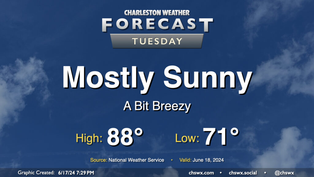
We’ve got one more generally quiet day of weather coming up for Tuesday before turning a little more unsettled heading into the second half of the week. Temperatures will remain around if not a touch below normal as a solid onshore breeze keeps us on the “cool” side. We’ll see a few clouds from time to time, but overall, expect a mostly sunny day. The only downside to the onshore flow will be a moderate risk of rip currents at the beaches, so be alert if you are going to be heading into the surf.