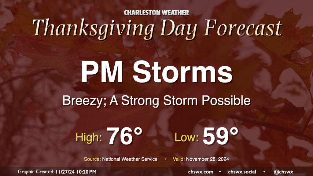
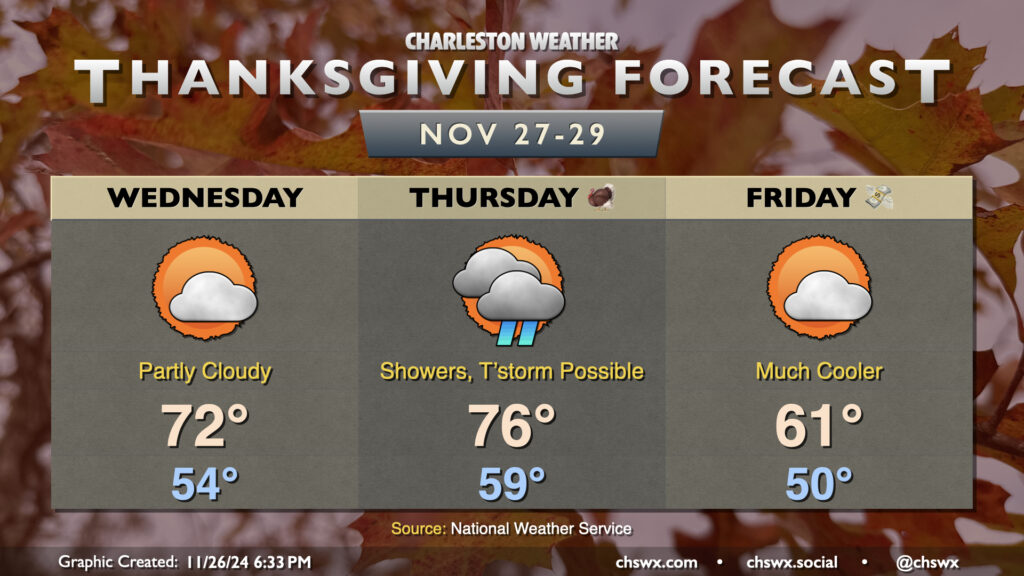
We won’t have the best weather on Thanksgiving Day, unfortunately, as a strong cold front moves through the area. It’ll bring with it some gusty winds and eventually some showers and even a few thunderstorms as we get into the afternoon and evening hours. It’ll be a warm and humid day by late November standards, with lows in the upper 50s to around 60° yielding to the mid-70s in the afternoon. This could help provide sufficient instability within a fairly well-sheared airmass to produce a strong to severe thunderstorm or two as the front approaches, with damaging straight-line wind gusts the main concern. The timing for storms appears to be generally between about 2pm-9pm, progressing west-to-east. It’s possible not everyone will see a storm or even any rain, but we just need to keep an eye on the storms that do fire to make sure they behave.
We have quite the weather rollercoaster in store for the Thanksgiving 2024 holiday period. First, Wednesday will run much warmer than normal despite a frontal passage Tuesday night; expect lows in the mid-50s to yield to highs in the low 70s under partly cloudy skies as the front lingers just to the south. We’ll stay rain-free on Wednesday, though showers will be approaching from the west with another, stronger frontal system.
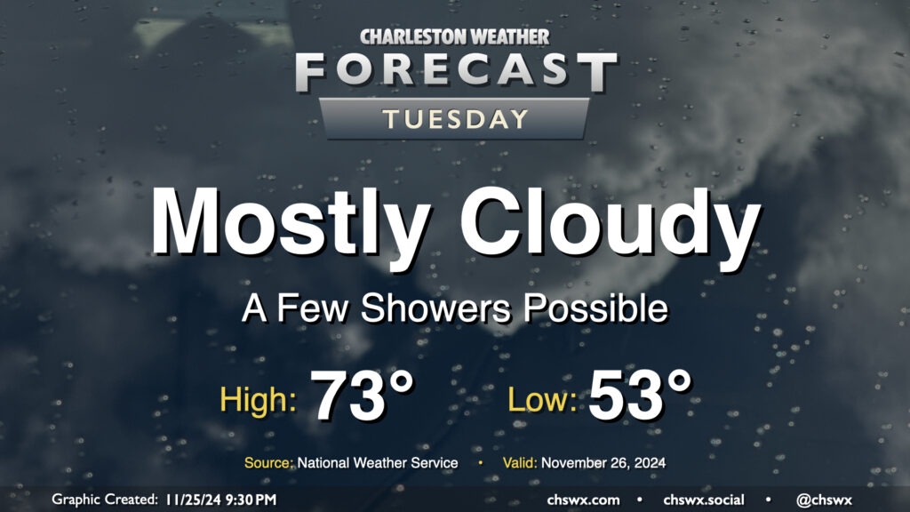
Tuesday begins an occasionally unsettled period of weather that’ll last through early Black Friday as a series of fronts moves through the area. The first one, poised to move through Tuesday evening, won’t be terribly strong; it’ll kick up some cloud cover and maybe a few showers as well out ahead of it, but it won’t really affect the airmass all that much. We’ll start Tuesday in the low 50s, warming to the low to mid-70s in the afternoon. Dewpoints will surge back into the 60s for a brief period, but those will begin to fall by evening as the front moves by.
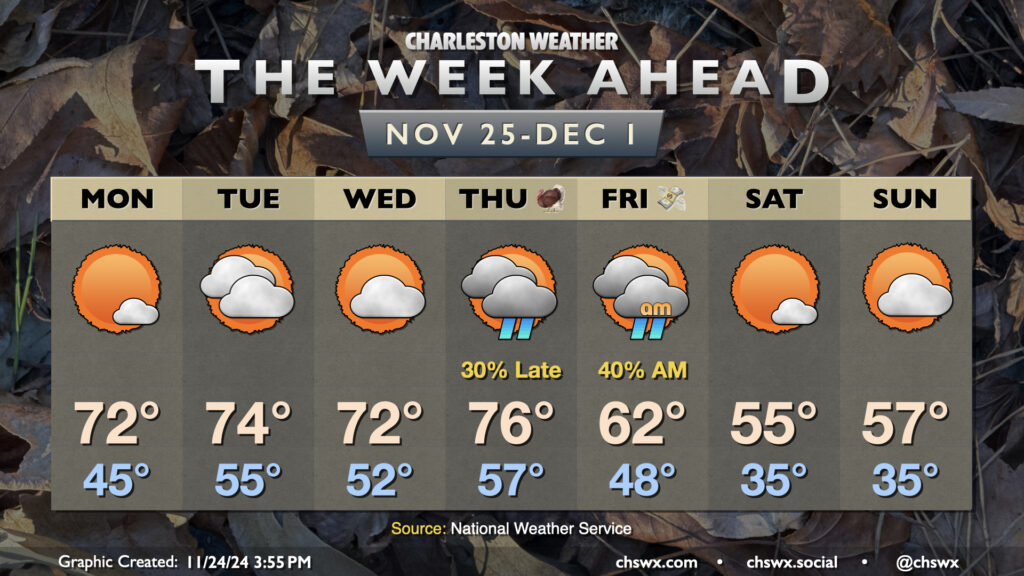
The week ahead will look a bit like last week: starting warm, a mid-week front, and a chilly round of weather for Friday and the weekend (that, in fact, will run even cooler than we did these past few days).
First, though, we’re back in the 70s on Monday as high pressure at the surface starts to move offshore. This makes for a seasonably warm day, starting in the mid-40s and warming to the low 70s in the afternoon. We turn warmer on Tuesday ahead of what should be a dry, fairly weak front, with a start in the mid-50s yielding to highs in the mid-70s in the afternoon under mostly cloudy skies. The front only acts to knock temperatures down a couple degrees, so Wednesday remains warmer than normal with lows in the low 50s yielding to highs in the low 70s in the afternoon.
Thanksgiving Day will be mostly dry, though a stronger front approaching from the west will bring rain chances into the area in the evening through the overnight. It’ll be a warm day, with lows in the mid-to-upper 50s warming to the mid-70s in the afternoon ahead of the rain. Once this front gets through, though, we’ll feel a noticeable change as another shot of cool air moves in. Black Friday’s highs should only peak in the low 60s — some 15° cooler than Thanksgiving — as rain and clouds depart. We’ll stay quite cool heading into the weekend, with perhaps some frost concerns each night as lows on Saturday and Sunday bottom out in the mid-30s, while highs only peak around the mid-50s each day.
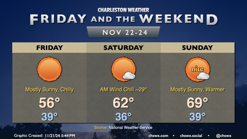
We have a chilly few days ahead as we close out the last work week before Thanksgiving. Friday will start in the upper 30s to around 40°, but factor in the wind, which will still be a bit breezy throughout the day, and it’ll feel closer to freezing as we head to work and school. Temperatures will then struggle to warm to the mid-50s in the afternoon despite full sunshine — a very wintry-feeling day, not so much like what a typical November day looks like.
Winds remain a touch elevated heading into Saturday, which will feature the coldest morning of the set. Expect temperatures to fall into the mid-30s in the metro thanks to continued cool advection and mostly clear skies; with the winds mixing in, it’ll feel more like the upper 20s at times. We’ll see a bit more of a rebound in highs, though, as the core of the coldest air lifts out of the area. Expect highs on Saturday to peak in the low 60s as the airmass begins to moderate. Another chilly start awaits on Sunday, with lows once again dipping into the upper 30s, but we’ll warm to near 70° in the afternoon under mostly sunny skies with a little lighter winds, too.
Looking for rain? It’s not looking likely for the next few days heading into Thanksgiving. We’ll be keeping an eye on a front for the middle of next week, which could kick up some rain chances for mid-to-late week, but it’s certainly not a done deal yet. Stay tuned.
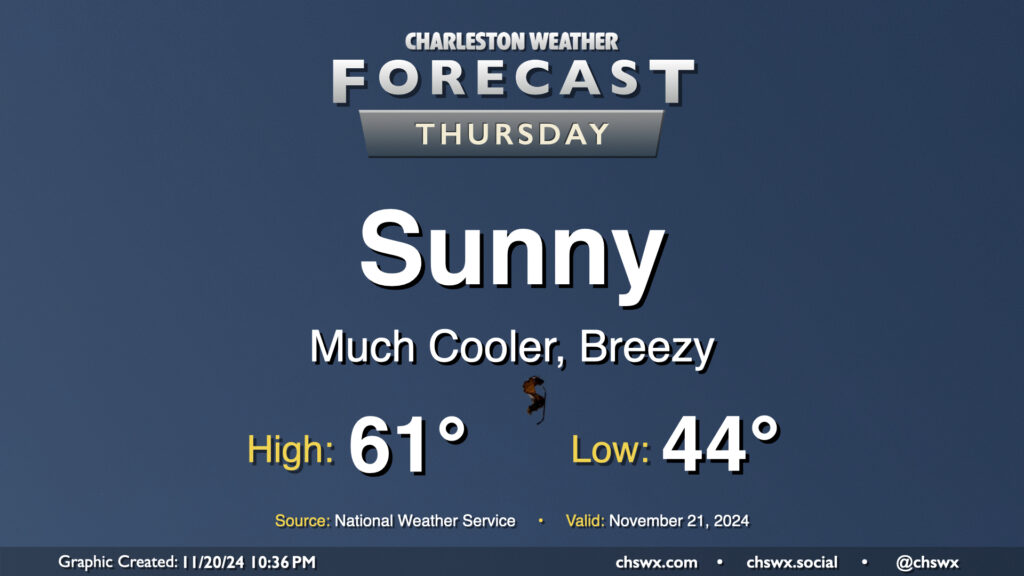
Thursday will kick off a stretch of below-normal temperatures that will continue into the first part of the weekend before we turn a little warmer for Sunday. We start Thursday in the mid-40s, but as cooler and drier air rushes into the area, producing some gusty winds at times, high temperatures will be limited to the low 60s at best despite full sunshine. This is closer to January normals than November normals — you’ll likely want to opt for some longer sleeves as a result, at least during the morning.
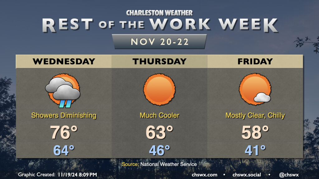
Showers will move into the area overnight and persist into a good chunk of Wednesday as a cold front moves by. We start Wednesday in the mid-60s, warming to the mid-70s in the afternoon. Showers should scour out by early evening, and from there, cooler and drier air will begin to work into the area. The airmass change will be very noticeable this go-around; we’ll start Thursday in the mid-40s, warming to the low-to-mid-60s in the afternoon at best. Friday will be even cooler, with lows in the low 40s warming to just the upper 50s in the afternoon despite full sunshine, roughly 10° below the normal temperature for November 22 and more reminiscent of normal highs for early January!