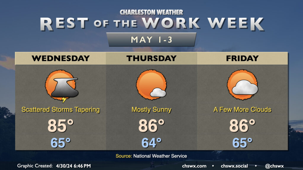
Scattered showers and thunderstorms will arrive in the metro area late Tuesday and last through Wednesday morning before tapering. An isolated storm is possible along the seabreeze in the early afternoon, but otherwise, expect a mostly quiet day of weather across the area for Wednesday. We’ll get started in the mid-60s — about 5° or so above normal for this point in the year — and warm to the mid-80s in the afternoon. These temperatures generally hold true for the rest of the week, too, as high pressure reasserts control. Thursday and Friday will be rain-free, with just a slight uptick in clouds on Friday ahead of a disturbance that brings scattered storm chances to the area for the weekend.
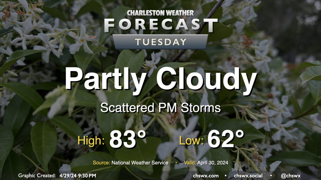
Our next chance of wet weather arrives later Tuesday as a disturbance aloft moves into the area. We start the day on a dry note, though, and not everyone will see rain all the time heading into Tuesday afternoon and evening. Expect generally partly cloudy skies away from the scattering of storms. Lows will run in the low 60s, yielding to low-to-mid-80s in the afternoon.
Showers and thunderstorms will be possible overnight Tuesday into Wednesday morning, which may have some relatively minor commute impacts depending on how quickly the disturbance can depart. Stay tuned.
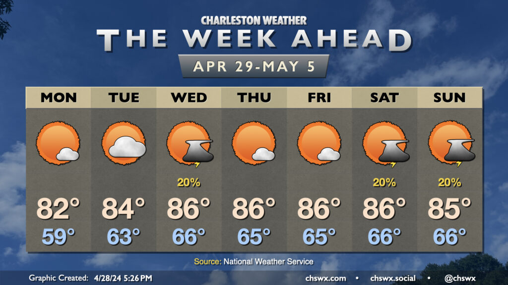
High pressure will be the main weather driver again this week, which will help drive temperatures a few degrees above normal to close out April and bring in May. Monday will be the coolest day of the period with lows in the upper 50s yielding to highs in the low 80s in the afternoon under mostly sunny skies. We warm a little bit on Tuesday with a bit more in the way of cloud cover as well (and maybe a shower or storm well inland). Seabreeze thunderstorms could be in the offing for Wednesday as we get into a stretch of temperatures about 5° or so above normal that’ll last well into the weekend. Quiet weather is expected Thursday and Friday before another disturbance potentially spawns a few isolated thunderstorms on Saturday afternoon as well as into Sunday. No washouts expected, though.
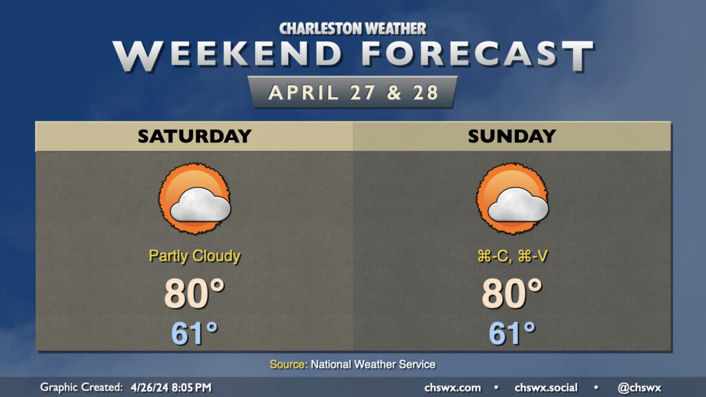
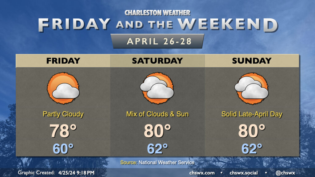
Another quiet and nice weekend to get outdoors is on tap. Saturday starts in the low 60s, warming to around 80° in the afternoon under partly cloudy skies. It’ll be another breezy day, with winds out of the east and southeast blowing around 10-15 MPH (a little higher toward the coast).
For Sunday, we highlight Saturday, press Cmd-C, select the “Sunday” cell, and press Cmd-V, as generally similar weather is in store. Winds may be a little less breezy, which is only the real change as high pressure continues to be the driving force in our weather for the weekend and into much of next week.
There’s not been too terribly much to write home about weather-wise this week, and that continues as we head into Friday and the weekend. Temperatures will remain generally within spitting distance of normal, and while we’ll have some cloud cover from time to time, plenty of sunshine will filter through as well as high pressure remains the dominant player in the forecast. Dewpoints will generally run in the mid-50s, yielding generally comfortable relative humidity values around 45-50% each afternoon.
Next week, expect temperatures to head several degrees above normal to close out April and welcome in May, with mid-to-upper 80s expected by mid-week. Shower chances look relatively low right now, even with a front trying to get nearby. So, if you’re looking for rain, it may be several more days!
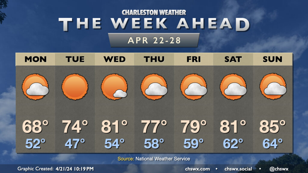
After last week’s summer preview, temperatures will be more seasonable by late April standards, even getting off to a much cooler than normal start on Monday as clouds gradually break up. Expect highs to only top out in the mid-to-upper 60s on Monday as a northerly breeze persists across the area. Tuesday gets off to the coolest start this week in the mid-40s before warming to the mid-70s in the afternoon — truly looking like a fantastic weather day in the Lowcountry. We’re back to the low 80s Wednesday before a dry front knocks temperatures back down to the upper 70s for Thursday and Friday. 80s return over the weekend, with some mid-80s possible by Sunday. You’ll notice a dearth of rain chances — it should be a great week overall to get outside, and I hope you can take advantage!