Friday & the weekend: Turning stormy and much cooler
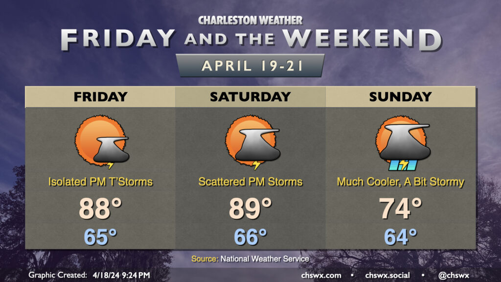
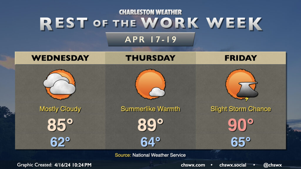
This week’s stretch of quiet weather comes to an end as we head into the weekend courtesy of a cold front. We hit 90° for the first time at the airport today, and could get close again on Friday, though a surface trough and some energy aloft could combine for a few showers and thunderstorms during the afternoon. A strong storm can’t be ruled out, either, with gusty winds and some hail a possibility.
More vigorous energy moves into the area as the backdoor front gets closer on Saturday. It’ll be one more very summer-like day with highs approaching 90° in the afternoon, though scattered showers and thunderstorms will be a possibility beginning mid-afternoon on. Off and on showers and thunderstorms remain in the forecast for Sunday, though as the front sinks southward, we’ll turn much cooler — expect highs to run almost 15° cooler than they did on Saturday. Rain chances should peak later in the evening into the overnight before tapering Monday.
High Water-goers, be alert this weekend for quickly changing conditions and be ready to safe shelter if lightning approaches. We usually get kind of lucky with this event and the weather, and hopefully we can keep that stretch going. If not, though, be sure to keep this mantra in mind…”When thunder roars, go indoors!”