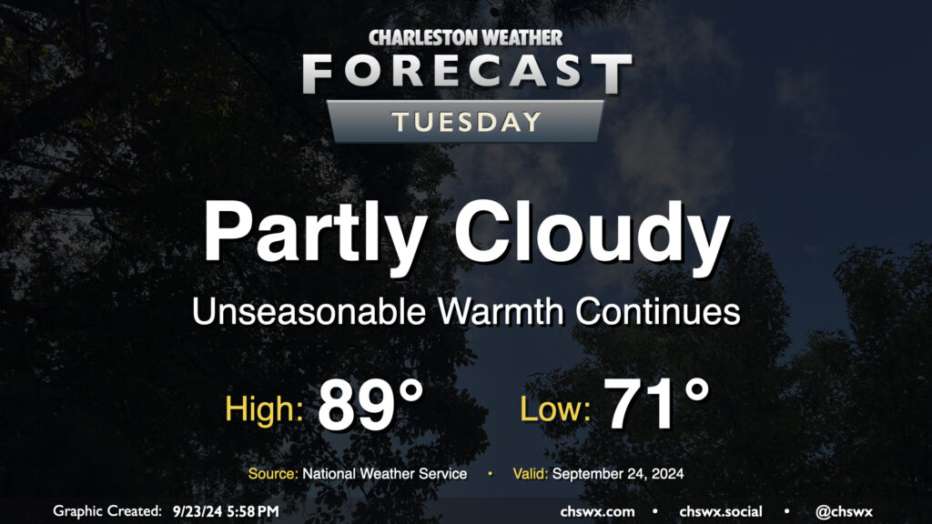
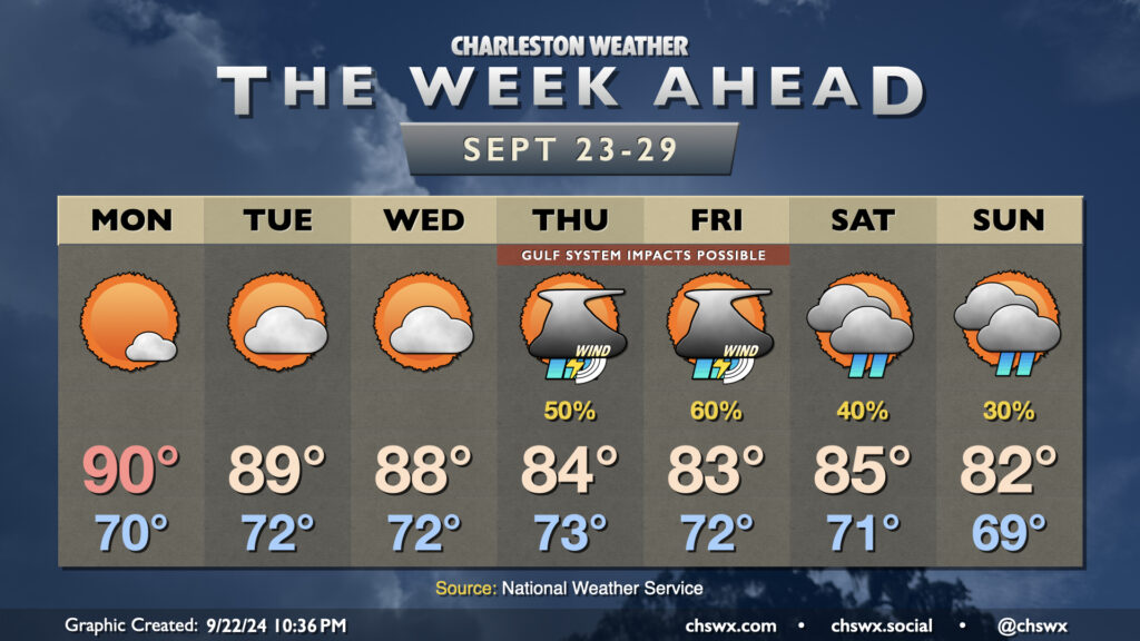
Quiet and unseasonably warm weather continues on Tuesday. Expect to start the day in the low 70s, warming to the upper 80s to around 90° in the afternoon. Dewpoints in the low 70s will yield heat indices in the mid-90s — not necessarily oppressive but certainly unpleasant considering where we are on the calendar. The ridge aloft will keep a lid on any shower activity, so no concerns there as we start to look ahead toward impacts from what is currently Potential Tropical Cyclone Nine later this week.
Well, it might be fall, but our local weather will continue to betray the calendar for a few more days as Atlantic high pressure to our east and ridging aloft keeps things warmer than normal as we head into the last week of September (already?). Then, things turn a little more interesting as we watch for the potential for a tropical cyclone to move northward through the Gulf of Mexico. Depending on how far east the storm develops and tracks, it’s possible we may see some impacts here at home, but it’s very tough to say exactly what that will look like just yet.
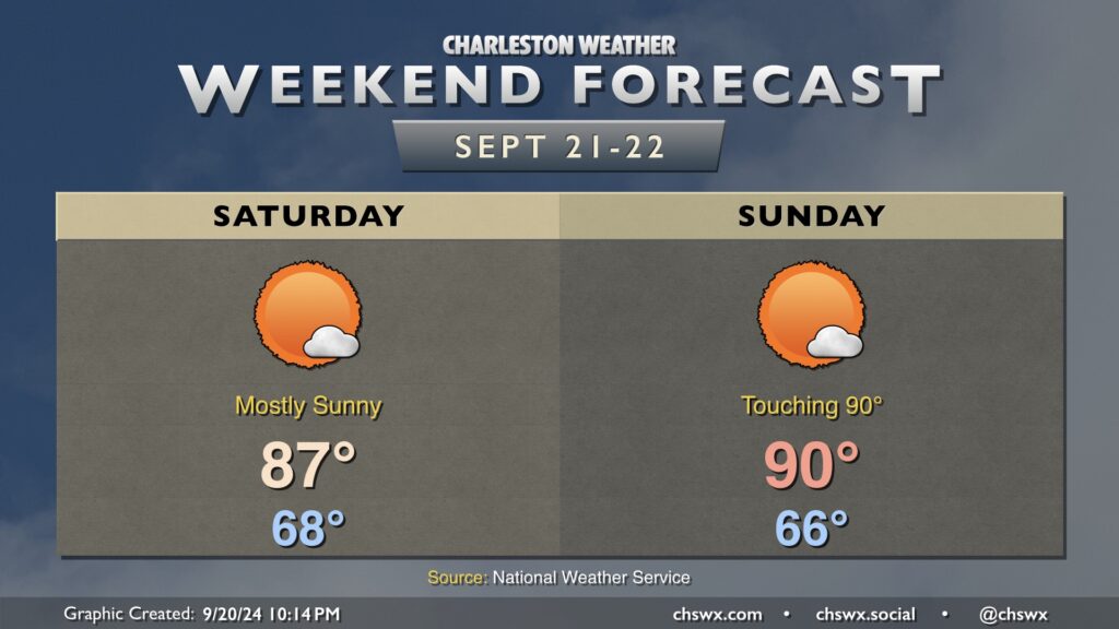
It’ll be a quiet, bright, sunny, and warm weekend in the Lowcountry, with a bit of a callback to summer despite the onset of the autumnal equinox on Sunday.
We start Saturday in the upper 60s, warming to the mid-to-upper 80s in the afternoon under mostly sunny skies as ridging aloft builds in. That ridge gets even a bit stronger for Sunday, and could send highs to around 90° for the first time since September 1, when we reached 91°.
The only real fly in the ointment weather-wise won’t even necessarily be all driven by weather, but rather by high astronomical tides thanks to the recent full moon. Water levels in Charleston Harbor look to peak well into moderate, but just shy of major, flood stage (7.9’) around the 11:14am high tide. As a result, get ready for more road closures like we saw mid-morning on Friday. Sunday should offer similar tide concerns around the midday high tide. Keep an eye out for Coastal Flood Advisories from the National Weather Service.
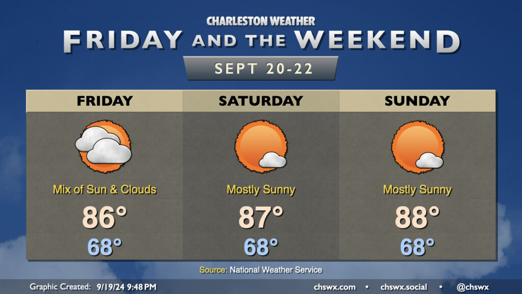
High pressure ridging in at the surface and aloft will make for a quiet and warm weekend of weather across the Lowcountry.
Clouds will still be around Friday as one more piece of energy ripples through before the high pressure ridge takes over. Rain isn’t expected, though a shower can’t be completely discounted. Expect highs in the mid-80s after an upper 60s start.
Despite the autumnal equinox on Sunday, the weekend will feel increasingly more like summer as highs climb into the mid-and-upper 80s each afternoon Saturday and Sunday. The high pressure ridge aloft will also keep a lid on much in the way of showers and thunderstorms (much less cloud cover). Not the worst set of days for an offseason beach visit, IMHO.
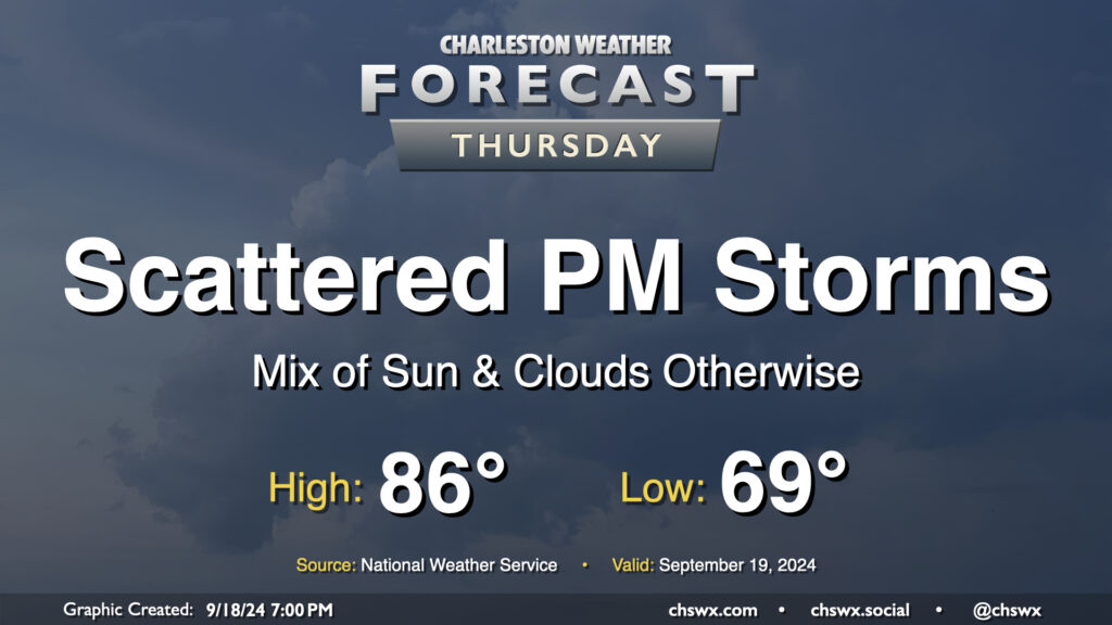
We’ve got one more day of unsettled weather as low pressure aloft and at the surface mosey their way on out of here ahead of what should be a nice weekend. After a generally nice start in the upper 60s, a mix of sun and clouds will send temperatures up to the mid-80s in the afternoon before a few showers and thunderstorms break out with the heating of the day. Not everyone sees rain, but some heavy downpours will be possible in a few spots once again. Severe weather is not expected.
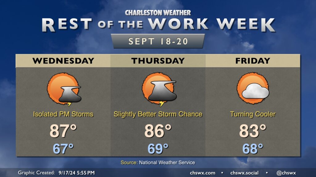
After a beautiful Tuesday — I’m sitting outside as I write this, in fact — we will see a bit more in the way of moisture work its way into the area over the next couple days. It’ll also turn a bit warmer, with highs in the upper 80s Wednesday and solidly in the mid-80s on Thursday.
There will be the risk for some afternoon showers and maybe a thunderstorm each afternoon over the next couple days as a front gets closer. The risk for rain is slightly higher on Wednesday as the front gets through the area.
Once that front gets through, though, a stretch of excellent weather will begin. Friday begins a stretch of several days of temperatures at or below normal, with partly cloudy to mostly sunny skies each day through at least the middle of next week as high pressure takes command of the local weather situation. Should be quite enjoyable!
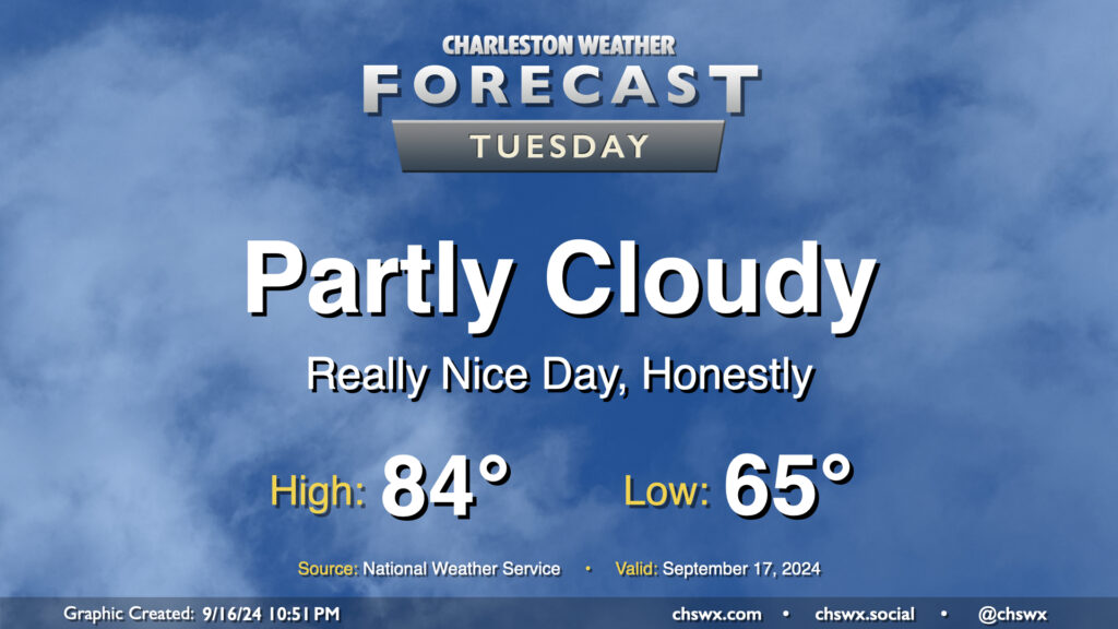
After our largely uneventful brush with Potential Tropical Cyclone Eight, we have a pretty nice weather day on tap for Tuesday as dry air wrapping around the back end of the system hangs around for one more day. We’ll start the day comfortably in the mid-60s, warming to the mid-80s in the afternoon under partly cloudy skies. Dewpoints run into the mid-to-upper 60s, so it’ll feel a little humid, but not too bad.