Weekend forecast: Shower chances hang around, but no washout, either
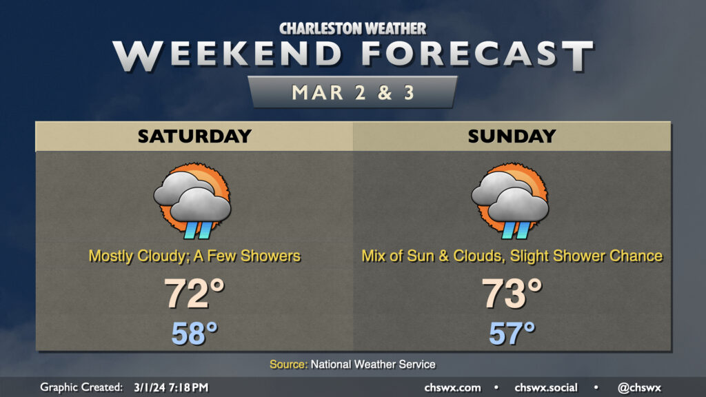
Surface low pressure will have pulled well away from the Lowcountry by Saturday morning, but we don’t get completely off the hook for rain chances this weekend with a lingering front and a warm airmass. Temperatures will run well above normal — we start the day in the upper 50s, warming to the low 70s in the afternoon. Cloud cover will feature prominently, and as mentioned, there is the risk for a few showers from time to time, but we should have a decent amount of rain-free time as well.
Sunday will be similar as the front continues to hang around. We’ll start the day in the mid-to-upper 50s once again, warming to the low 70s with sun peeking through cloud cover occasionally. The risk for showers remains, though it will be a little lower than we saw on Saturday. Shower chances will quiet down for Sunday evening, leading to a dry Monday before shower and thunderstorm chances return to the forecast for Tuesday through much of the upcoming week.