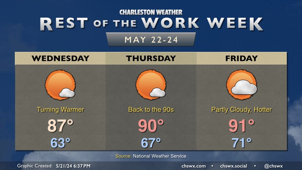
The forecast for the rest of the work week is fairly straightforward: Partly cloudy to mostly sunny skies with temperatures gradually getting warmer (with dewpoints unfortunately following suit) as time goes on. Wednesday will feature one more cool start in the low 60s before warming to the mid-to-upper 80s in the afternoon. Dewpoints will mix out to the low 60s, so it won’t feel too bad. They’ll start to climb into the upper 60s on Thursday, though, as highs reach 90° in the afternoon. With the additional humidity, expect heat indices to run a few degrees warmer. Friday continues the warming trend, with highs once again in the low 90s and dewpoints creeping up even further to the 70° mark making for another warm and muggy day.
While the rest of the work week looks to remain rain-free, slight shower and thunderstorm chances will figure into the forecast as we head into the Memorial Day weekend. It doesn’t look like a rainout, but you’ll want to have indoor backup plans in case thunderstorms threaten.
Finally, a programming note: I’m taking the next few days off for some much-needed downtime. Posts will be scattershot at best. As always, the latest NWS forecast is on the chswx.com homepage. See y’all next week!
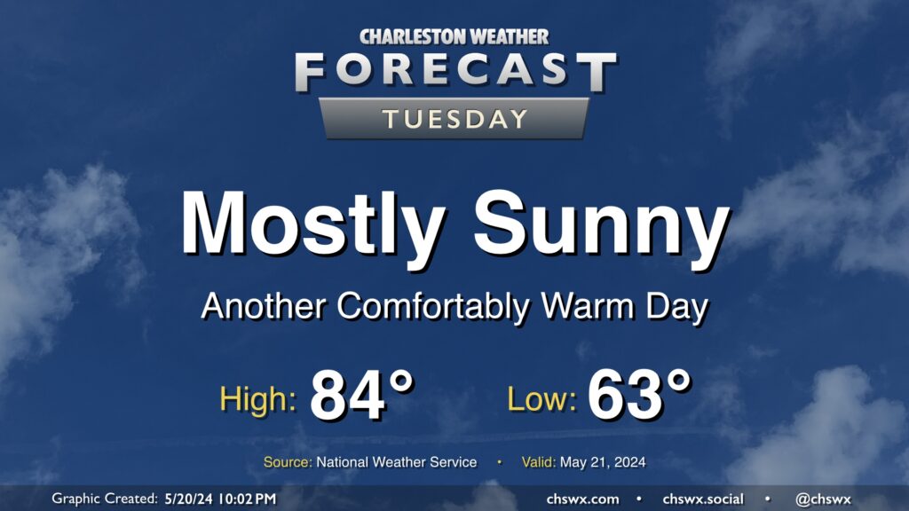
We have another nice day ahead Tuesday. We’ll start the day in the low 60s once again, with highs topping out in the low-to-mid-80s under mostly sunny skies. It’ll be a touch breezy, with winds out of the northeast once again around 10 MPH, but this is what’s keeping us a little on the cooler side, so we’ll take it.
The only weather concern will be the risk for water levels peaking in minor flood stage again with the Tuesday evening high tide. Minor coastal flooding looks probable between 7-9 PM with water levels peaking around 7.1’. It’ll be enough to cover the more vulnerable roads once again with salt water, but it won’t be a widespread issue.
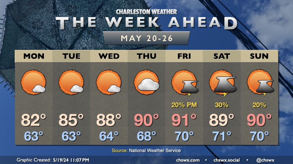
The weather turns quiet to start the new work week, and we’ll even enjoy slightly lower temperatures and a little less humidity for at least a couple days, too! Monday looks particularly nice with lows in the mid-60s warming to highs in the low 80s in the afternoon under mostly sunny skies. A warming trend commences thereafter, with highs in the mid-80s Tuesday followed by upper 80s Wednesday. 90s return on Thursday, and we stay around there for Friday and the weekend as well…alas, with a bit more summertime humidity in play, too.
Rain chances are quiet through Thursday as ridging aloft rules the roost. This ridging will give way to a few disturbances starting Friday and lasting into the weekend, which will bring some shower and thunderstorm chances primarily in the afternoons. There’s no washouts anywhere that we can see, though — just be sure to have a secondary indoor plan to go along with your outdoor plans as we head into the Memorial Day weekend.