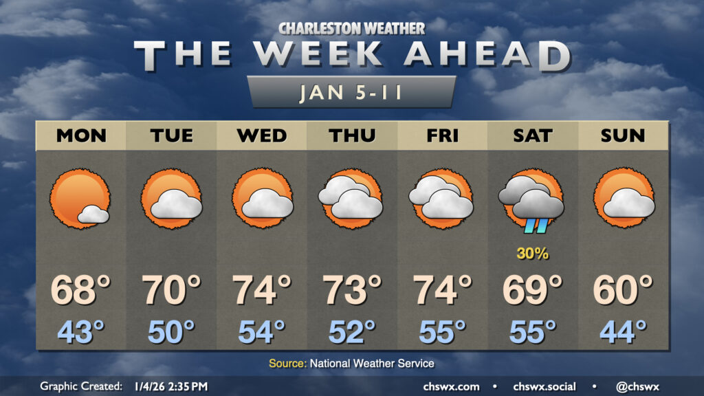
A quiet and warm week of weather lies ahead as we go back to work and school for the first time in 2026. Temperatures this week will climb some 10-15° above normal at times, but we should stay just short of any record highs.
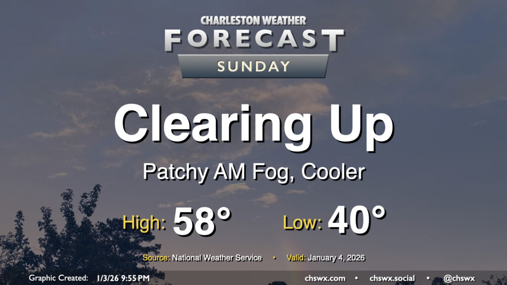
The cold front that brought some much-needed rainfall to the area on Saturday will clear the area for Sunday, bringing about a cooler, drier, and sunnier day after some patches of fog in the morning. Temperatures start around 40°, but northerly winds blowing in cooler air will keep temperatures capped below 60° for most of us. Sunday will be the coolest day of the week as high pressure shifts offshore, bringing about quite a warm spell for the first full work week of 2026.
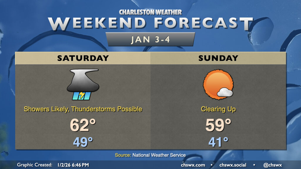
The first rain chance of the new year arrives on Saturday as low pressure along a cold front develops and approaches the area. We’ll clear out in time for a pleasant and seasonable Sunday, though.
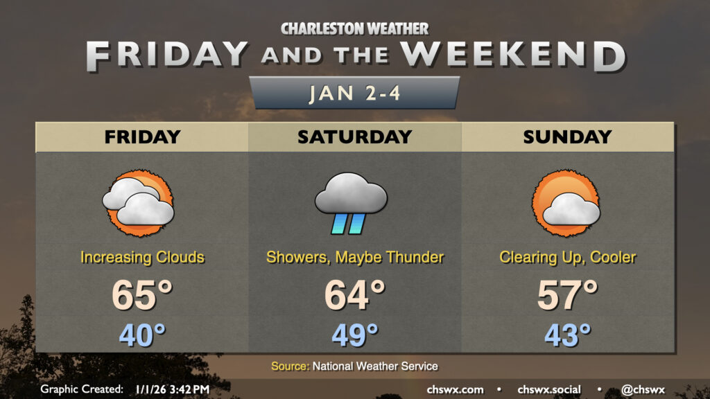
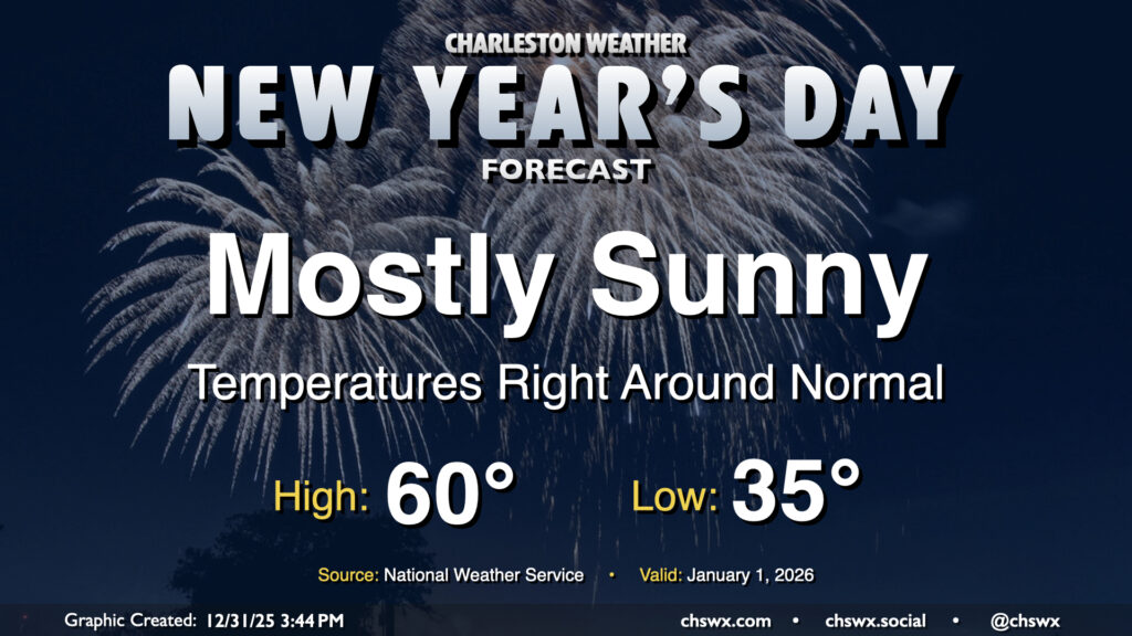
I hope you and yours are having a nice and safe start to your 2026! We certainly have had a nice day of weather on Thursday to kick the new year off right, but the first storm system of the year won’t waste any time getting through the area on Saturday.
We’ll get 2026 off to a slightly chilly but seasonable start with surface high pressure in control. Temperatures will fall to the mid-30s by morning, with some freezing temperatures possible closer to I-95. With plenty of sunshine, though, temperatures will rebound right to where they should be for the beginning of the year, with highs peaking around 60° in the afternoon. It’ll be a bit breezy, especially in the morning, but those winds will slacken some as we head into the evening.
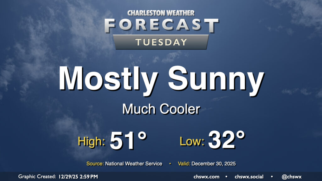
A cold front getting through the area Monday afternoon will usher in much cooler air for Tuesday. We’ll start the day around freezing away from the coast, with wind chills bottoming out in the mid-to-upper 20s in the morning thanks to northwesterly winds around 5-10 MPH. This breeze continues for much of the day. Despite full sunshine, the ongoing influx of cold air will keep highs pinned to the low 50s across the metro.