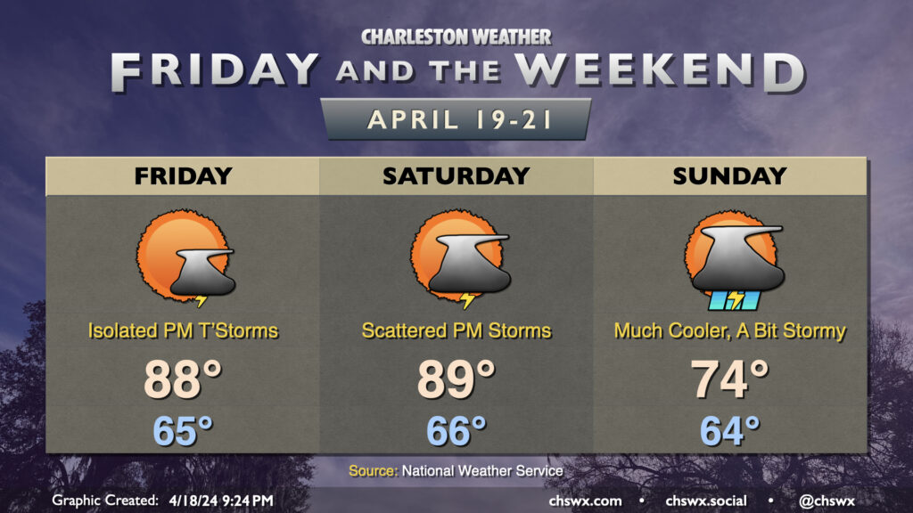
This week’s stretch of quiet weather comes to an end as we head into the weekend courtesy of a cold front. We hit 90° for the first time at the airport today, and could get close again on Friday, though a surface trough and some energy aloft could combine for a few showers and thunderstorms during the afternoon. A strong storm can’t be ruled out, either, with gusty winds and some hail a possibility.
More vigorous energy moves into the area as the backdoor front gets closer on Saturday. It’ll be one more very summer-like day with highs approaching 90° in the afternoon, though scattered showers and thunderstorms will be a possibility beginning mid-afternoon on. Off and on showers and thunderstorms remain in the forecast for Sunday, though as the front sinks southward, we’ll turn much cooler — expect highs to run almost 15° cooler than they did on Saturday. Rain chances should peak later in the evening into the overnight before tapering Monday.
High Water-goers, be alert this weekend for quickly changing conditions and be ready to safe shelter if lightning approaches. We usually get kind of lucky with this event and the weather, and hopefully we can keep that stretch going. If not, though, be sure to keep this mantra in mind…”When thunder roars, go indoors!”
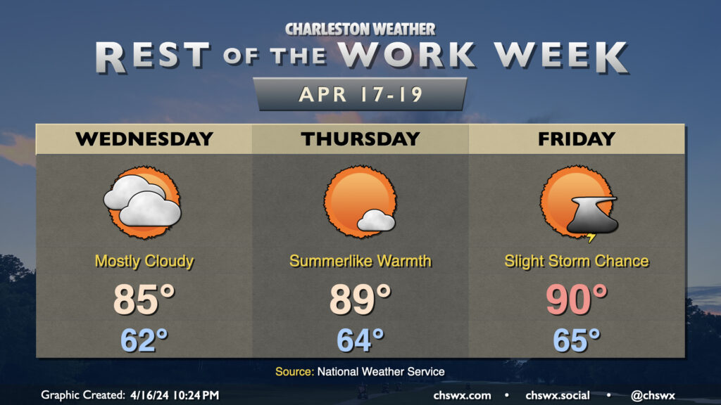
High cloud cover will factor in somewhat prominently on Wednesday, but we’ll still get plenty warm with the filtered sunshine. Expect highs in the mid-80s after a low 60s start.
The heat turns back up to levels closer to Monday’s upper 80s with another couple runs at the 90° mark for the first time in 2024 coming up Thursday and Friday. High clouds will clear, leaving behind a mostly sunny sky on Thursday. A surface trough will move into the area Friday, which could act as an instigator for a few showers or thunderstorms in the afternoon (though most will stay dry). If we don’t hit 90° Thursday, we should do it Friday.
The above-normal warmth carries into Saturday before a front knocks temperatures back down to more seasonable levels for Sunday into next week. (Alas, the aforementioned front will also keep shower and thunderstorm chances in the forecast over the weekend as well, though it won’t be a washout.)
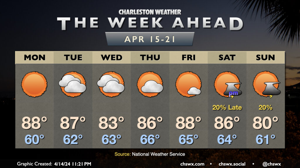
You’d be forgiven if you thought this week’s forecast was something straight out of early June, but no, it indeed is the forecast for the third week of April. High pressure ridging overhead will keep the weather generally quiet, with the storm track staying to our north. Expect highs in the mid-to-upper 80s on Monday and Tuesday, with cloud cover ticking up Tuesday into Wednesday as temperatures briefly cool down mid-week. We’ll warm back up into the mid-to-upper 80s to close out the week ahead of a front, which could bring a slight shower or storm chance to the area — along with cooler temperatures — for the weekend.
It was a very soggy Thursday with rainfall records falling across the area before the morning was out. Fortunately, the payoff is here, and it’ll be pretty great (albeit a bit windy to start). Friday will be very, very sunny, and a bit cooler than the previous couple days. We’ll start in the mid-50s, warming to the mid-70s in the afternoon. The only real fly in the ointment will be the wind, with gusts to 30 MPH possible at times as high pressure builds in.
Saturday will start even a little cooler, with lows around 50° expected before we warm to the mid-70s in the afternoon under predominantly sunny skies once again. It’ll still be a bit breezy during the day, with winds generally in the 10-15 MPH range, but it’ll be overall a great day to get outdoors. The 80s return on Sunday, and even warmer weather will follow next week.