The week ahead: Cooling back off to close 2025
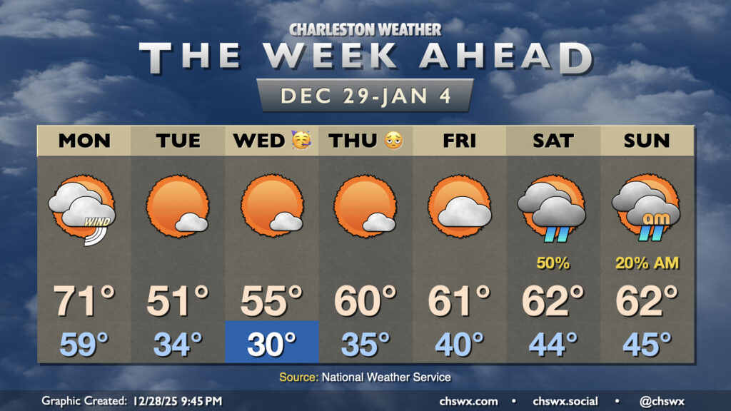
One more unseasonably warm day is on tap for Monday before the airmass flips, which will help us usher in 2026 on a cooler and more seasonable note.
Read more »Forecast explanations, atmospheric science, and other cool weather-related stuff for Charleston, SC
One more unseasonably warm day is on tap for Monday before the airmass flips, which will help us usher in 2026 on a cooler and more seasonable note.
Read more »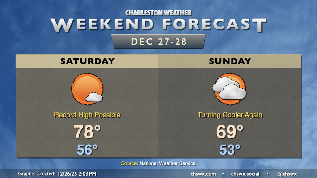
Quiet weather continues this weekend, though the temperature rollercoaster will continue to roll on as record highs Saturday yield to cooler (but still warmer-than-normal) temperatures on Sunday.
Read more »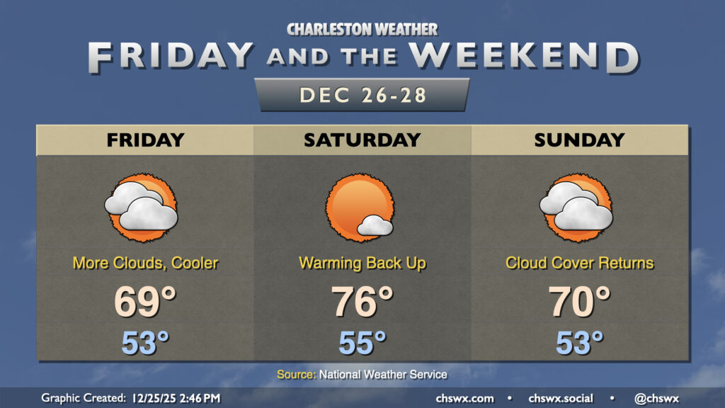
I hope everyone celebrating had a very Merry Christmas! It was certainly a warm one as the high reached 78° today, just two degrees off the record of 80° last set in 2015 and cementing itself ahead of Christmas 2016 for the second-warmest Christmas high temperature on record at the airport.
A backdoor cold front stalling nearby will drive more cloud cover into the area for Friday as well as a bit more in the way of onshore flow, which will make for a cooler day (though temperatures will remain above normal). Lows in the low-to-mid-50s will warm to the upper 60s to around 70°. Model guidance keeps the core of the cold air damming regime to the north of the area, but some spots further north in the Tri-County could see temperatures come in a little cooler than that depending on how far south the front penetrates.
Read more »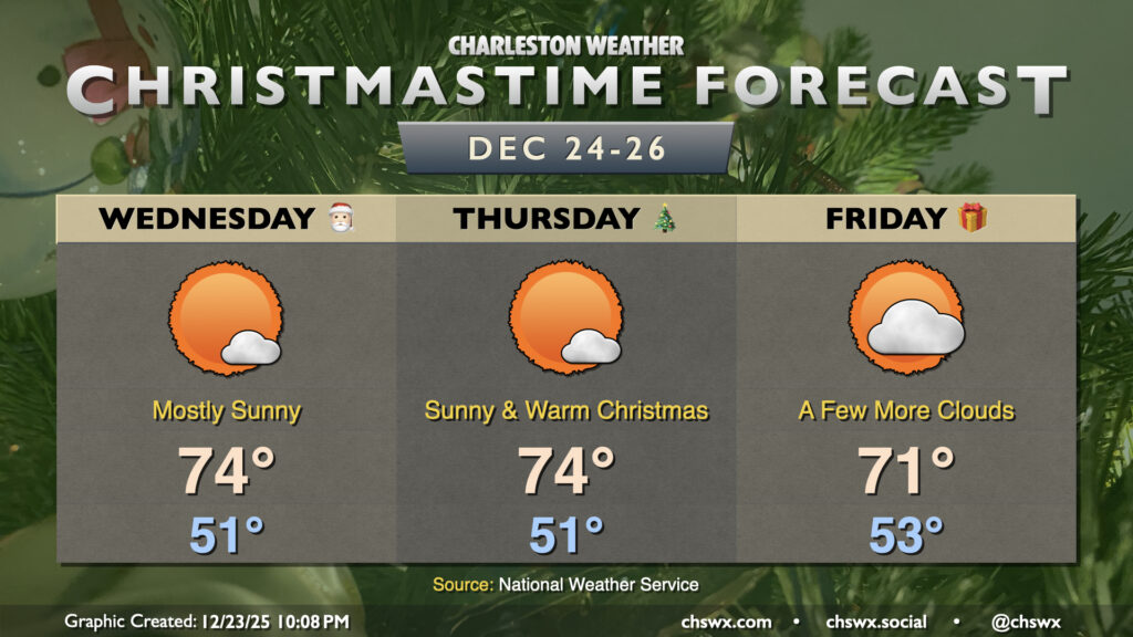
Sprawling high pressure aloft over the central part of the country will keep warmer-than-normal temperatures in the forecast through Christmas and heading into the weekend. There are changes coming, though, in the form of an Arctic blast that will bring 2025 to a chilly end.
Read more »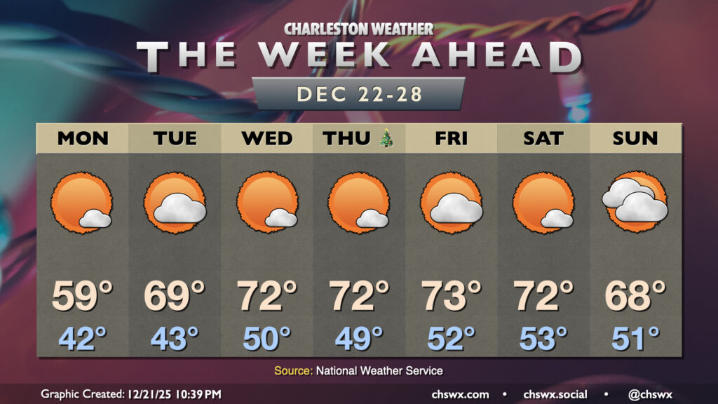
The main weather story for the week ahead — including Christmas Day — will be much warmer-than-normal temperatures as high pressure aloft will remain the dominant weather feature across a good bit of the continental US.
Read more »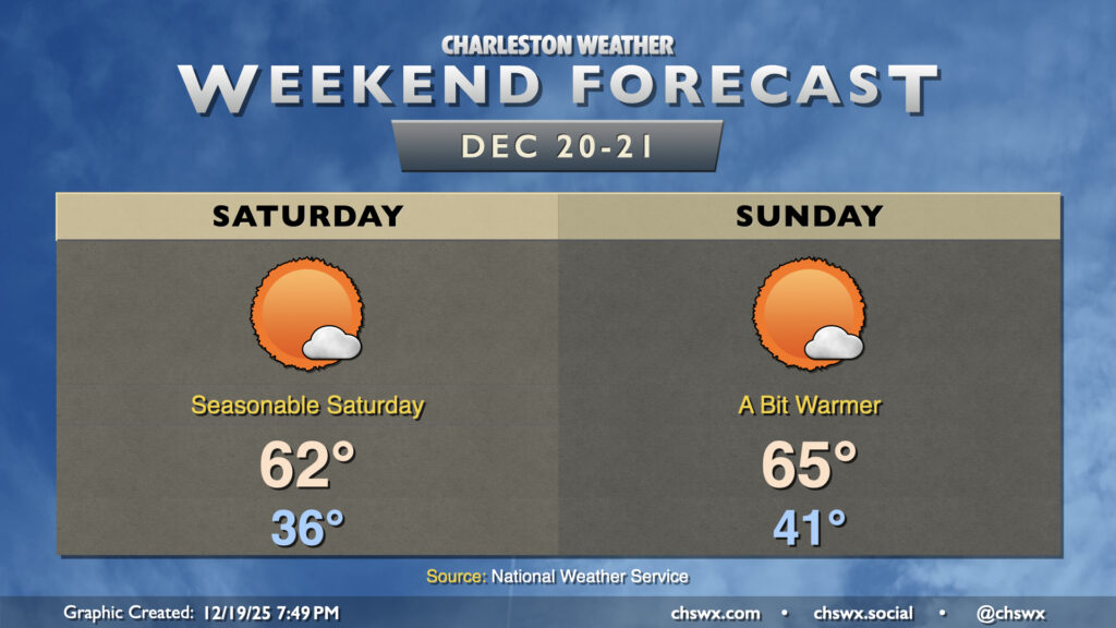
It’ll be a quiet and seasonable weekend of weather in the Lowcountry as we embark on the last shopping weekend before Christmas. Temperatures Saturday will start on the cool side, with calm winds and clear skies allowing temperatures to fall to the mid-30s by morning. Mostly sunny skies will help temperatures warm to the low 60s in the afternoon, about right where we should be for December 20.
The airmass moderates a bit on Sunday ahead of another front. We’ll start the day in the low 40s, warming to the mid-60s in the afternoon with mostly sunny skies once again expected. The frontal passage late Sunday will be dry, but will bring a decent shot of cool air to start the abbreviated work week on Monday. We’ll warm back up for Christmas, though, and may even crack 70° on Christmas Day, as we look to close 2025 on a warmer-than-normal note with sprawling high pressure developing aloft across much of the continental US.