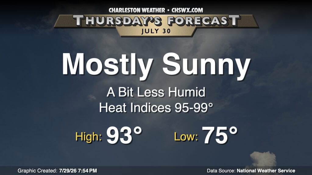
What looks to be a top-five-warmest July on record will close on a slightly cooler and drier note as high pressure nudges in from the north. Thursday starts in the mid-70s across the area, warming to the low-to-mid-90s in the afternoon with plenty of sunshine. As mentioned, the drier air will keep heat indices a little more in check, though they may still get close to 100° near the coast where the more humid maritime airmass resides. But with all that in mind, it’ll still feel better outside than it did at the start of the week.
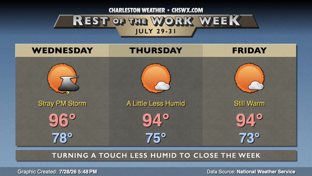
Another hot and humid day awaits for Wednesday, then a bit of drier air filters in to take the edge off the heat ever so slightly to close out the work week and the month of July.
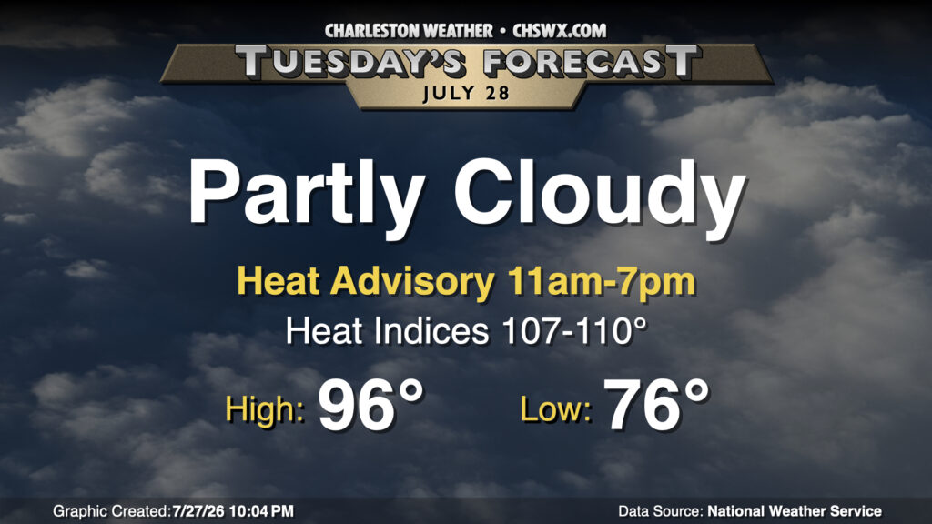
High heat returns to the Lowcountry on Tuesday as southwest winds pump plenty of warm and humid air into the area. We start in the mid-70s inland and upper 70s downtown and at the coast, and with plenty of sunshine, we’ll warm to the mid-to-upper 90s. Dewpoints will run in the mid-70s inland, while they’ll be running in the upper 70s to near 80° at the coast and behind the seabreeze. This will drive heat indices into the upper 100s to low 110s during peak heating, spiking in the wake of the seabreeze as dewpoints surge. A Heat Advisory will go into effect at 11am, and will run through 7pm for the entire Tri-County area. Take frequent water and shade breaks if you’re working outside during the height of the day tomorrow. A stray storm or two can’t be totally ruled out, especially overnight as a front drives southeastward into the Midlands before stalling out.
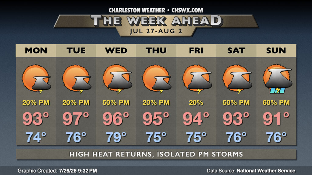
After a very wet weekend that included flooding rains at Mt. Pleasant and Isle of Palms, we should see a bit of a downtrend in rain chances as some of the deeper moisture that’s been hanging around this weekend moves offshore and further into the Atlantic. The pesky cold front that’s been hanging around will start the day just to our south, lifting north during the afternoon, so between this and the seabreeze, it’s still possible for a few afternoon thunderstorms to fire. Temperatures will run in the mid-70s Monday morning, topping out in the low to mid-90s in the afternoon. Heat indices should run around 102-106°, highest near the coast.