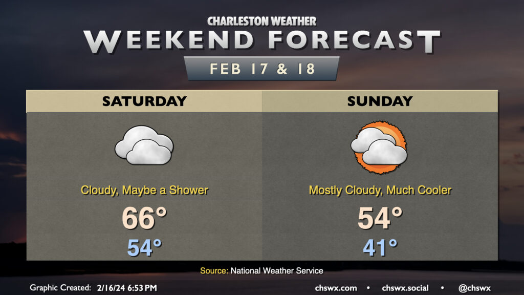
This latest stretch of 70°+ weather comes to an end Saturday as a cold front moves through the area. Dry air near the surface will preclude much, if any, rainfall from affecting the area as the front moves by, though a light shower or two can’t be totally discounted. We start the day in the mid-50s before warming to just the mid-60s in the afternoon as the front moves by and we start to cool off.
Clouds struggle to break up post-front on Sunday, but we should see at least a few peeks of sun. Still, it’ll turn much cooler — we start in the low 40s, but will only warm to the mid-50s at best with all the cloud cover around. This chill doesn’t hang around particularly long, though, as we’re back in the 60s on Monday and approaching 70° later next week.
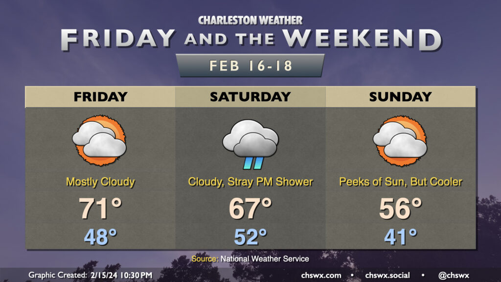
Friday & the weekend will feature more in the way of cloud cover, with a cold front bringing a brief cooldown to the area for Sunday. We’ve got one more day of 70s ahead on Friday, though, despite mostly cloudy skies as moisture increases ahead of the next storm system. Said storm system doesn’t amount to too much here, though, as it’ll primarily keep us overcast with a few stray showers possible on Saturday, but little else as the bulk of the low-level moisture stays to our south. Temperatures on Saturday start on the warm side thanks to the overcast, with lows only bottoming out in the low 50s before warming to the mid-60s in the afternoon. A cold front then sweeps through overnight, leaving us in the low 40s Sunday morning and only warming to about the mid-50s in the afternoon. There will be some peeks of sun through the cloud cover, but clearing in earnest will take place as we get into Monday.
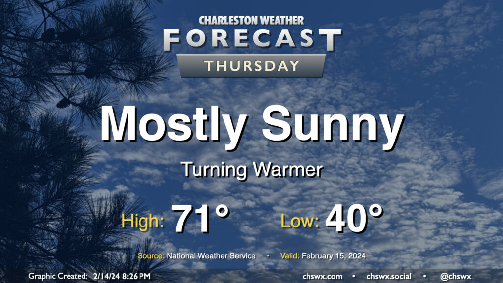
We got close to 70° on Wednesday, but we should reach it on Thursday with another day of mostly sunny skies under the influence of high pressure. We start the day around 40° and warm quickly to the upper 60s by midday, and will likely peak in the low 70s during the early part of the afternoon. Winds will shift to the southwest and will pick up a little in the afternoon, with speeds around 10 MPH becoming common later in the day.
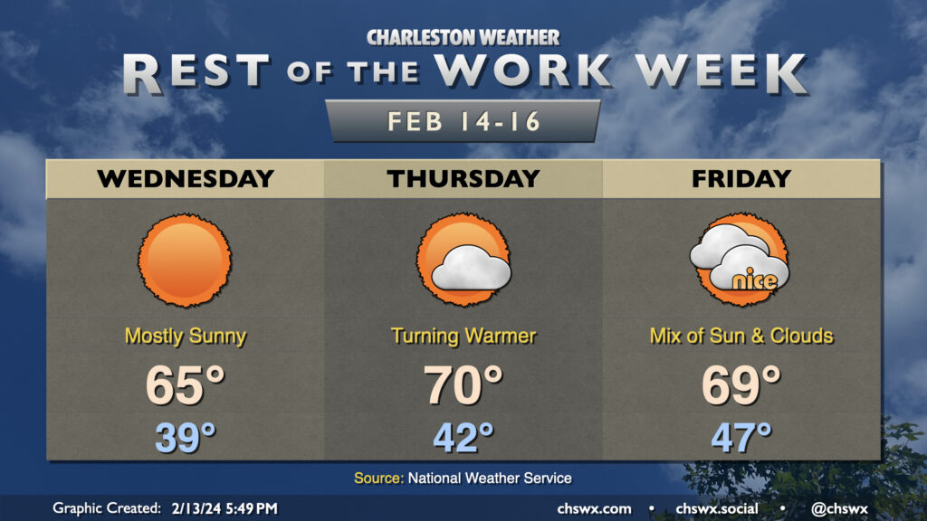
We’ve got quiet weather for the rest of the work week as high pressure remains in control through Friday. Wednesday will bring another round of nearly uninterrupted sunshine, but will also represent the coldest start to a day for the rest of the week with lows bottoming out in the upper 30s. The sun will help warm us up quite nicely into the mid-60s in the afternoon, a couple clicks above normal for Valentine’s Day.
We turn even warmer on Thursday, albeit with a little bit more in the way of clouds around. Thursday starts in the low 40s and warms to around 70° in the afternoon. A dry cold front will blunt the warming trend on Friday. We start the day in the upper 40s thanks to a little more cloud cover blanketing the area, but highs will be limited to the upper 60s to around 70° under mostly cloudy skies. Still, it should be a nice day.
The next rain chance arrives Saturday as low pressure moving toward the mid-Atlantic states drags a decidedly more wet cold front through the area. High pressure builds in behind it for Sunday, which will briefly cool us off before temperatures rebound to around and slightly above normal values by next Tuesday.
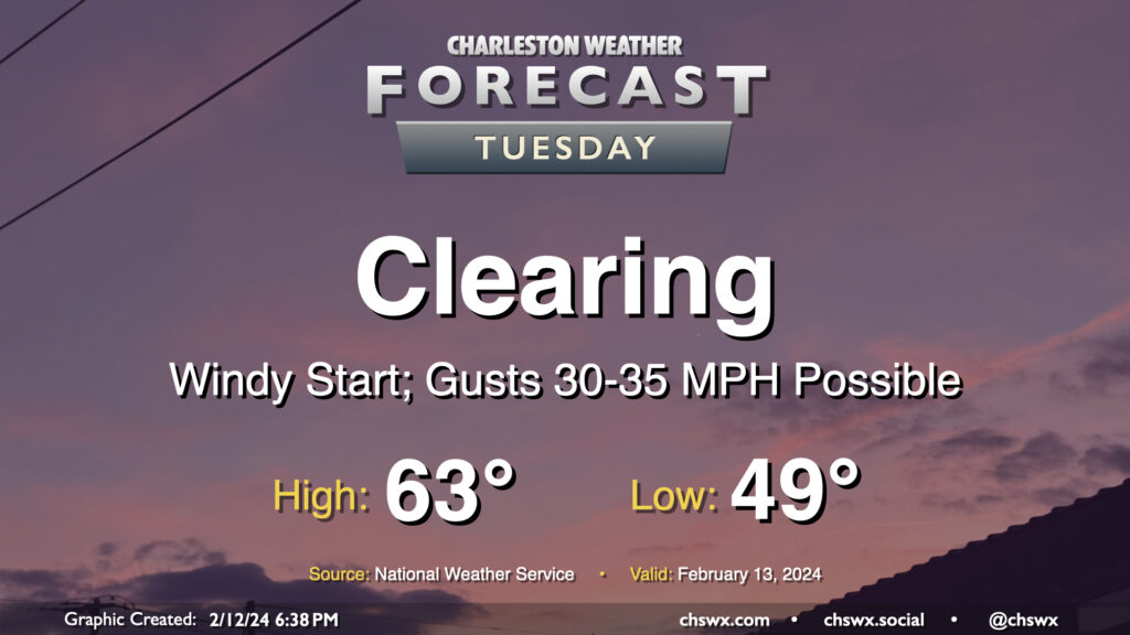
The storm system that’s soaked us on Monday will lift away from the area on Tuesday, clearing us out but also producing a period of gusty winds overnight as high pressure starts to build in from the west. Watch for gusts 30-35 MPH at times, especially on bridges and overpasses, that will affect the area through the morning commute. We should see gusts calm down gradually as the day goes on, thankfully. Clouds will depart and temperatures will warm to the low-to-mid-60s after an upper 40s start, yielding a pleasant and seasonable mid-February day.