After a rare dreary weekend, the sun will slowly return to our skies on Monday — generally in fits and starts, with some overcast periods in there as well — before more doggedly reasserting itself on Tuesday as high pressure builds in behind a dry front. After another front and maybe a few showers Friday, temperatures look to plunge for the weekend.
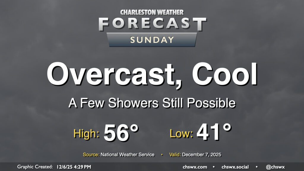
We’ve had some much-needed rain over the past few days, but it’s certainly not made for the best outdoors weather, either. Unfortunately that continues on Sunday, which will decidedly not live up to its name as overcast skies look to persist with a few showers continuing to be possible at times. It won’t be as much rain as we’ve seen over the past couple days with some drier air working in, but there will still be enough moisture to wring out a few more raindrops. Temperatures will remain on the cool side, with lows in the low 40s warming to just the mid-50s in the afternoon at best, making for a sixth consecutive day of highs in the 50s.
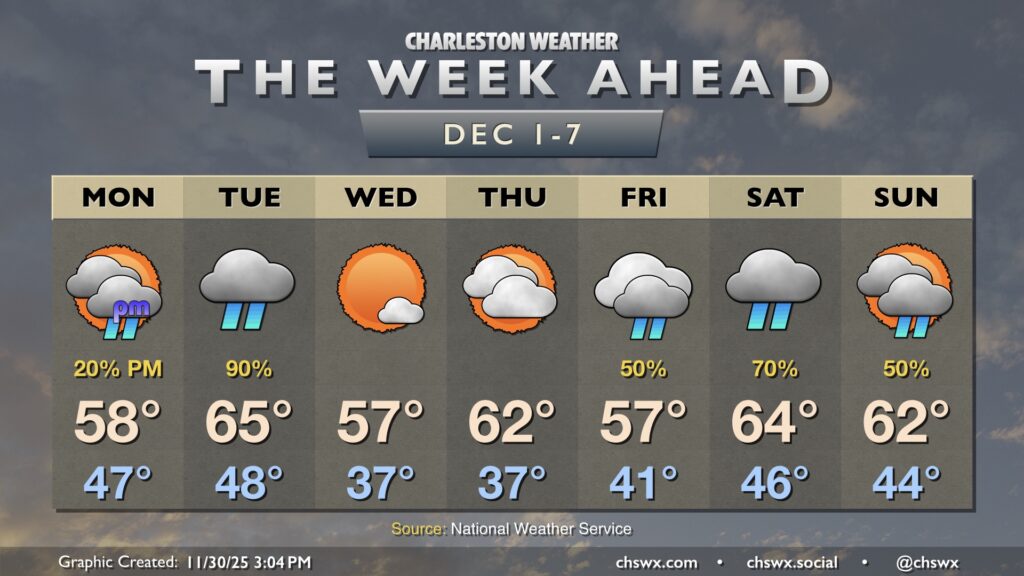
This dreary stretch will start to work itself out on Monday, with a front ushering in cool and dry high pressure by Tuesday, which will scour out the clouds. It’ll be chilly still, but we do have a brief warmup into the low 60s for Wednesday and Thursday before cooling right back off for the weekend with another front.
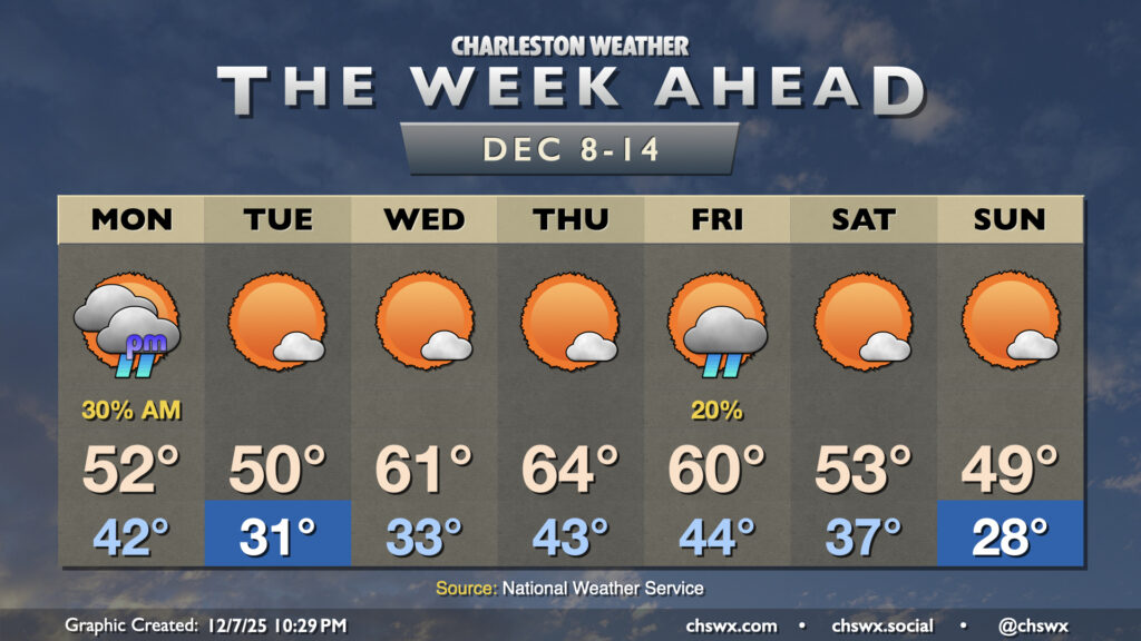
Much-needed rain and below-normal temperatures are in store for the week ahead as a series of fronts affect the area. We’ll also see the risk for some tidal flooding in the mornings beginning Tuesday courtesy of the upcoming full moon.
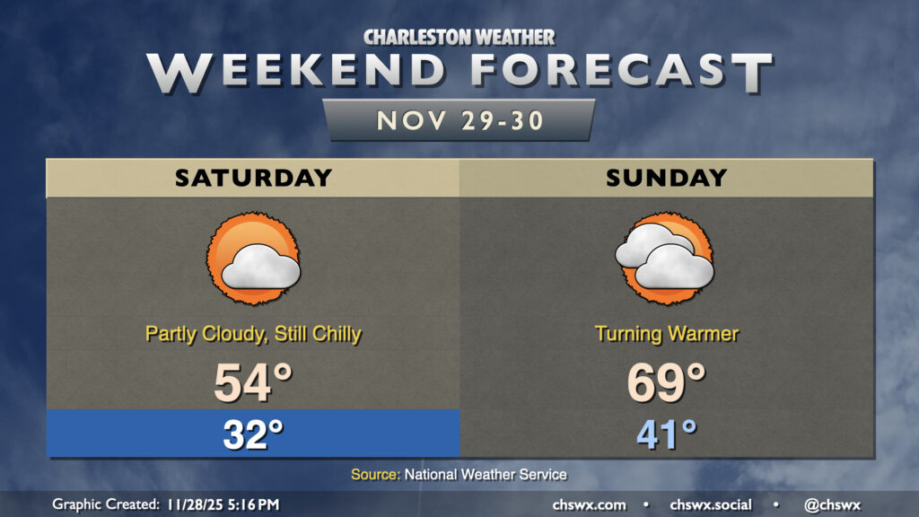
Overall, expect generally quiet weather to continue this weekend, though Saturday will get off to a very chilly start. Expect another morning around or below freezing across much of the area away from the locally warmer coastline, with breezy northeasterly winds making it feel more like the mid-20s. We’ll only warm to the mid-50s in the afternoon with partly cloudy to mostly sunny skies expected.
High pressure slips offshore overnight, and we’ll start to turn warmer on Sunday as a result as winds go more southerly. We’ll start the day in the low 40s, warming to the upper 60s to near 70° in the afternoon despite an increase in cloud cover over Saturday as a low spins up offshore. We’ll stay dry during the day, but a few showers will be possible overnight into early Monday morning as another front cools us back down to start December.
One front has come through as of this writing Wednesday evening, with another front hot on its heels to pass through overnight into early Thanksgiving morning. This second front is going to bring in quite the cooldown for the next few days, especially as we get into Friday and Saturday, but Thanksgiving will certainly illustrate the contrast from the past few days: expect lows in the mid-40s to warm to just about 60° in the afternoon, which is just a hair warmer than Wednesday’s morning low! We’ll have plenty of sunshine, though, with no weather worries for the holiday.