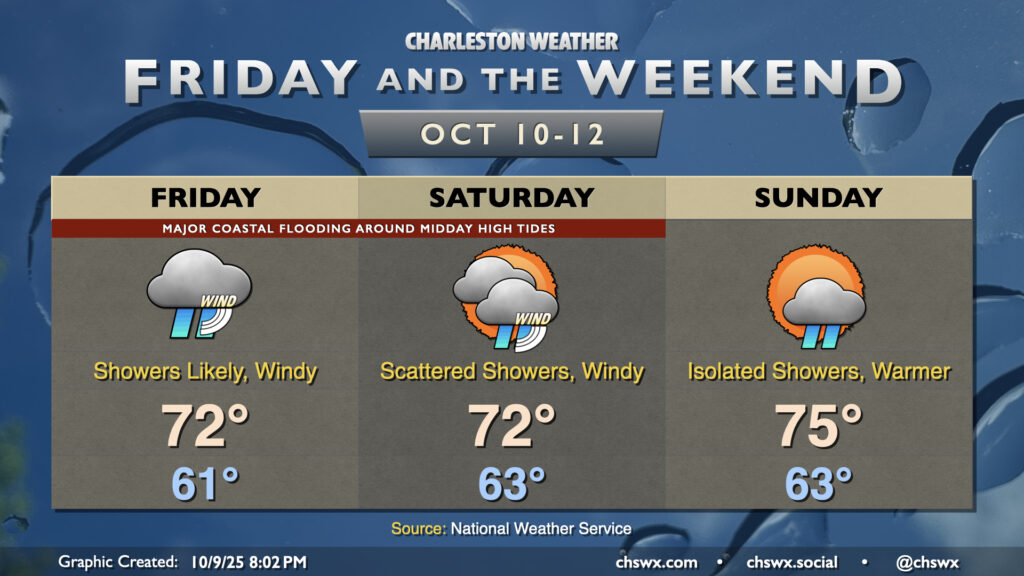
A non-tropical storm system spinning up offshore will bring wind and rain to the area along with major coastal flooding with the midday high tides Friday and Saturday. We’ll start to see some improvements Sunday, thankfully.
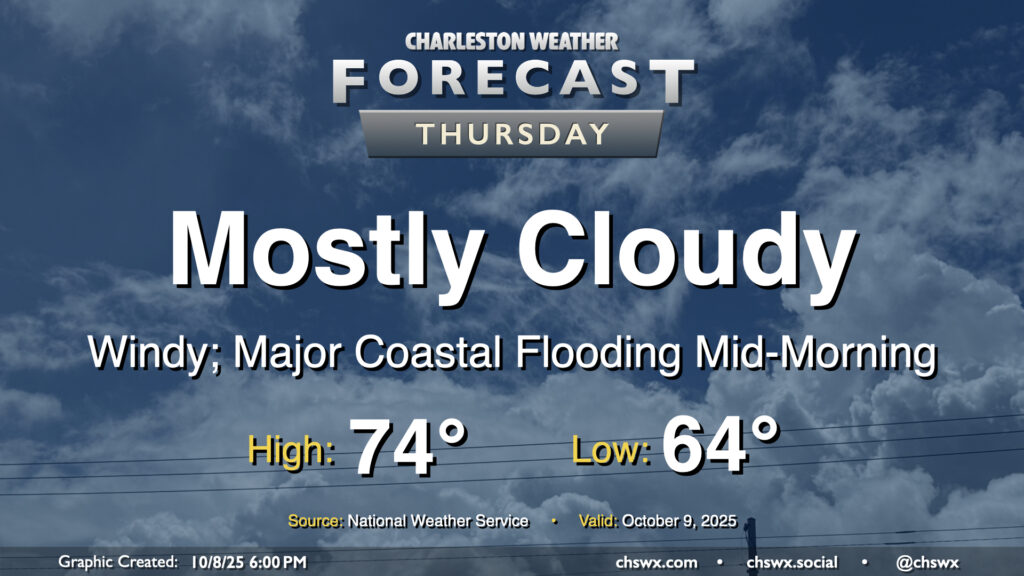
A cold front will pass through overnight, bringing with it a chance for showers and maybe even some thunder as it moves by. Behind that front will be a significant airmass change as high pressure builds southwestward into the area. We’ll wake up to lows in the mid-60s, with temperatures climbing just to the mid-70s under mostly cloudy skies. It’s going to be quite breezy, with northeasterly winds gusting 30-35 MPH at times, especially near the coast.
The strong northeasterly winds will drive water levels in the harbor quite high on top of already high astronomical tides, especially during the day on Thursday (and for the next several days). High tide will peak around 10:06 AM around 8-8.2′ MLLW, which is comfortably in the major flooding threshold. A Coastal Flood Watch is in effect and will likely be upgraded to a warning if trends continue overnight. Be ready for numerous road closures in downtown Charleston as well as salt water impingement onto roads on James and Johns Islands as well as Daniel Island. Moderate coastal flooding is expected with the evening high tide as well, with water levels peaking around 7.5-7.7 MLLW between 9 PM and midnight. This should be high enough for another round of road closures downtown, so be mindful if your travels take you there Thursday night.
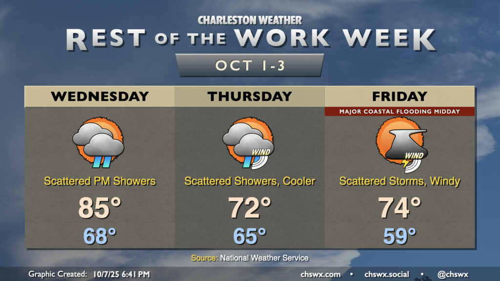
Occasionally unsettled and breezy conditions will continue for the next few days as a front moves through, high pressure builds in, and low pressure spins up offshore.