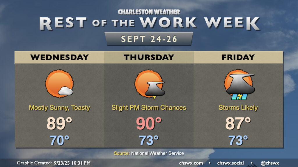
After hitting 91° on Wednesday, we look to take another trip to the 90s on Thursday as ridging aloft combines with Atlantic high pressure to keep us well on the warm side of normal for another day. Temperatures start in the low to mid-70s, well above normal for this point in the year, warming to the 90s in the afternoon with heat indices making it feel more like the mid-90s. We could see a stray shower or thunderstorm in the afternoon and evening along and ahead of the seabreeze, but most of us should stay dry.
Warmer-than-normal temperatures will persist for the next few days, especially ahead of a cold front that will bring some fairly solid rain chances to the area for the first time in a little while on Friday.
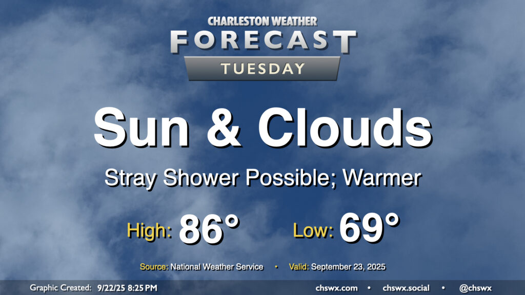
A warming trend begins Tuesday as high pressure to the north continues to weaken and winds turn more onshore, ushering in a much more summer-like feel over the next few days. Temperatures Tuesday start in the upper 60s to around 70°, warming to the mid-80s in the afternoon with a mix of sun and clouds. Factor in the upper 60s-lower 70s dewpoints and it’ll feel more like 90°. Like we saw on Monday, a few afternoon showers are possible, though the weakening high also will portend a weakening coastal trough, which should keep the risk for showers relatively low.
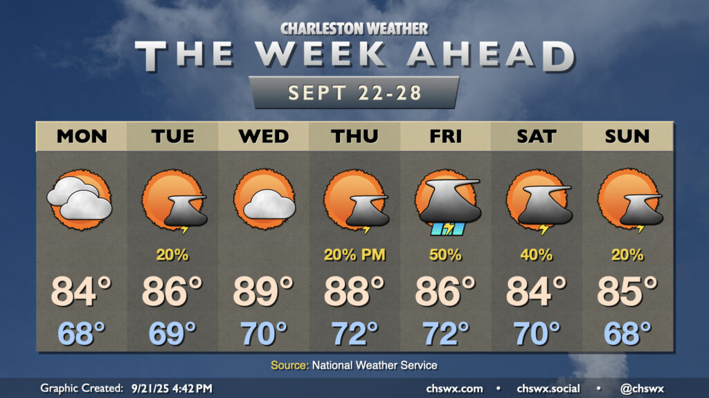
Astronomical fall begins on Monday with the autumnal equinox at 2:19 PM, but it will increasingly feel more like summer as the week wears on as above-normal temperatures take hold by midweek.
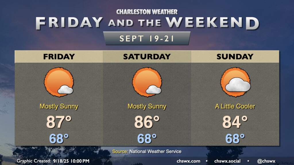
There’s really not terribly much to write home about weather-wise for Friday and the weekend with high pressure remaining in control. Temperatures will remain on the warm side of normal, particularly on Friday and Saturday. We start each day in the upper 60s, warming to the upper 80s Friday and into the mid-80s on Saturday with mostly sunny skies expected. A front sinking south across the area on Sunday will bring in some cloud cover and maybe even a stray shower or two, along with gusty winds (especially at the coast). This will keep highs a little cooler as a result, but still right around normal for this point in the year. Dewpoints will remain elevated — generally running in the upper 60s to around 70° — so there will be a bit of mugginess in the air as well (especially compared to how we started the week).
With winds starting to come back around to the northeast, we could see another round of coastal flooding begin with Saturday evening’s high tide. Stay tuned for possible Coastal Flood Advisories from the National Weather Service.
Another warm day is ahead for Thursday as high pressure generally remains in control with winds coming a bit more out of the west and southwest. Temperatures Thursday start much warmer than they did on Wednesday, with lows in the upper 60s to around 70° expected. We’ll warm to the mid-to-upper 80s in the afternoon under generally partly cloudy skies. A stray shower or storm is possible well inland, but the vast, vast majority of us will stay rain-free.
There’s not too much to write home about weather-wise for Tuesday other than it will be a really nice mid-September day across the Lowcountry. Below-normal temperatures continue, with lows in the low 60s warming to the low 80s in the afternoon under mostly sunny skies. Dewpoints mix down to the mid-50s in the afternoon, making the warmth comfortable. Plus, water levels will fall short of flood stage Tuesday as we get further away from the full moon and the recent perigee, so there are no coastal flooding concerns for the rest of the week, either.