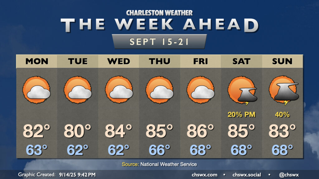
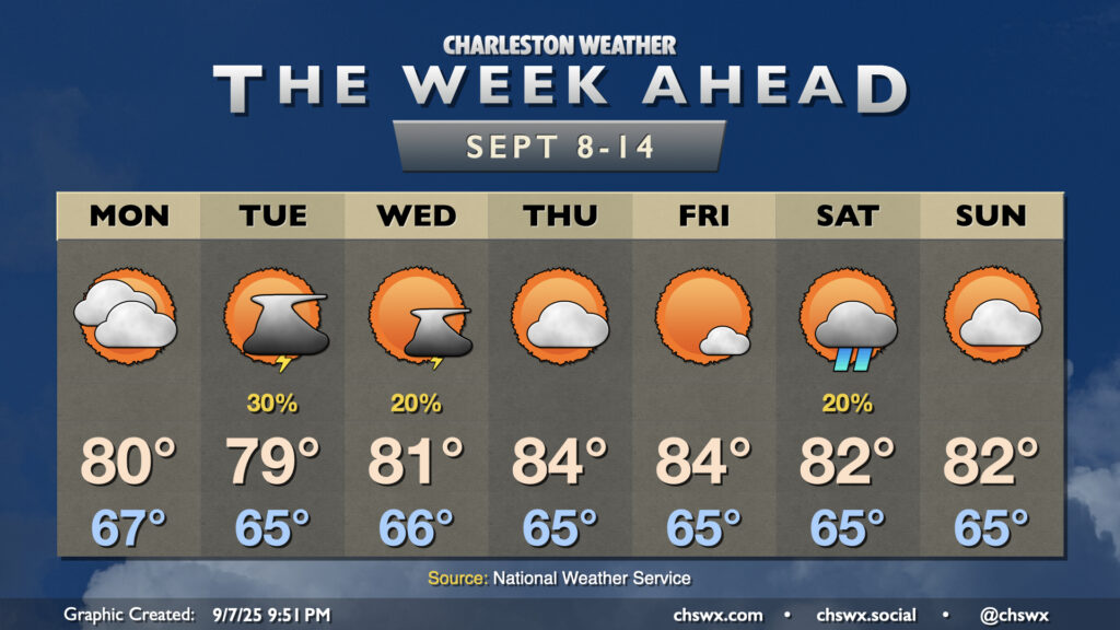
The week ahead will remain generally quiet, but we’ll start to turn warmer later this week as high pressure ridges in aloft. Slight shower and storm chances return to the area for the weekend, particularly on Sunday.
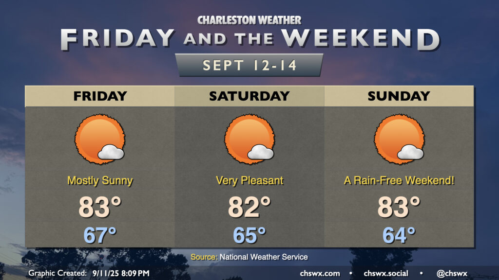
More sunshine will show itself starting Friday and lasting into the weekend courtesy of continued high pressure and northeasterly winds keeping a feed of cooler and drier air coming in. All in all, we can expect lows in the mid-60s each morning, with highs peaking in the low to mid-80s in the afternoon. Fun fact: This looks like the first weekend since July 26-27 without at least a trace of rain at either of the climate sites, so suffice it to say, we are very, very due for a quiet weekend of weather.
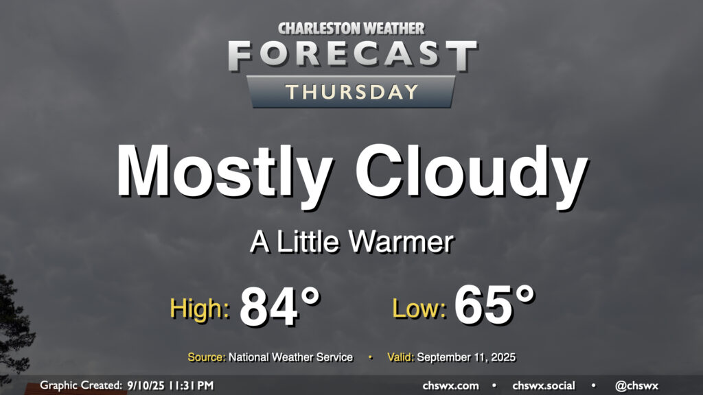
Thursday will run a bit on the cloudy side, but we’ll still see some peeks of sun at times to allow temperatures to warm from the mid-60s in the morning to the mid-80s in the afternoon. Northeasterly winds persist, keeping dewpoints relatively low and the air comfortably warm as a result. We will continue to contend with some salt water flooding around the midday high tide, which could close a few roads for those of us headed for an early lunch downtown.
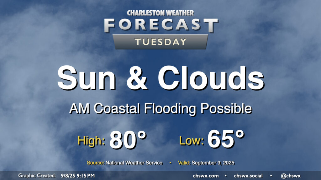
Another quiet weather day is ahead as high pressure wedges across the area from the northeast. Expect a mix of sun and clouds with comfortable temperatures. We start the day in the mid-60s, warming to about 80° in the afternoon. It’ll be a bit breezy, with winds gusting around 15-20 MPH especially near the coast. These northeasterly winds will continue to drive tidal departures in Charleston Harbor above flood stage, and we should see minor to moderate flooding with the 9:35 AM high tide. Some flooding may have impacts on the tail end of the commute, so be prepared for delays if downtown is your destination.
A front which helped stir up another round of heavy rain and flooding in downtown Charleston on Sunday will clear the area overnight into early Monday, yielding a week of comfortable temperatures with occasional slight shower and storm chances.