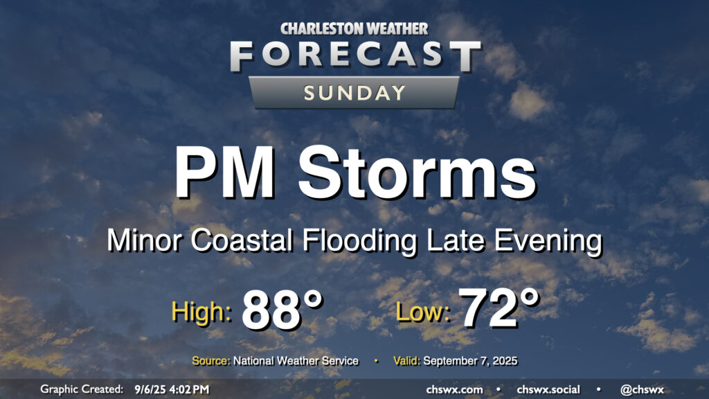
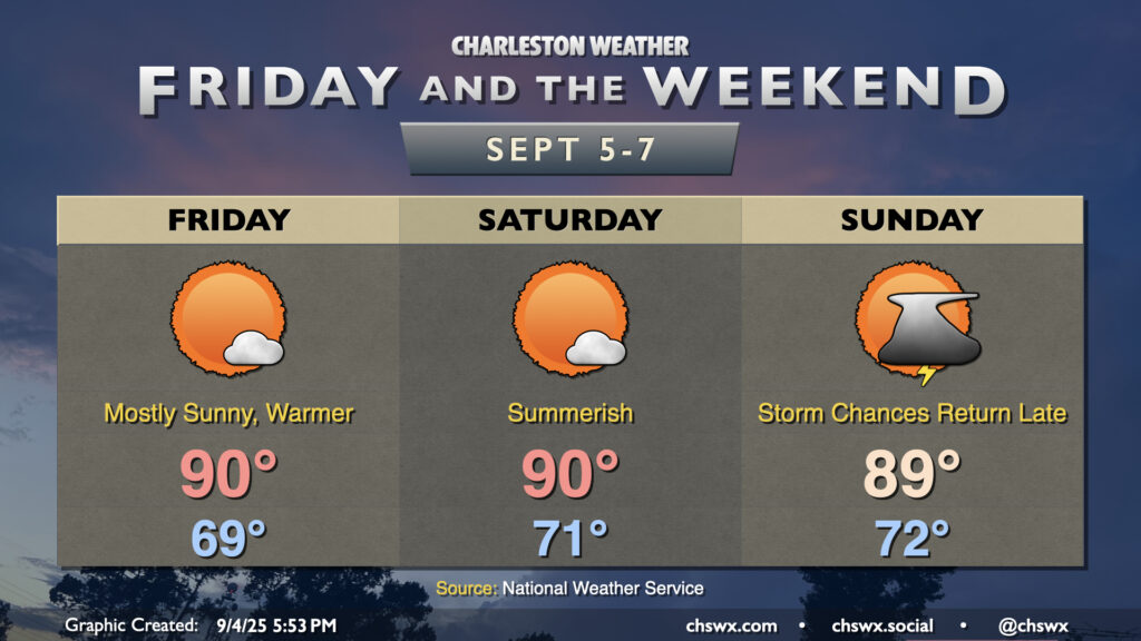
After a few welcome rain-free days, shower and storm chances return to the forecast for Sunday as a cold front moves into the area. We’ll start the day in the low 70s, working our way into the upper 80s in the afternoon before showers and storms kick off. Some rain could be heavy at times, and lightning may be an issue particularly inland where some stronger storms may be possible. It won’t be an all-day rainout, thankfully, but you’ll want to have your indoor plans ready to go if thunderstorms approach.
Isolated salt water flooding may also be a concern around the 7:47 PM high tide. The current total water level forecast brings the tide right to around 7′, which may be enough to cause a little flooding on the most vulnerable roads in downtown Charleston. The risk for coastal flooding around times of high tide increase throughout the first part of the week with the combination of the full moon, lunar perigee, and northeasterly winds in the wake of Sunday’s front, so stay tuned for Coastal Flood Advisories from the National Weather Service.
Warmer and a little more humid air will return to the area Friday as winds go more southerly. With high pressure remaining in control for a few more days, though, we’ll stay largely quiet weather-wise this weekend before a front starts to affect the area later Sunday.
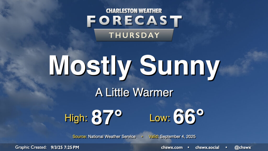
We’ll start to turn a little warmer on Thursday as high pressure to the northeast breaks down a bit, but we should still get one more good day of low humidity in before we start to see dewpoints begin to climb back toward 70° starting Friday. Temperatures on Thursday start quite comfortably once again, with mid-60s the general rule across much of the area. We’ll warm to the upper 80s on Thursday afternoon with plenty of sunshine. The only fly in the ointment may be some very minor coastal flooding around the 6:19 PM high tide, with water levels currently forecast just below 7′. If water levels trend a little higher, a Coastal Flood Advisory may be issued. Otherwise, though, it’ll be another really nice early September day in the Lowcountry.
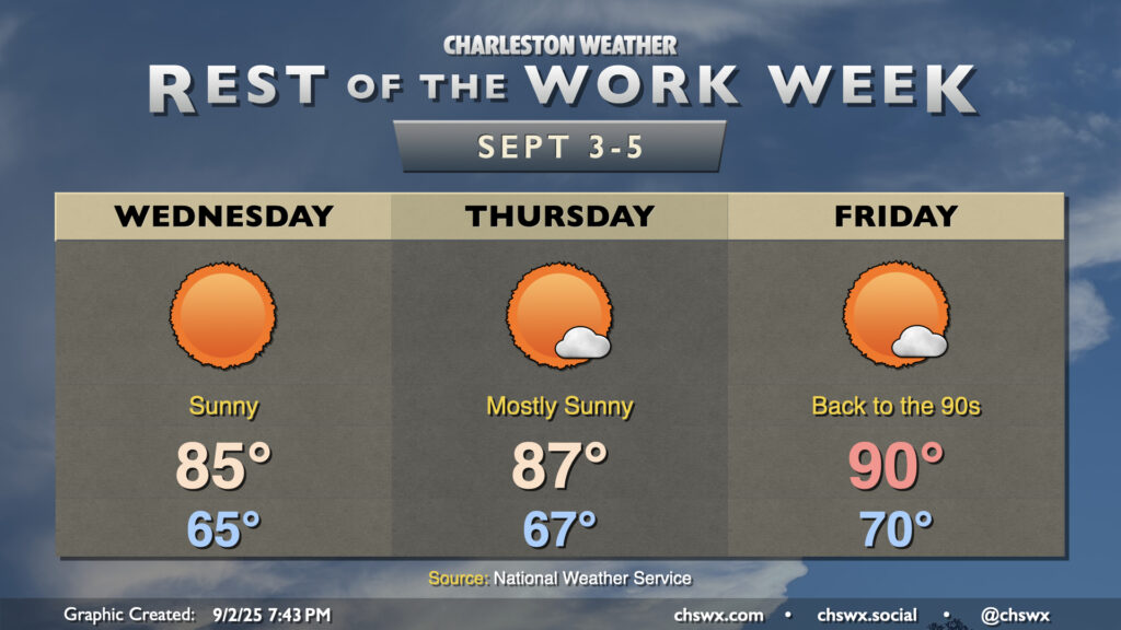
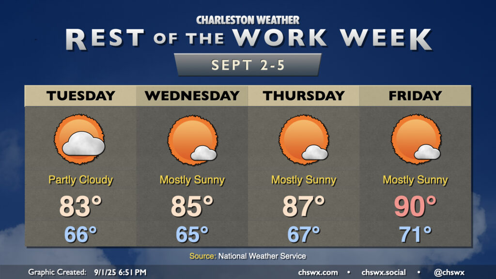
The rest of the work week will remain generally quiet (weather-wise, anyway), as high pressure remains in control at the surface. Temperatures will be on a warming trend as we get over the hump and into the second half of the work week as the mid-level trough that’s kept us on the cool side flattens out and retreats a bit north. We’ll also start to see high pressure build back in from the Atlantic for a few days, which turns the flow at the surface more southerly and starts to bring that more warm and humid air back to the area. We’re in the mid-80s Wednesday, upper 80s Thursday, and likely back to around 90° on Friday, with lows steadily climbing with the dewpoints back to around 70° by Friday morning. However, we look to stay rain-free through about Saturday before another front approaches for late weekend/early next week.
Mostly quiet weather is expected for the rest of the work week, with a warming trend taking us from the fall-like Labor Day weekend back to something a little more resembling summer by the end of the week, with highs back in the 90s by Friday.