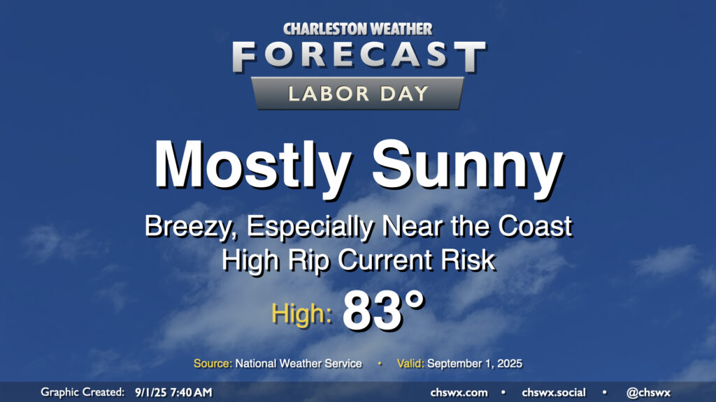
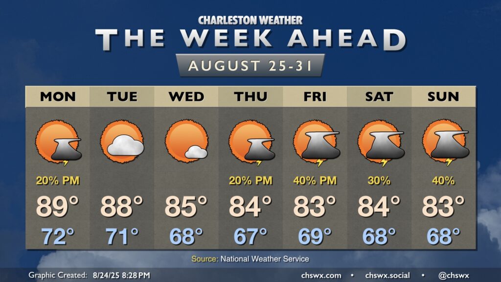
High pressure wedging into the area from the north will make for a beautiful Labor Day and start to climatological fall. Temperatures are starting in the low to mid-60s for the first time since early June, and we’ll warm to the low to mid-80s in the afternoon under mostly sunny skies with an elevated northeasterly breeze keeping things on the cool side.
If the beaches are in your plans, it’ll be noticeably windier there — gusts 25-30 MPH will be possible — and there is a high risk of rip currents today as a result. Today just won’t be a good day to get into the ocean as it could turn dangerous in a hurry. However, the refreshing dry air and comfortable warmth will certainly help make up for it!
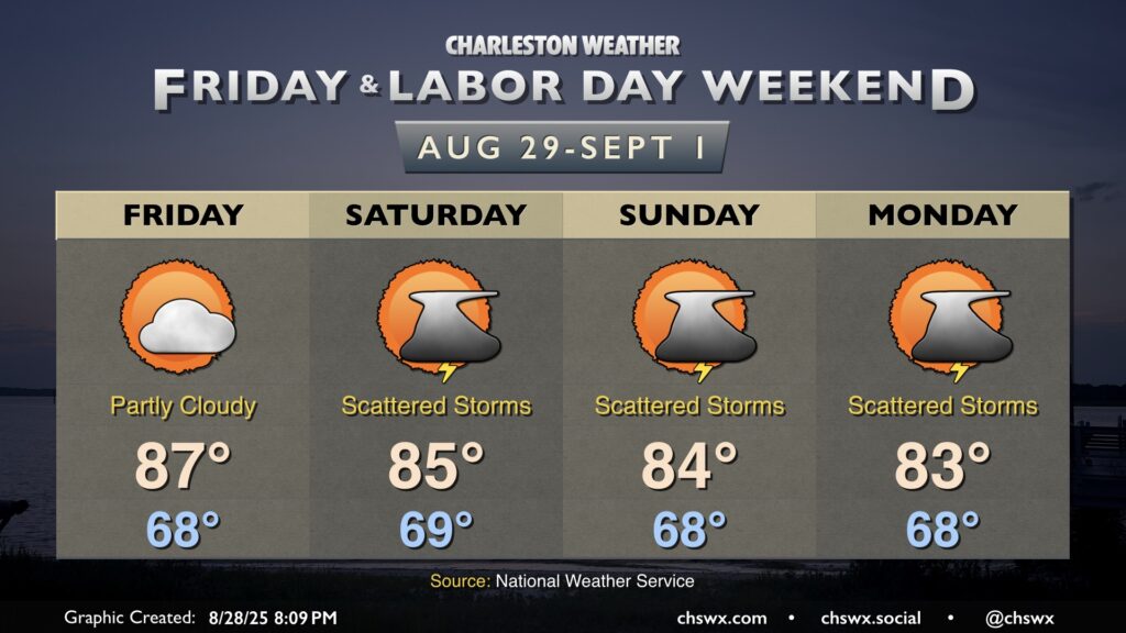
Friday is looking a little warmer but should remain rain-free as high pressure remains the main weather driver for at least one more day. Temperatures start in the upper 60s, warming to the mid-to-upper 80s in the afternoon under partly cloudy skies. An uptick in cloud cover and maybe a stray shower or two could accompany the seabreeze in the afternoon, but guidance keeps the majority of the area dry.
Shower and thunderstorm chances kick up a little bit for the weekend, though the trend has been a bit drier overall as high pressure to the north keeps the better rain chances further south. Still, waves of low pressure should at least kick up scattered coverage across the area especially in the afternoons, but it doesn’t look like a washout, and it will be a far, far cry from last weekend’s deluge. Temperatures will continue to run below normal; expect highs in the mid-80s each afternoon after starting each day in the upper 60s. It won’t feel much like summer as we unofficially bring it to a close, but it should still at least feel fairly pleasant when storms aren’t around.
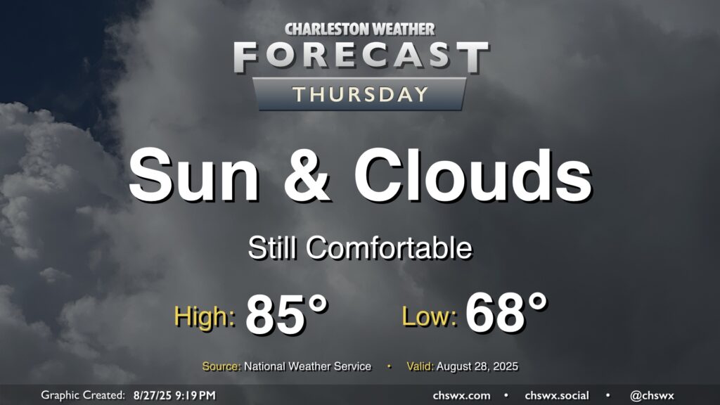
Another nice day lies ahead on Thursday, with a nice start in the upper 60s warming to the mid-80s in the afternoon. We should see a little uptick in cloud cover with a little higher-dewpoint air infiltrating in, but the forecast is largely rain-free. So, it’ll be another nice day to get out and about if you’ve got some time.
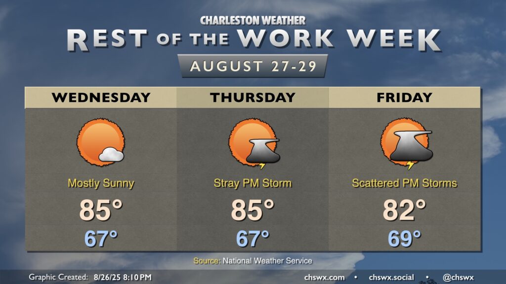
Cooler and drier air will continue to push into the area overnight into Wednesday, yielding a well-deserved beautiful day across the Lowcountry with comfortable warmth and few clouds. We start the day in the mid-to-upper 60s, warming to the mid-80s in the afternoon. Dewpoints mixing down to the low 60s — and perhaps as low as the upper 50s — will feel quite good!
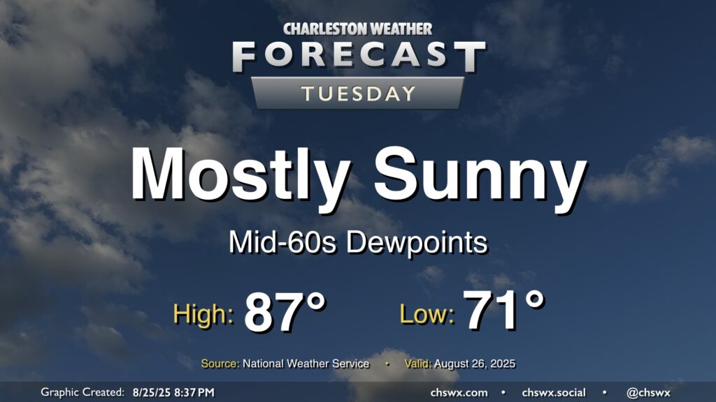
Dewpoints will continue to fall on Tuesday as drier air filters into the area, making for a comfortably warm day with plenty of sunshine to be had. We start the day in the low 70s, warming to the mid-to-upper 80s in the afternoon with just some fair weather cloud cover to be had. All in all, a welcomed nice day after yet another deluge in Mt. Pleasant on Monday.
The main weather story this week will be much more pleasant than last week’s: cooler, drier air working into the area will bring along a decent early-fall preview to close out August, though a few storms will be possible heading into late week.