Weekend forecast: More heavy rain appears likely
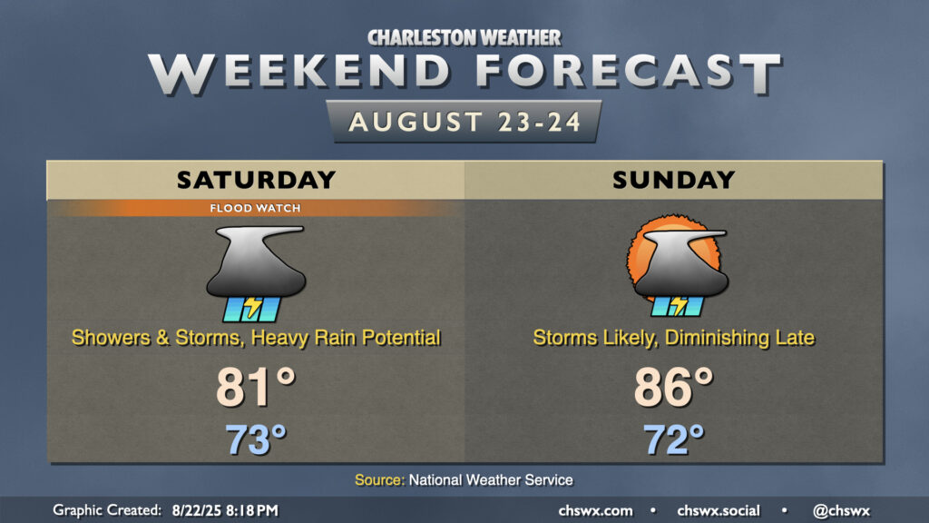
After record-breaking rainfall on Friday, more heavy rain appears likely for Saturday and to a lesser extent on Sunday as waves of low pressure along a stalled front continue to traverse the area, which has been well-moistened by an influx of tropical air.
Read more »